
La Paz, officially known as Nuestra Señora de La Paz, is the de facto capital of Bolivia and is the seat of government of the Plurinational State of Bolivia. With an estimated 816,044 residents as of 2020, La Paz is the third-most populous city in Bolivia. Its metropolitan area, which is formed by La Paz, El Alto, Achocalla, Viacha, and Mecapaca makes up the second most populous urban area in Bolivia, with a population of 2.2 million, after Santa Cruz de la Sierra with a population of 2.3 million. It is also the capital of the La Paz Department.
Transport in Bolivia is mostly by road. The railways were historically important in Bolivia, but now play a relatively small part in the country's transport system. Because of the country's geography, aviation is also important.

U.S. Route 180 is an east–west United States highway. Like many three-digit routes, US 180 no longer meets its "parent", US 80. US 80 was decommissioned west of Mesquite, Texas, and was replaced in Texas by Interstate 20 and Interstate 10 resulting in U.S. 180 being 57 miles longer than U.S. 80. The highway's eastern terminus is in Hudson Oaks, Texas, at an intersection with Interstate 20. Its western terminus is unclear. Signage at an intersection with State Route 64 in Valle, Arizona 40 miles (64 km) northwest of Flagstaff indicates that the route starts at SR 64, which is consistent with the AASHTO U.S. Highway logs. However, many maps continue the US 180 designation to the south rim of the Grand Canyon at Grand Canyon Village. Signage at the SR 64 intersection as of 2021 indicated that US 180 continues north concurrent with the route. However, no signage along the route exists past this intersection until SR 64 turns east towards Cameron, Arizona. At this intersection, signage makes no mention of US 180 nor is there any mention at the terminus of SR 64 at US 89.
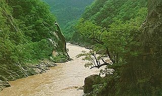
Pilcomayo is a river in central South America. At 1,100 kilometres (680 mi) long, it is the longest western tributary of the Paraguay River. Its drainage basin is 270,000 square kilometres (100,000 sq mi) in area, and its mean discharge is 200 cubic metres per second (7,100 cu ft/s).
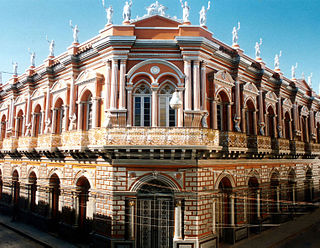
Tarija or San Bernardo de la Frontera de Tarixa is a city in southern Bolivia. Founded in 1574, Tarija is the largest city and capital and municipality within the Tarija Department, with an airport offering regular service to primary Bolivian cities, as well as a regional bus terminal with domestic and international connections. Its climate is semi-arid (BSh) with generally mild temperatures in contrast to the harsh cold of the Altiplano and the year-round humid heat of the Amazon Basin. Tarija has a population of 234,442.

The Catholic Church in Bolivia is part of the worldwide Catholic Church, under the spiritual leadership of the Pope in Rome. Catholicism was introduced in the 1530s and the first diocese was established in 1552. Evangelization among the Indians bore much fruit from the mid-18th to early 19th century, resuming again in 1840. The country declared independence from Spain in 1825.

The Battle of Suipacha was fought on 7 November 1810 in Bolivia during the Bolivian War of Independence between the Spanish colonial army and the Republican forces sent by the Primera Junta from Buenos Aires. At the time Bolivia was known as Upper Peru. It was the first decisive defeat of the Royalists by Republican forces. The battle took place 25 km (16 mi) southeast of Tupiza, near the small town of Suipacha, on the margin of the Suipacha river in the Sud Chichas province.
Municipalities in Bolivia are administrative divisions of the entire national territory governed by local elections. Municipalities are the third level of administrative divisions, below departments and provinces. Some of the provinces consist of only one municipality. In these cases the municipalities are identical to the provinces they belong to. There are 340 municipalities.

U.S. Route 81 (US-81) is a north–south U.S. highway running through the central United States' Great Plains region, from Fort Worth, Texas to the U.S.–Canadian border at Pembina, North Dakota. A 229.28-mile (368.99 km) segment of the highway lies within the state of Oklahoma. US-81 crosses the Red River from Texas south of Terral, passing through several Oklahoma cities, such as Chickasha, El Reno, Kingfisher, and Enid, before entering Kansas north of Renfrow.
Toledo (Oruro) is a small town in Bolivia. Toledo is the administrative seat of Saucarí Province, as well as that of Toledo Municipality. The town lies at an elevation of 3,715 metres (12,188 ft) between Río Laq'a Jawira in the west and Río Vinto Jahuira in the east, both of which drain into Lake Poopó.
The 2010 Bolivian regional elections were held on 4 April 2010. Departmental and municipal authorities were elected by an electorate of approximately 5 million people. Among the officials elected are:
The first Bolivian judicial election was held on 16 October 2011. The national vote was held to elect magistrates to serve on the Supreme Court of Justice, the Plurinational Constitutional Court, the Agro-environmental Court and members of the Judiciary Council. It was originally scheduled to be held on 5 December 2010, but officials of the National Electoral Court and of the MAS majority in the Plurinational Legislative Assembly delayed it. The vote will be the first time that a Latin American country directly elects its highest judicial officials.

Diego Horacio Wayar Cruz is a Bolivian footballer who plays for The Strongest as either a defensive midfielder or a right back.
Route 2 is a National Road in Bolivia. It connects La Paz to Khasani via Batallas and Copacabana, is paved for its entire length.
Route 3 is a National Road in Bolivia. It connects La Paz to Trinidad via Cororico, Caranavi, Yucumo, and San Ignacio de Moxos.

The 1828 Peruvian–Bolivian War was an invasion of Bolivia by Peru headed by Agustín Gamarra in the form of a foreign intervention in an internal conflict in the Republic of Bolivia, being the first important war in the new country, just three years after becoming independent, and endangering its autonomy as a result of the occupation. Its objective was to force the departure of the troops of the Republic of Colombia from Bolivia, the resignation of Antonio José de Sucre, and the prevention of the opening of a southern front in the event of a war with Colombia. The intervention escalated tensions further, culminating in the Gran Colombia–Peru War.
Route 4 is a National Road in Bolivia. It is 1,657 kilometres in length, and crosses Bolivia from west to east, from the Cordillera Occidental on the Chilean border to the lowlands by the Brazilian border.
