Tierra Amarilla is a census-designated place in and the county seat of Rio Arriba County, New Mexico, United States.

Wiseman is a census-designated place (CDP) in Yukon-Koyukuk Census Area, Alaska, United States. The full time resident population is 12 as of 2022.

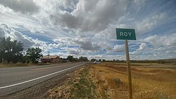
Kim is a Statutory Town in Las Animas County, Colorado, United States. The population was 63 at the time of the 2020 United States Census.

Wisdom is a census-designated place (CDP) in Beaverhead County, Montana, United States. The population was 98 at the 2010 census. The ZIP Code of the area is 59761. The town includes three tourist lodgings, service station, grocery, school (K-8), post office and a Forest Service office.

Sun River is a census-designated place (CDP) in Cascade County, Montana, United States. The population was 124 at the 2010 census. It is part of the Great Falls, Montana Metropolitan Statistical Area.

Lewistown is a city in and the county seat of Fergus County, Montana, United States. The population was 5,952 at the 2020 census. Lewistown is located in the geographic center of the state, southeast of Great Falls and northwest of Billings. First planned in 1882, it was the site of an 1880s gold rush, and served as an important railway destination, supplying surrounding communities with bricks via rail.

Big Timber is a city in, and the county seat of, Sweet Grass County, Montana, United States. The population was 1,650 at the 2020 census.

Hot Springs is a city in and county seat of Fall River County, South Dakota, United States. As of the 2020 census, the city population was 3,395. In addition, neighboring Oglala Lakota County contracts the duties of Auditor, Treasurer and Register of Deeds to the Fall River County authority in Hot Springs.

Eureka is an unincorporated town and census-designated place in and the county seat of Eureka County, Nevada, United States. With a population of 414 as of the 2020 United States census, it is the second-largest community in Eureka County. Attractions include the Eureka Opera House, Raine’s Market and Wildlife Museum, the Jackson House Hotel, and the Eureka Sentinel Museum.

Emigrant is an unincorporated community in Park County, Montana, United States. As of the 2010 census, the ZIP Code Tabulation Area (59027) for Emigrant had a population of 372. Emigrant is located in southern Montana, on the Yellowstone River, approximately 30 miles (48 km) north of Yellowstone National Park, and 20 miles (32 km) south of Livingston.
Condon is an unincorporated community and census-designated place in Missoula County, Montana, United States. Located along the Swan River and Montana Highway 83, Condon is situated between the Swan Range to the east and the Mission Mountains to the west, providing ready access to the Bob Marshall Wilderness and Mission Mountains Wilderness, respectively. Its population was 285 as of the 2020 United States census, down from 343 in 2010.
Glennville is an unincorporated community and census-designated place (CDP) in Kern County, California.

Clay Springs is a census-designated place (CDP) in Navajo County, Arizona, United States. Clay Springs is 16 miles (26 km) northwest of Show Low. Clay Springs has a post office with ZIP code 85923.

Bowie is an unincorporated community and a census-designated place in Cochise County, Arizona, United States. As of the 2010 U.S. Census the population of Bowie was 449.
Coffee Creek is an unincorporated community in Fergus County, Montana, United States. It is located along Montana Highway 81 in west central Fergus County, several miles northwest of Denton. Coffee Creek has a post office with the ZIP code 59424.

Petroleum County is a county in the U.S. state of Montana. As of the 2020 census, the population was 496, making it the least populous county in Montana and the eighth-least populous in the United States. Its county seat is Winnett. The county's area was partitioned from Fergus County in 1925 to become the last of Montana's 56 counties to be organized.
Springdale is a census-designated place and unincorporated community in Park County, Montana, United States. Its population was 42 at the 2010 census. The community is located near Interstate 90 and the Yellowstone River. Springdale has its own ZIP code, 59082.
Kila is a census-designated place and unincorporated community in Flathead County, Montana, United States. Its population was 424 as of the 2020 census. Kila has a post office with ZIP code 59920, which opened on May 27, 1901. The community is located along U.S. Route 2, 10 miles from Kalispell.
Marion is a census-designated place and unincorporated community in Flathead County, Montana, United States. Its population was 1,119 as of the 2020 census. Marion has a post office with ZIP code 59925.
Sedan is a census-designated place (CDP) in Gallatin County, Montana, United States. The population was 99 at the 2010 census. It is located on Montana Highway 86, 27 miles from Bozeman. The Zip Code 59086.