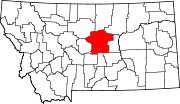
Denton, Montana | |
---|---|
Coordinates: 47°19′8″N109°56′48″W / 47.31889°N 109.94667°W | |
Country | United States |
State | Montana |
County | Fergus |
Government | |
• Mayor | Joel Barber |
Area | |
• Total | 0.71 sq mi (1.85 km2) |
• Land | 0.71 sq mi (1.85 km2) |
• Water | 0.00 sq mi (0.00 km2) |
Elevation | 3,599 ft (1,097 m) |
Population (2020) | |
• Total | 205 |
• Density | 287.52/sq mi (110.96/km2) |
Time zone | UTC-7 (Mountain (MST)) |
• Summer (DST) | UTC-6 (MDT) |
ZIP code | 59430 |
Area code | 406 |
FIPS code | 30-20425 |
GNIS feature ID | 0770605 [2] |
Denton is a town in Fergus County, Montana, United States. The population was 205 at the 2020 census. [3]
Central Montana Rail, Inc. is headquartered in Denton.
A post office called Denton has been in operation since 1888. [4] It was named after the Missouri county where the postmaster previously lived. [5] The town was established at its present site when the railroad was extended to that point. [6]
The fast-moving West Wind Fire swept through the town in December 2021. [7] Twelve families lost their homes. The wildfire destroyed or damaged many structures including garages, barns and grain elevators. There were no serious injuries as the town was evacuated minutes before the fire, which burned 10,000 acres (4,000 ha), reached the town. [8]
Montana Highway 81 passes through town. According to the United States Census Bureau, the town has a total area of 0.76 square miles (1.97 km2), all land. [9]
Census | Pop. | Note | %± |
---|---|---|---|
1920 | 431 | — | |
1930 | 345 | −20.0% | |
1940 | 406 | 17.7% | |
1950 | 435 | 7.1% | |
1960 | 410 | −5.7% | |
1970 | 398 | −2.9% | |
1980 | 356 | −10.6% | |
1990 | 350 | −1.7% | |
2000 | 301 | −14.0% | |
2010 | 255 | −15.3% | |
2020 | 205 | −19.6% | |
U.S. Decennial Census [10] [3] |
As of the census [11] of 2010, there were 255 people, 120 households, and 64 families living in the town. The population density was 335.5 inhabitants per square mile (129.5/km2). There were 156 housing units at an average density of 205.3 per square mile (79.3/km2). The racial makeup of the town was 99.2% White and 0.8% from two or more races. Hispanic or Latino of any race were 2.0% of the population.
There were 120 households, of which 23.3% had children under the age of 18 living with them, 45.0% were married couples living together, 4.2% had a female householder with no husband present, 4.2% had a male householder with no wife present, and 46.7% were non-families. 42.5% of all households were made up of individuals, and 21.7% had someone living alone who was 65 years of age or older. The average household size was 2.13 and the average family size was 2.92.
The median age in the town was 44.8 years. 22.7% of residents were under the age of 18; 5.6% were between the ages of 18 and 24; 22% were from 25 to 44; 22.7% were from 45 to 64; and 27.1% were 65 years of age or older. The gender makeup of the town was 51.8% male and 48.2% female.
As of the census [12] of 2000, there were 301 people, 133 households, and 82 families living in the town. The population density was 395.4 inhabitants per square mile (152.7/km2). There were 158 housing units at an average density of 207.6 per square mile (80.2/km2). The racial makeup of the town was 99.34% White, and 0.66% from two or more races. Hispanic or Latino of any race were 1.00% of the population.
There were 133 households, out of which 24.8% had children under the age of 18 living with them, 56.4% were married couples living together, 4.5% had a female householder with no husband present, and 37.6% were non-families. 34.6% of all households were made up of individuals, and 15.0% had someone living alone who was 65 years of age or older. The average household size was 2.26 and the average family size was 2.96.
In the town, the population was spread out, with 24.6% under the age of 18, 7.3% from 18 to 24, 21.6% from 25 to 44, 24.3% from 45 to 64, and 22.3% who were 65 years of age or older. The median age was 42 years. For every 100 females there were 109.0 males. For every 100 females age 18 and over, there were 100.9 males.
The median income for a household in the town was $28,393, and the median income for a family was $32,232. Males had a median income of $23,125 versus $16,528 for females. The per capita income for the town was $14,982. About 5.9% of families and 8.5% of the population were below the poverty line, including 4.9% of those under the age of eighteen and 2.4% of those 65 or over.
Denton Public Schools educates students from kindergarten through 12th grade. [13] They are known as the Trojans. [14] Denton High School had 19 students in 2021. [15]
Townsend is a city in and the county seat of Broadwater County, Montana, United States. The population was 1,787 at the 2020 census.
Cascade is a town in Cascade County, Montana, United States. The population was 600 at the 2020 census. It is part of the Great Falls, Montana Metropolitan Statistical Area, which in 2020 had a population of 84,414. Cascade was incorporated in 1911.
Moore is a town in Fergus County, Montana, United States. The population was 194 at the 2020 census.
Winifred is a small town in rural north-central Fergus County, Montana, United States. It was founded in 1913 and provides services for its region's populace. The town population was 172 at the 2020 census. The current mayor is Travis Willson.
West Yellowstone is a town in Gallatin County, Montana, United States, adjacent to Yellowstone National Park. The population was 1,272 at the 2020 census. West Yellowstone is served by Yellowstone Airport. It is part of the Bozeman, MT Micropolitan Statistical Area.
Ryegate is a town in, and the county seat of, Golden Valley County, Montana, United States. The population was 223 at the 2020 census. Ryegate is situated on the north bank of the Musselshell River.
Drummond is a town in Granite County, Montana, United States. The population was 272 at the 2020 census.
Hingham is a town in Hill County, Montana, United States. Its economy is largely agricultural. The population was 131 at the 2020 census.
Sheridan is a town in Madison County, Montana, United States named after the Civil War general Philip Sheridan. The population was 694 at the 2020 census. Sheridan is known as the "heart of the Ruby Valley." Seven mountain ranges surround the town: Tobacco Root Mountains, Highland Mountains, McCartney Mountain, The Pioneers, The Ruby Range, The Gravelly Range and the Snowcrest Range. The Ruby River winds through the valley just west of the town.
Superior is a town in, and the county seat of, Mineral County, Montana, United States. The population was 830 at the 2020 census.
Heart Butte is a census-designated place (CDP) in Pondera County, Montana, United States. The population was 698 at the 2000 census. The town is on the Blackfeet Indian Reservation.
Fairview is a town in Richland County, Montana, United States. The population was 896 at the 2020 census. The town is directly on the North Dakota border. Fairview incorporated in 1913.
Bainville is a town in Roosevelt County, Montana, United States. The population was 271 at the 2020 census. It is named for Charles M. Bain, an early resident and the town's first postmaster. Bainville celebrated its centennial on July 4, 2006.
Froid is a town in Roosevelt County, Montana, United States. The population was 195 at the 2020 census. Froid was named for the French word for "cold".
Dutton is a town in Teton County, Montana, United States. The population was 303 at the 2020 census.
Nashua is a town in Valley County, Montana, United States. The population was 301 at the 2020 census.
Broadview is a town in Yellowstone County, Montana, United States. The population was 139 at the 2020 census.
Denton is a village in Lancaster County, Nebraska, United States. It is part of the Lincoln, Nebraska Metropolitan Statistical Area. The population was 189 at the 2020 census.
Plevna is a town in Fallon County, Montana, United States. The population was 179 at the 2020 census.
Double Oak is a town in Denton County, Texas, United States. The population was 2,867 at the 2010 census.