Ru’gyog

Last updated

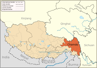
Rugyog is a village and township in the Tibet Autonomous Region of China.

Tibet Autonomous Region Autonomous region

The Tibet Autonomous Region (TAR) or Xizang Autonomous Region, called Tibet or Xizang for short, is a province-level autonomous region in southwest China. It was formally established in 1965 to replace the Tibet Area, an administrative division the People's Republic of China inherited from the Republic of China (ROC), about five years after the dismissal of the Kashag by the PRC following the 1959 Tibetan uprising, and about 13 years from the Tibet's incorporation into the PRC in 1951.

China State in East Asia

China, officially the People's Republic of China (PRC), is a country in East Asia and the world's most populous country, with a population of around 1.404 billion. Covering approximately 9,600,000 square kilometers (3,700,000 sq mi), it is the third- or fourth-largest country by total area. Governed by the Communist Party of China, the state exercises jurisdiction over 22 provinces, five autonomous regions, four direct-controlled municipalities, and the special administrative regions of Hong Kong and Macau.

See also

Coordinates: 29°42′N84°52′E / 29.700°N 84.867°E / 29.700; 84.867

Geographic coordinate system Coordinate system

A geographic coordinate system is a coordinate system that enables every location on Earth to be specified by a set of numbers, letters or symbols. The coordinates are often chosen such that one of the numbers represents a vertical position and two or three of the numbers represent a horizontal position; alternatively, a geographic position may be expressed in a combined three-dimensional Cartesian vector. A common choice of coordinates is latitude, longitude and elevation. To specify a location on a plane requires a map projection.


Related Research Articles

Xabyai human settlement in China

Xabyai is a village in the Tibet Autonomous Region of China

Xia Lingka is a village in the east of the Tibet Autonomous Region of China with a latitude (DMS) of 29° 23' 60N and a longitude of 97° 42' 0E. It lies at an altitude of 4326 metres.

Bilung is a township in Biru County, Tibet Autonomous Region of China.

Bumgyê is a township in Gonjo County, the Tibet Autonomous Region of China. It lies at an altitude of 3,933 metres.

Chacang is a township in Xainza County, Tibet Autonomous Region of China.

Chagla is a village in the Tibet Autonomous Region of China. It lies at an altitude of 5,328 metres. The village has a population of about 201.

Chongsar is a village in the Tibet Autonomous Region of China. It lies at an altitude of 4,389 metres. The village has a population of about 380.

Digna is a village in the Tibet Autonomous Region of China. It lies at an altitude of 4,583 metres. The village has a population of about 2,543 people.

Dombang is a village in the Tibet Autonomous Region of China in eastern Tibet. It lies at an altitude of 2,625 metres. The village has a population of about 399 people.

Qigêgyizhungma is a village in the Tibet Autonomous Region of China.

Gorqu Place in Tibet, China

Gorqu is a village in the Tibet Autonomous Region of China.

Gurum is a small town and township of Doilungdêqên District in the Tibet Autonomous Region of China.

Gyorxung is a village in the Tibet Autonomous Region of China.

Langgar is a village in the Tibet Autonomous Region of China.

Lêba is a village and township in the Tibet Autonomous Region of China.

Lhainag is a village in the Tibet Autonomous Region of China.

Lopu is a village in the Tibet Autonomous Region of China.

Lungmar is a village and township in the Tibet Autonomous Region of China.

Doxong is a village in the Tibet Autonomous Region, in China.

Korra is a village in Zhag'yab County, of the Chamdo Prefecture in the northeastern Tibet Autonomous Region of China. Korra in Tibetan refers to the act of Circumambulation.