Related Research Articles
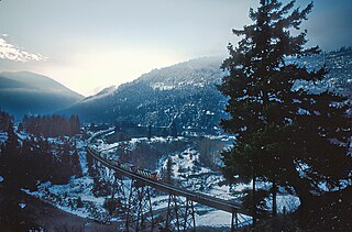
Laidlaw is an unincorporated settlement in the Upper Fraser Valley region of British Columbia, Canada, located just west of the westernmost boundary of Hope, British Columbia on the south side of the Fraser River and along the Trans-Canada Highway.
Goldpan Provincial Park is a provincial park in British Columbia, Canada, located on the Trans-Canada Highway between Lytton (W) and Spences Bridge (E), on the Thompson River. The park has camping above the highway and a picnic area and riverfront below.
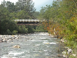
Ruby Creek is a locality on the Fraser River in the District of Kent, British Columbia, Canada, in the Upper Fraser Valley region, located on BC Highway 7 and the mainline of the Canadian Pacific Railway, near the confluence of Ruby Creek with the Fraser, northeast of Sea Bird Island. Ruby Creek Indian Reserve No. 2 of the Skawahlook First Nation is nearby, as is also Skawahlook Indian Reserve No. 1, one mile northeast of the mouth of Ruby Creek. Also in the locality is Lukseetsissum Indian Reserve No. 9 of the Yale First Nation.
The Upper Similkameen Indian Band or Upper Smelqmix, is a First Nations band government in the Canadian province of British Columbia, whose head offices are located in town of Hedley in the Similkameen Country. They are a member of the Okanagan Nation Alliance.

The Stswecem'c Xgat'tem First Nation, formerly known as Canoe Creek Band/Dog Creek Indian Band, created as a result of merger of the Canoe Creek Band and Dog Creek Band is a First Nations government of the Secwepemc (Shuswap) Nation, located in the Fraser Canyon-Cariboo region of the Central Interior of the Canadian province of British Columbia. It was created when the government of the then-Colony of British Columbia established an Indian reserve system in the 1860s. It is a member government of the Northern Shuswap Tribal Council.
The Esk'etemc First Nation, also known as the Alkali Lake Indian Band, is a First Nations government of the Secwepemc (Shuswap) people, located at Alkali Lake in the Cariboo region of the Central Interior of the Canadian province of British Columbia. It was created when the government of the then-Colony of British Columbia established an Indian reserve system in the 1860s. It is one of three Secwepemc bands that is not a member of either the Shuswap Nation Tribal Council or the Northern Shuswap Tribal Council.
The Lytton First Nation, a First Nations band government, has its headquarters at Lytton in the Fraser Canyon region of the Canadian province of British Columbia. While it is the largest of all Nlaka'pamux bands, unlike all other governments of the Nlaka'pamux (Thompson) people, it is not a member of any of the three Nlaka'pamux tribal councils, which are the Nicola Tribal Association, the Fraser Canyon Indian Administration and the Nlaka'pamux Nation Tribal Council.
The Tlʼesqox First Nation is a Tsilhqotʼin community located west of the Fraser Canyon in the Chilcotin region of the Canadian province of British Columbia. It is a member of the Carrier-Chilcotin Tribal Council, which includes both Tsilhqotʼin and Carrier (Dakelh) communities.

Hat Creek is a tributary of the Bonaparte River in British Columbia, Canada, joining that stream at Carquile, which is also known as Lower Hat Creek and is the site of the Hat Creek Ranch heritage museum and visitor centre. The Hat Creek basin includes a broad upper plateau area encircled by the gentle but high summits of the Clear Range and, to its east, the Cornwall Hills; this area is known as Upper Hat Creek. Adjacent to Upper Hat Creek is the gateway to Marble Canyon and a rancherie of the Pavilion First Nation, who are both a St'at'imc and Secwepemc people. During the Fraser Canyon and Cariboo Gold Rushes an important trail northwards from the lower Fraser Canyon led from Foster Bar on the Fraser via Laluwissen Creek into Upper Hat Creek, then via the creek to the Bonaparte River. The economy of the basin is ranching-based and includes some of the oldest ranches in the British Columbia Interior. On the northwest edge of the Upper Hat Creek basin there is a large lignite deposit and several exploratory pits, some dating back to the 19th century but some more recent, part of an intended, but now shelved Hat Creek coal-thermal proposal.
The Silver River, aka the Big Silver River and Big Silver Creek, or zácta in the St'at'imcets language of the In-SHUCK-ch people, is the second-largest stream entering Harrison Lake in the Lower Mainland of British Columbia, Canada. Rising in the central Lillooet Ranges to the east of the lake, it is approximately 40 km in length; its main tributary is the Little Silver River. A logging camp at its mouth was once a thriving community named Silver River.
The Anderson River is a tributary of the Fraser River in the Canadian province of British Columbia.
The Katzie First Nation or Katzie Nation is the band government of the Katzie people of the Lower Fraser Valley region of British Columbia, Canada.
Slesse Creek is a tributary of the Chilliwack River in North America. It flows through Whatcom County in the U.S. state of Washington and through the Canadian province of British Columbia. The creek is known as Silesia Creek in the United States and as Slesse Creek in Canada.
Ruby Creek 2, normally referred to as Ruby Creek Indian Reserve No. 2, is an Indian reserve in the Upper Fraser Valley region of British Columbia, Canada, located at the mouth of Ruby Creek at the northeast end of the District of Kent, near the locality of the same name, which is a part of Kent. The reserve is 16.6 hectares in size, and is under the jurisdiction of the Skawahlook First Nation, a member government of the Sto:lo Nation tribal council.
Cottonwood River is a tributary of the Fraser River in the Central Interior of British Columbia, Canada. Rising at the confluence of the Swift River and Lightning Creek at Coldspring House in the Cariboo goldfields of the northern Cariboo Plateau, it flows northwest and then turns southwest to join the Fraser just north of the city of Quesnel, which is at the confluence of the Quesnel River with the Fraser.
The Sq'éwlets First Nation (Scowlitz) is the band government of Skaulits subgroup of the Stó:lō people located on Harrison Bay in the Upper Fraser Valley region between Chehalis (E) and Lake Errock, British Columbia, Canada (W). They are a member government of the Stó:lō Tribal Council.
Yale First Nation is a First Nations government located at Yale, British Columbia. Yale has 16 distinct reserves stretching from near Sawmill Creek to American Creek, with the most southern reserve situated at Ruby Creek in the District of Kent.
Ruby Creek may refer to:
Hill's Bar is a long-abandoned ghost town located in the Fraser Canyon region of British Columbia, Canada. The site of the former boomtown is situated near the right bank of the Fraser River, between Yale and the mouth of Emory Creek. The eponymous bar was the first active placer mining site at the onset of the Fraser Canyon Gold Rush, and was the scene of the Boatmakers of San Francisco claim, which included Ned McGowan of McGowan's War, and involved a dispute with Kowpelst, chief of the Spuzzum people.
Keatley Creek is a left tributary of the Fraser River in the Glen Valley area of the Fraser Canyon in the Interior of British Columbia, Canada. Its outlet into the Fraser is between those of Pavilion and Fountain Creeks, approximately 16 miles upstream from the town of Lillooet; the next tributary southwards is the larger Sallus Creek.
References
49°21′00″N121°36′00″W / 49.35000°N 121.60000°W