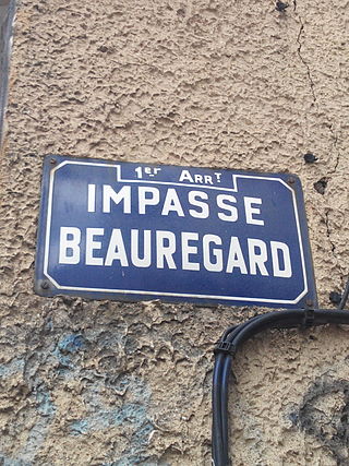
The 1st arrondissement of Lyon is one of the nine arrondissements of the City of Lyon. It is located below the hill of Croix-Rousse and on the north part of the Presqu'île formed by the Saône and the Rhône, the two rivers in Lyon.
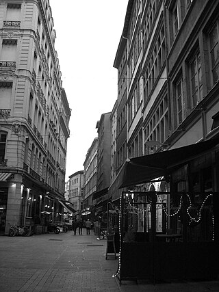
Rue Mercière is a street of Les Cordeliers quarter in the 2nd arrondissement of Lyon. From north to south, it connects the Place des Jacobins to the Place d'Albon. This street is served by metro stations Bellecour and Cordeliers of the line and by the bus station Jacobins of the lines 91 and 99. It belongs to the zone classified as World Heritage Site by UNESCO.

The Rue des Marronniers is a street located in the Bellecour quarter, in the 2nd arrondissement of Lyon. It is a small paved pedestrian street famous for its many bouchons. It is served by the metro station Bellecour and many buses. The street belongs to a zone classified as a World Heritage Site by UNESCO.

The Place Sathonay is a square located in the 1st arrondissement of Lyon, France, at the bottom of hill of La Croix-Rousse, in La Martinière quarter. It was named after Nicolas-Marie-Jean-Claude Fay de Sathonay, mayor of Lyon from 1805 to 1812, as a tribute for all the importants works undertaken under his presidency. The square is currently the third largest square in Lyon and belongs to the zone classified as World Heritage Site by UNESCO. According to Lyon geography agrégé Jean Pelletier, it is "one of the most interesting squares of Lyon", because of its harmonious proportions, its boundaries composed of buildings with beautiful 1920s facades, and its plantations, which brings "a charm tinged of poetry" and give it the appearance of a village square.

The Passage Thiaffait is an urban area located on the slopes of La Croix-Rousse, in the 1st arrondissement of Lyon. It has an entry by a portico and is a curved traboule (path) which ends with a staircase leading to the hill. The street belongs to the zone classified as World Heritage Site by UNESCO.
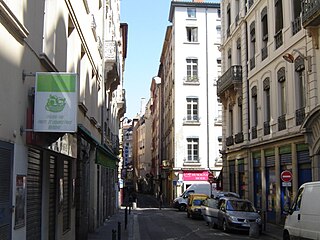
The Rue de Brest is a street located in the 2nd arrondissement of Lyon. This is one of the main shopping and tourist streets of the city center, parallel to the rue Édouard-Herriot. It begins in the wake of the rue Paul Chenavard and ends with the Place des Jacobins.
The Montée des Carmélites is one of the oldest streets of Lyon, dating from Roman times, located in the 1st arrondissement of Lyon. It connects the Saint-Vincent quarter to the Plateau de la Croix-Rousse. It is situated between the rue de la Tourette and the rue Ray Fernand, and ends at the intersection of the rue Burdeau, rue du Jardin des Plantes and rue de l'Annonciade.

The Avenue du Maréchal de Saxe is a broad avenue located in the 3rd and the 6th arrondissements of Lyon. It was named after Maurice de Saxe, Marshal of France.
The rue Sainte-Catherine is a very old street at the foot of the slopes of La Croix-Rousse quarter, in the 1st arrondissement of Lyon. It is particularly known for being a drinking street. The street belongs to the zone classified as World Heritage Site by UNESCO.
The Montée de la Grande Côte, or the Montée de la Grande-Côte, is a street of La Croix-Rousse quarter, in the 1st arrondissement of Lyon, which connects the Terreaux quarter and the Plateau de la Croix Rousse. It is characterized by a high elevation and is more narrow at the bottom. The street belongs to the zone that is classified as World Heritage Site by UNESCO.

The Rue Burdeau is a street located in the 1st arrondissement of Lyon, at the bottom of the slopes of La Croix-Rousse, just above the Église Saint-Polycarpe, between the Saône and the Rhône. It leads at one side to the Montée Saint-Sébastien and at the other to the Jardin des Plantes and crosses the montée de la Grande Côte which renovation is completed. The street belongs to the zone classified as World Heritage Site by UNESCO.

The Rue Royale is a street located in the 1st arrondissement of Lyon and was the main street of the quarter when it was created. It starts between the Place Servetus and the Rue de Provence and ends by joining the Grande Rue des Feuillants. There are many traboules closed which link the street with the Quai Lassagne and the rue d'Alsace-Lorraine. It is served by line C of the metro.
The Rue d'Austerlitz is a street in the 4th arrondissement of Lyon, in La Croix-Rousse quarter. It begins on the rue du Mail, at the corner of Place de la Croix-Rousse, crosses the rue du Pavilion, the rue de Belfort and the rue Aimé Boussange, and ends on Place Bellevue. Its name refers to the Battle of Austerlitz, one of the greatest victories of Napoleon. There are metro and velo'v stations.

The Rue Lainerie is an ancient cobbled pedestrian street of the Vieux Lyon quarter, in the 5th arrondissement of Lyon. From north to south, it connects two quarters, Saint-Paul and Saint-Jean, and more precisely the Place du Change and the Place Saint-Paul. There is currently an academy of music at No. 1 and many hotels. The street is served by many buses (29-30-31-44-184), two metro stations and a velo'v station. It belongs to the zone classified as World Heritage Site by UNESCO.

The Rue Dumenge is a street located in the 4th arrondissement of Lyon, in the quarter of La Croix-Rousse. It begins on the rue du Mail, crosses the rue du Pavillon and the rue de Belfort and ends on the rue Dumont-d'Urville. The street is served by a metro station of the line C and a velo'v station.

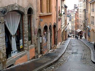
The Rue du Bœuf is a 188-metre cobbled pedestrian street of the Vieux Lyon quarter, located in the 5th arrondissement of Lyon. Very representative of the Renaissance architecture of the neighborhood, it is lined only with old houses from the 16th or 17th century. The street connects the rue de Gadagne which it continues after the Place du Petit Collège and the intersection of the rue du Chemin Neuf, the rue de la Bombarde and the rue Tramassac which prolongs it. The street belongs to the zone classified as World Heritage Site by UNESCO.

The Place Benoît-Crépu is a stone-paved square, located in Saint-Georges quarter, on the banks of the Saône, in the 5th arrondissement of Lyon. It has fountains with dolphin heads, many benches and trees and a playground. The place belongs to the area classified as World Heritage Site by UNESCO.

The Rue de Gadagne is a paved pedestrian street of the Saint-Jean quarter, in the 5th arrondissement of Lyon. It extends the rue du Bœuf and ends on the rue Lainerie that leads itself to the Place Saint-Paul. It is located in the center of Vieux Lyon and is part to the area which includes a mosaic of squares : Place du Change, Place du Petit Collège and Place de la Baleine in the extension of rue Saint-Jean. The street belongs to the zone classified as World Heritage Site by UNESCO. It is served by buses 29-30-31-44-184, a metro station and three velo'v stations.

The Rue du Sergent Blandan is one of the oldest streets of Lyon. It connects Saint Vincent and the slopes of the Croix-Rousse quarters, in the 1st arrondissement of Lyon. The street starts at rue Pareille, runs along the Place Sathonay, crosses the rue Hippolyte Flandrin, the rue Louis Vitet and the rue du Terme, and becomes the rue des Capucins just after the square of the same name. The street belongs to the zone classified World Heritage Site by UNESCO. It is named in honour of Sergent Blandan, who participated in the conquest of Algeria.

The Place Croix-Paquet is a square located in the 1st arrondissement of Lyon, in the pentes de la Croix-Rousse quarter. It is formed by the intersection of the rue du Griffon, the rue des Capucins and the montée Saint-Sébastien. The square belongs to the zone classified World Heritage Site by UNESCO.

