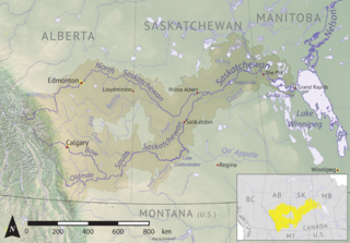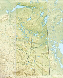
Waterhen River is an east-flowing river in the north-west area of the Canadian province of Saskatchewan in the drainage basin of the Beaver River. It is north of and parallel to the east-flowing part of the Beaver River and joins the north-flowing part of that river. Most of the river and its drainage basin is at the southern edge of the boreal forest belt. While the river's source is Lac des Îles, its drainage basin reaches north into the Mostoos Hills and west well into the neighbouring province of Alberta.
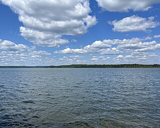
Waterhen Lake is a lake in Meadow Lake Provincial Park in the Canadian province of Saskatchewan, located about 40 kilometres (25 mi) north of the city of Meadow Lake. The lake is situated along the course of the Waterhen River in the boreal forest ecozone of Canada.
Rusty Lake is a lake in Meadow Lake Provincial Park in the Canadian Province of Saskatchewan in the boreal forest ecozone of Canada. The lake is the first of six notable lakes in the Rusty Creek watershed part of Meadow Lake Provincial Park. The other lakes include First Mustus, Second Mustus, Third Mustus, Peitahigan, and Fourth Mustus.

Flotten Lake is a lake in Meadow Lake Provincial Park in the Canadian Province of Saskatchewan. While the lake has one outflow, Flotten River, there are several small inflow creeks, including Fleury Creek, Young Creek, Ross Creek, Moloney Creek, and Salt Creek. Flotten River exits the lake at the south end and flows south into Waterhen Lake, which is the source of the Waterhen River.

Cold River is a river in the Canadian province of Saskatchewan. The river's source is Cold Lake, which is a large lake on the provincial border of Saskatchewan and Alberta, and its mouth is at the western end of Lac des Îles in Meadow Lake Provincial Park. It is an east flowing river and the entirety of its course is in Meadow Lake Provincial Park and the boreal forest.

Martineau River is a river in the Canadian provinces of Saskatchewan and Alberta. Its source is at Primrose Lake in north-western Saskatchewan and its mouth is at Cold Lake in Alberta. The river travels in a south-westerly direction through muskeg and the boreal forest ecozone of Canada The majority of the river and its tributaries are in Saskatchewan with only the final leg being in Alberta.
Lac des Îles is a lake in Meadow Lake Provincial Park in the Canadian Province of Saskatchewan in the boreal forest ecozone of Canada. The primary inflow is the Cold River and its outflow is the Waterhen River. The lake and associated rivers are part of the Hudson Bay drainage basin as the Waterhen River flows into Beaver River, which meets the Churchill River, a major river that flows into Hudson Bay, at Lac Île-à-la-Crosse.

Greig Lake is a lake in Meadow Lake Provincial Park in the Canadian province of Saskatchewan in the boreal forest ecozone of Canada. On the eastern shore of the lake is the resort village of Greig Lake and Greig Lake Campground. The south-west corner of the lake has a resort called Waters Edge Eco Lodge. The lake is accessed from Highway 224 at the south end.
Kimball Lake is a lake in Meadow Lake Provincial Park in the Canadian Province of Saskatchewan in the boreal forest ecozone of Canada. The lake is located near the centre of the park, north of the Waterhen River and Little Raspberry Lake and south of First Mustus Lake. Rusty and Greig Lakes are to the east. Several small streams feed into the lake and the outflow is at the southern shore, which feeds into the Waterhen River, a tributary of Beaver River. The Beaver River, in turn, flows north into Lac Île-à-la-Crosse and the Churchill River, a major tributary in the Hudson Bay drainage basin.
Matheson Lake is a lake in Meadow Lake Provincial Park in the Canadian Province of Saskatchewan in the boreal forest ecozone of Canada. The lake is located near the centre of the park, north of the Waterhen River, west of Vivian Lake and south of Peitahigan Lake. Several small streams feed into the lake and the outflow is at the southern shore, which feeds into the Waterhen River, a tributary of Beaver River. The Beaver River, in turn, flows north into Lac Île-à-la-Crosse and the Churchill River, a major tributary in the Hudson Bay drainage basin.
First Mustus Lake is a lake in Meadow Lake Provincial Park in the Canadian Province of Saskatchewan in the boreal forest ecozone of Canada. The lake is the first of four lakes in a row named Mustus in the Rusty Creek watershed. The other lakes are Second, Third, and Fourth Mustus. Rusty Creek and the lakes are part of the Waterhen River drainage basin. The Waterhen River is a tributary of the Beaver River, which flows north into Lac Île-à-la-Crosse and the Churchill River, a major tributary in the Hudson Bay drainage basin. Highway 224 provides access to both First and Second Mustus Lakes.
Peitahigan Lake is a lake in Meadow Lake Provincial Park in the Canadian Province of Saskatchewan in the boreal forest ecozone of Canada. The lake is one of six notable lakes in the Rusty Creek watershed. The other lakes include Rusty, First Mustus, Second Mustus, Third Mustus, and Fourth Mustus. Rusty Creek and the lakes are part of the Waterhen River drainage basin. The Waterhen River is a tributary of the Beaver River, which flows north into Lac Île-à-la-Crosse and the Churchill River, a major tributary in the Hudson Bay drainage basin.
Mistohay Lake is a lake in Meadow Lake Provincial Park in the Canadian Province of Saskatchewan in the boreal forest ecozone of Canada. The lake is part of the Waterhen River drainage basin. The Waterhen River is a tributary of the Beaver River, which flows north into Lac Île-à-la-Crosse and the Churchill River, a major tributary in the Hudson Bay drainage basin.
Meadow Lake is a small, shallow, oval-shaped lake that is the source of Meadow River and the namesake of Meadow Lake Provincial Park, despite not being within the park's boundaries. The lake is in the transition zone between the boreal forest and prairies ecozones of Canada.

White Gull Creek is a river in the Canadian province of Saskatchewan. The river's source is White Gull Lake, near the south-western boundary of Narrow Hills Provincial Park and near the southern slopes of the Cub Hills. The river travels through boreal forest and muskeg en route to its mouth at the Torch River. The Torch River is a tributary of the Saskatchewan River as it flows into one of North America's largest inland fresh water deltas, the Saskatchewan River Delta. There are no communities nor settlements along the river.
Summit Lake is a lake in the east-central part of the Canadian province of Saskatchewan in Narrow Hills Provincial Park. It is situated in a glacier-formed valley in the Cub Hills and the boreal forest ecozone of Canada. It is located north of Lost Echo Lake and is accessed from Highway 913. There are no communities or settlements on the lake.

Caribou Creek is a river in the east-central part of the Canadian province of Saskatchewan. The river's source is in a hilly plateau called Cub Hills, near the western boundary of Narrow Hills Provincial Park. The river heads south following a glacier-carved valley through the Cub Hills en route to its mouth at Lower Fishing Lake. The entire course of the river is in the boreal forest ecozone of Canada. Caribou Creek is a tributary of Stewart Creek, which flows south and into the east-flowing Torch River. Torch River is a tributary of the Saskatchewan River as it flows into the Saskatchewan River Delta. Much of the upper watershed was burned in 1977 in what is known as the Fishing Lakes Fire and is now dominated by a forest of jack pine.
Baldy Lake is a lake in the east-central part of the Canadian province of Saskatchewan in Narrow Hills Provincial Park. It is situated in the Cub Hills and the boreal forest ecozone of Canada.
McBride Lake is a lake in the east-central part of the Canadian province of Saskatchewan in the boreal forest ecozone of Canada. It is a narrow lake that runs west to east along the course of the Pepaw River known for its fishing and recreational opportunities. It is situated in the Porcupine Hills and within Saskatchewan's Porcupine Provincial Forest. There is a provincial park and a small subdivision along the lake's shore and access is from Highway 983. Eldredge Lake is upstream from McBride Lake along the course of the Pepaw River and Pepaw Lake is downstream. Swallow lake is to the north and a short stream flows from Swallow Lake into the eastern end of McBride Lake.

Piwei River is a river in the east-central part of the Canadian province of Saskatchewan in the boreal forest ecozone of Canada. It begins at the western end of the Porcupine Hills at Piwei Lakes and heads in an easterly direction through a glacier-formed valley and into the Etomami River, which is a tributary of the Red Deer River.


