A cotton gin—meaning "cotton engine"—is a machine that quickly and easily separates cotton fibers from their seeds, enabling much greater productivity than manual cotton separation. The fibers are then processed into various cotton goods such as calico, while any undamaged cotton is used largely for textiles like clothing. The separated seeds may be used to grow more cotton or to produce cottonseed oil.

Sasakwa is a town in Seminole County, Oklahoma, United States. The population was documented as 150 in both the 2010 and 2000 census.

Bardwell is a city in Ellis County, Texas. The population was 649 at the 2010 census.

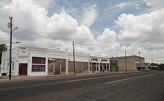
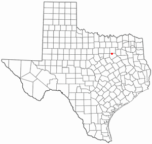
Milford is an incorporated rural community located in North Central Texas, in the southwestern corner of Ellis County, in the United States. The population was 722 at the 2020 census.

Hungerford is a census-designated place (CDP) in northeastern Wharton County, Texas, United States. U.S. Route 59, Texas State Highway 60, and Farm to Market Road 1161 intersect in the community. The Kansas City Southern Railway Co. passes through Hungerford. The population was 347 at the 2010 census. It is located on what in the 1820s was part of colonist Alexander Jackson's land grant north of George E. Quinan's home. By the 1870s, the Quinan settlement grew up a short distance away, but its residents moved to the new town when the railroad came through Hungerford.

Sachse is a city in Collin and Dallas counties in the U.S. state of Texas and is part of the DFW metroplex. A northeastern suburb of Dallas, the city population was 27,103, as of the 2020 census with an estimated population of 29,042 people today. Sachse is located off Texas State Highway 78 and President George Bush Turnpike and is approximately 1 mile (1.6 km) north of the Firewheel Town Center.

Ovilla is a city in Dallas and Ellis Counties in the U.S. state of Texas. The population was 4,304 at the 2020 census.

Telico is an unincorporated community in northeastern Ellis County, Texas, United States on Highway 34.

The Munger Place Historic District is a neighborhood and historic district in Old East Dallas, Texas (USA), generally lying between North Fitzhugh Avenue on the southwest, Gaston Avenue on the northwest, Henderson Avenue on the northeast, and Columbia Avenue on the southeast. Detailed boundaries are defined in the Munger Place Ordinance. It is a Dallas Landmark District and listed on the National Register of Historic Places.

The Swiss Avenue Historic District is a residential neighborhood in East Dallas, Dallas, Texas (USA). It consists of installations of the Munger Place addition, one of East Dallas' early subdivisions. The Swiss Avenue Historic District is a historic district of the city of Dallas, Texas. The boundaries of the district comprise both sides of Swiss Avenue from Fitzhugh Street, to just north of La Vista, and includes portions of Bryan Parkway. The District includes the 6100-6200 blocks of La Vista Drive, the west side of the 5500 block of Bryan Parkway the 6100-6300 blocks of Bryan Parkway, the east side of the 5200-5300 block of Live Oak Street, and the 4900-6100 blocks of Swiss Avenue. The entire street of Swiss Avenue is not included within the bounds of the Swiss Avenue Historic District. Portions of the street run through Dallas' Peaks Suburban Addition neighborhood and Peak's Suburban Addition Historic District. 5215 Swiss was built in 1914 and was the home of J. P. Cranfield

Gause is an unincorporated community and census-designated place in Milam County, Texas, United States. According to the Handbook of Texas, the community had an estimated population of 400 in 2000. It was first listed as a CDP in the 2020 census with a population of 275.
Monaville is an unincorporated community in Waller County, Texas, United States, at the intersection of FM 359 and FM 1887. The town was named for its founder's daughter in 1886.
Warrenton is an unincorporated community in northeastern Fayette County, Texas, United States. Located on State Highway 237 between Spencer Pool and Coon Creek, twelve miles northeast of La Grange. Founded by William Neese, who landed in Galveston in 1847 and named the new settlement that grew around his store for Warren Ligon, another early colonist. This area was settled by many German colonists who, with an admixture of Anglos, formed several small farming communities based on the production of cotton, corn, and dairy products. The community flourished in the late 1800s. A post office was established in 1873, when the town had a population of over 100, churches, schools, a gin, and supporting businesses. Poor soil conditions led to a shift to cattle and poultry after 1900. By 1950, the number of businesses in Warrenton had declined to seven, and the population held at 180. By 1985, the population was down to fifty, but twelve antique stores had opened and St. Martin's Church, at twelve by sixteen feet proclaimed the world's smallest Catholic church, attract visitors. The population reached sixty-five in 2000.
Wilderville, Texas is an unincorporated community in Falls County, Texas. It is six miles southeast of Rosebud, located on FM 413. In 2000, the population was 45.
Clear Springs is a historic settlement in Guadalupe County, Texas, United States. It is part of the San Antonio Metropolitan Statistical Area. It shares its name with the nearby Clear Springs Air Force Base.
Matthews is an unincorporated community on the southeastern edge of Colorado County, in the U.S. state of Texas. The community is located south of Eagle Lake near the junction of FM 102 and FM 950. The settlement was named for a man who owned an area plantation before the American Civil War. By 2013, the school, post office, businesses and railroad line that once served Matthews were gone, but the number of silos in the neighborhood indicated that the land was still being intensively farmed.

The Georgia Museum of Agriculture & Historic Village, formerly known as Agrirama, is a 19th-century living museum located in Tifton, Georgia. It opened on July 4, 1976. The grounds consist of five areas: a traditional farm community of the 1870s, an 1890s progressive farmstead, an industrial sites complex, rural town, national peanut complex, and the Museum of Agriculture Center.
Chappell Hill Female College was a private college in Chappell Hill, a rural community in Washington County, Texas, United States. It was founded in 1850 as part of the coeducational school Chappell Hill Male and Female Institute. First chartered by the Texas Legislature in 1852 as a non-denominational preparatory school, the charter was amended to affiliate the school with the Methodist Church in 1854, and was rechartered as a women's college after the male department was spun off as Soule University in 1856. It was closed in 1912 and the building became a public school until a replacement was built in 1927 that preserves the college's bell. The site was added to the National Register of Historic Places in 1985.
Five Points is an unincorporated community in Ellis County, Texas, United States. It is located on Farm to Market Road 876, approximately eight miles southwest of Waxahachie.

Robert Sylvester Munger and his wife Mary Collett Munger (1857–1924) invented the "system cotton gin". After that achievement, Munger started and ran some of the largest gin manufacturing companies in the United States. He also developed properties in Dallas, Texas later designated as National Historic Places. Finally, he was a philanthropist who supported numerous causes in the Birmingham, Alabama area.


