
The Tuzla Canton is one of 10 cantons of the Federation of Bosnia and Herzegovina, one of two entities in Bosnia and Herzegovina. The cantonal seat is in Tuzla.

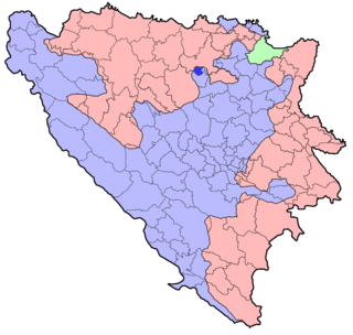
The Zenica-Doboj Canton is one of 10 cantons of the Federation of Bosnia and Herzegovina in Bosnia and Herzegovina. The capital is Zenica.

Zavidovići is a town and municipality located in Zenica-Doboj Canton of the Federation of Bosnia and Herzegovina, an entity of Bosnia and Herzegovina. It is situated in central Bosnia and Herzegovina, located between Doboj and Zenica on the confluence of rivers Bosna, Krivaja and Gostović. It sits in a valley surrounded by many mountains of which the largest is Klek. As of 2013, it has a population of 40,272 inhabitants.

Kakanj is a town and a municipality located in Zenica-Doboj Canton of the Federation of Bosnia and Herzegovina, an entity of Bosnia and Herzegovina. As of 2013, it has a population of 38,937 inhabitants. It is situated in central Bosnia and Herzegovina, north of Visoko and southeast of Zenica. It was built along the slopes of wide hills on either side of the Zgošća river.

Gračanica is a town and a municipality located in Tuzla Canton of the Federation of Bosnia and Herzegovina, an entity of Bosnia and Herzegovina. It is located in northeastern Bosnia and Herzegovina, east of Doboj and west of Tuzla. As of 2013, it has a population of 45,220 inhabitants.
Žepče is a town and municipality located in Zenica-Doboj Canton of the Federation of Bosnia and Herzegovina, an entity of Bosnia and Herzegovina. It is situated in central Bosnia and Herzegovina, between Doboj and Zenica. As of 2013, it has a population of 31,582 inhabitants.

Vareš is a town and municipality located in Zenica-Doboj Canton of the Federation of Bosnia and Herzegovina, an entity of Bosnia and Herzegovina. It is situated in central Bosnia and Herzegovina, and is famous for the local mining activities and production of iron. As of 2013, it has a population of 8,892 inhabitants.

Olovo is a town and municipality located in Zenica-Doboj Canton of the Federation of Bosnia and Herzegovina, an entity of Bosnia and Herzegovina. It is situated about 50 kilometers northeast of the capital city of Sarajevo.
Usora is a village and municipality located in Zenica-Doboj Canton of the Federation of Bosnia and Herzegovina, an entity of Bosnia and Herzegovina. It borders with Doboj and Tešanj municipality, and it is named after the Usora River.

Doboj South is a village and municipality located in Zenica-Doboj Canton of the Federation of Bosnia and Herzegovina, an entity of Bosnia and Herzegovina. It borders with the municipality of Doboj, which is a part of Republika Srpska entity.

Doboj East is a town and municipality located in Tuzla Canton of the Federation of Bosnia and Herzegovina, an entity of Bosnia and Herzegovina. It was created after the Dayton peace agreement in 1998 by seceding from the municipality of Doboj.

Maglaj is a town and municipality located in Zenica-Doboj Canton of the Federation of Bosnia and Herzegovina, an entity of Bosnia and Herzegovina. It is located in northern Bosnia and Herzegovina, 25 km (16 mi) south of Doboj. It has a population of 24,980 inhabitants.

Petrovo is a town and municipality located in Republika Srpska, an entity of Bosnia and Herzegovina. As of 2013, the town has a population of 2,322 inhabitants, while the municipality has 6,474 inhabitants.

Škabrnja is a village in northern Dalmatia, Croatia, located halfway between Zadar and Benkovac in the lowland region of Ravni Kotari. Its municipality is also called Škabrnja, and it includes Škabrnja with a population of 1,413 as well as the smaller village of Prkos, population 363 with a total of 1,776 residents. The total area of the municipality is 22.93 km2.

Breza is a town and municipality located in Zenica-Doboj Canton of the Federation of Bosnia and Herzegovina, an entity of Bosnia and Herzegovina. It is situated in central Bosnia and Herzegovina, and is famous for mining and production of coal. It covers an area of 73 km2 (28 sq mi).
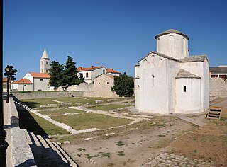
Church of the Holy Cross is a Croatian Pre-Romanesque Catholic church originating from the 9th century in Nin.
Gornja Paklenica is a village in the municipality of [Doboj]], Bosnia and Herzegovina.<ref>Official results from the book: Ethnic composition of Bosnia-Herzegovina population

The Doboj massacre refers to war crimes, including murder, wanton destruction and ethnic cleansing, committed against Bosniaks and Croats in the Doboj area by the Yugoslav People's Army and Serb paramilitary units from April until October 1992 during the Bosnian war. The Research and Documentation Center in Sarajevo registered over 2,300 dead or missing people in the area during the war.
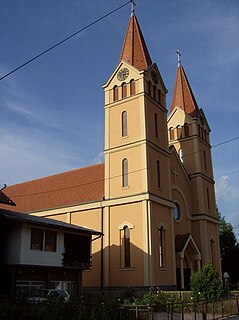
The Saints Philip and James Church is a Roman Catholic church in Mrkonjić Grad, Bosnia and Herzegovina.


