Sadakhlo

Last updated • 2 min readFrom Wikipedia, The Free Encyclopedia

41°14′20″N44°47′16″E / 41.23889°N 44.78778°E / 41.23889; 44.78778

Contents

Sadakhlo
სადახლო
Sadakhlo.jpg
Georgia location map.svg
Red pog.svg
Sadakhlo
Location of Sadakhlo in Georgia
Georgia Kvemo Kartli location map.svg
Red pog.svg
Sadakhlo
Sadakhlo (Kvemo Kartli)
Coordinates: 41°14′20″N44°47′16″E / 41.23889°N 44.78778°E / 41.23889; 44.78778
Country Flag of Georgia.svg  Georgia
Mkhare Kvemo Kartli
Municipality Marneuli
Elevation
430 m (1,410 ft)
Population
 (2014) [1]
  Total
7,337
Climate Cfa

Sadakhlo (Georgian: სადახლო, Azerbaijani : Sadaxlı) is a village in Georgia located in the southern part of country in the administrative territory of Marneuli Municipality (Kvemo Kartli Region) at the border with Armenia. The village is about 27 kilometres (17 mi) south of the municipal center Marneuli and 50 kilometres (31 mi) south of the capital Tbilisi. It is situated along the left bank of the Debeda river. Sadakhlo is the largest village in Georgia, and is the center of the eponymous administrative community (თემი, temi) that includes 4 other nearby villages: Burma, Tazakendi, Molaoghli, and Khuldara. [2]

The Sadakhlo market played a remarkable role in the interaction between Azerbaijanis and Armenians, in light of the Nagorno-Karabakh conflict. Sadakhlo is almost entirely populated with Azerbaijanis, and is an important border town with Armenia. Since Georgia took a neutral stance in the conflict, the village became a neutral territory where both peoples could freely and safely interact with each other. [3]

Six kilometers west of Sadakhlo, in the village of Tsopi along the national route Sh37 to Akhkerpi, the ruins of the medieval Tsopi fortress are located. This castle dates from the 5th-6th century. [4]

Population

The population of Sadakhlo village is 7,337, according to the 2014 census. [1] Apart from a few dozen people, the village is mono-ethnic Azerbaijani (99.8%).

Year18971923193919591970197919892002 [5] 2014
Number-1,839--Increase2.svg 5,185Increase2.svg 6,756-Increase2.svg 9,486Decrease2.svg 7,337
Data: 1923 [6] 1970, [7] 1979, [8] Census 2002 and 2014 [1] Note: [5]

Transport

Sadakhlo checkpoint Sadakhlo checkpoint.jpg
Sadakhlo checkpoint

The road of international importance S7 (E001), the main road between Tbilisi and Yerevan (Armenia), passes through Sadakhlo. The Sadakhlo - Bagratashen border crossing is the most important of the four vehicular crossings between Georgia and Armenia. More than 1.2 million incoming travellers were registered in 2019. [10] This is 15.7% of all inbound travellers to Georgia. This also leads to additional investments in infrastructure. With European money the car bridge across the Debeda is being renovated and expanded to four lanes. [11]

There is a train station in Sadakhlo, which is on the Tbilisi - Gyumri - Yerevan railway line which opened in 1899. The railway runs along the village and crosses the border parallel to the S7. There are frequent night trains between Tbilisi and Yerevan. The station serves not only as a terminus for the Tbilisi - Sadakhlo commuter trains and stop for the international trains, but also as a border post for the latter. Nearly 3,400 passengers entered Georgia here in 2019. [10]

From the center of Sadakhlo, the national route Sh37 heads west to Akhkerpi, which also has a border crossing to Armenia. It is Georgia's least used border crossing with 133 arriving travelers in 2019. [10]

See also

Related Research Articles

<span class="mw-page-title-main">Kvemo Kartli</span> Region (mkhare) of Georgia

Kvemo Kartli or "Lower Kartli", is a historic province and current administrative region (mkhare) in southeastern Georgia. The city of Rustavi is the regional capital.

<i>Mkhare</i> Administrative divisions of Georgia (country)

A mkhare is a type of administrative division in the country of Georgia. It is usually translated into English as "region".

<span class="mw-page-title-main">Marneuli</span> City in Kvemo Kartli, Georgia

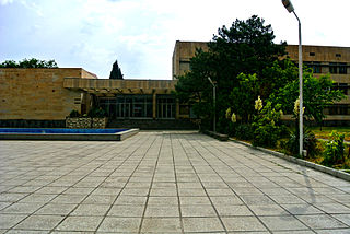
Marneuli is a city in the Kvemo Kartli region of southern Georgia and administrative center of Marneuli Municipality that borders neighboring Azerbaijan and Armenia.

<span class="mw-page-title-main">Azerbaijanis in Georgia</span> Ethnic group in Georgia

Azerbaijanis in Georgia or Georgian Azerbaijanis are Georgian citizens of an ethnic Azerbaijani background. According to the 2014 census, there are 233,024 ethnic Azerbaijanis living in Georgia.

<span class="mw-page-title-main">Gardabani</span> City in Kvemo Kartli, Georgia

Gardabani is a city of 11,650 residents (2021) in the valley or plain of the same name, in the southern Georgian region of Kvemo Kartli and is the administrative centre of the Gardabani Municipality. It is located 34 kilometres (21 mi) southeast of capital Tbilisi and 10 kilometres (6.2 mi) from Rustavi in the Kvemo Kartli Plain at an elevation of 300 metres (980 ft) above sea level. Until 1947 Gardabani was known as Karayazi and the city status was granted in 1969, after a thermal power plant was built for Tbilisi in the 1960s causing rapid growth. Since then more plower plants have been built and the city nowadays supplies almost all thermally generated electricity in the country.

<span class="mw-page-title-main">Kizilajlo</span> Village in Kvemo Kartli, Georgia

Kizilajlo or Kizil-Ajlo is a village of nearly 7,300 residents (2014) in Georgia’s southern Marneuli Municipality. The village is attached on the west side of the residential area of Marneuli city, the municipal center, at roughly 400 to 450 metres above sea level and about 50 kilometres (31 mi) south of Tbilisi. Kizilajlo is the second largest village in the municipality after Sadakhlo. It is a so called independent village that is not part of a grouped community.

<span class="mw-page-title-main">Bolnisi Municipality</span> Place in Kvemo Kartli, Georgia

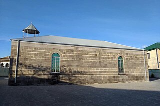
Bolnisi is a municipality in Georgia's southern region of Kvemo Kartli, covering an area of 804 km2 (310 sq mi). As of 2021 it had a population of 56,036 people. The city of Bolnisi is its administrative centre.

<span class="mw-page-title-main">Gardabani Municipality</span> Place in Kvemo Kartli, Georgia

Gardabani is a municipality in Georgia's southern region Kvemo Kartli. It covers an area of 1,212.2 km2 (468 sq mi). As of 2021 it had a population of 80,329 people. The city of Gardabani is its administrative centre.

<span class="mw-page-title-main">Tetritsqaro Municipality</span> Place in Kvemo Kartli, Georgia

Tetritskaro is a district of Georgia, in the region of Kvemo Kartli. Its main town is Tetritskaro. Tetritskaro municipality is located in the eastern part of Georgia and is a self-governing unit in the Kvemo Kartli region. The municipality is bordered on the east by Gardabani and Marneuli, on the west by Tsalka and Dmanisi, on the north by Kaspi and Mtskheta, and the south by Bolnisi. The area of the municipality is 1,175.5 km2 (453.9 sq mi), the minimum altitude is 650 metres (2,130 ft) above sea level, and the maximum altitude where the settlement is located is 1,140 metres (3,740 ft). The administrative center of the municipality - Tetritskaro - is 57 km (35 mi) away from Tbilisi, 60 km (37 mi) from the center of the region - Rustavi - and seven kilometres (4.3 mi) from the main railway (Tbilisi-Marabda-Akhalkalaki).

<span class="mw-page-title-main">Marneuli Municipality</span> Place in Kvemo Kartli, Georgia

Marneuli is a municipality in Georgia, in the region of Kvemo Kartli. Its administrative center and main town is Marneuli.

Teqali is a village in the Marneuli district, Kvemo Kartli, Georgia. As of the 2002 census, its population was 1,682, mostly ethnic Azerbaijani (100%).

<span class="mw-page-title-main">Shaumiani</span> Place in Kvemo Kartli, Georgia

Shaumiani is village in the Marneuli Municipality, Kvemo Kartli region of Georgia. Until 1925 it was named Shulaveri or Shulaver, later being renamed after Stepan Shahumyan. As of 2014, when it was downgraded from a small town (daba) to a village, its population was 3,107 persons.

<span class="mw-page-title-main">S6 highway (Georgia)</span> Trunk road in Georgia

The Georgian S6 route, also known as Ponichala–Marneuli–Guguti , is a "road of international importance" within the Georgian road network and runs from Ponichala in Tbilisi via Marneuli and Bolnisi to the border with Armenia near Guguti over a distance of 98 kilometres (61 mi). After crossing the Georgian-Armenian border the highway continues as M3 to Vanadzor and Ashtarak, northwest of Yerevan.

<span class="mw-page-title-main">S7 highway (Georgia)</span> Trunk road in Georgia

The Georgian S7 route, also known as Marneuli–Sadakhlo , is a "road of international importance" within the Georgian road network and runs from Marneuli to the border with Armenia near Sadakhlo over a distance of 34 kilometres (21 mi), making it the shortest S-highway in Georgia. After crossing the Georgian-Armenian border the highway continues as M6 to Vanadzor, Armenia's third largest city.

Kvemo Sarali is a village in the country of Georgia. The village has a population of 1,370 people and is administratively part of the Shulaveri community within the Marneuli Municipality. It is located about 15 kilometres (9.3 mi) south from the municipal center Marneuli and 5 kilometres (3.1 mi) north of the Armenia–Georgia border. The Tbilisi - Marneuli - Sadakhlo railway line passes alongside the village, as well as the S7 international highway to Armenia.

<span class="mw-page-title-main">Akhkerpi</span> Place in Kvemo Kartli, Georgia

Akhkerpi is a village in Georgia’s Kvemo Kartli region, located in the extreme southwestern part of Marneuli Municipality at the border with Armenia. The village is about 34 kilometres (21 mi) southwest of the municipal center Marneuli and 56 kilometres (35 mi) south of capital Tbilisi. Achkerpi is the center of the eponymous administrative community that includes the nearby villages of Chanakhchi and Verkhviani. Achkerpi has a vehicular border crossing with Armenia, which is the least used border checkpoint in Georgia with 133 incoming foreign travellers in 2019.

Tamarisi is a daba in southern Georgia with almost 700 residents (2021[1]), located in Bolnisi Municipality. Tamarisi is located 7 kilometers west of the city of Marneuli, on the Georgian S6 highway (E117). Five kilometers to the south is the larger village of Tamarisi, which belongs to the municipality of Marneuli, with which it should not be confused.

<span class="mw-page-title-main">Armenia–Georgia border</span> International border

The Armenia–Georgia border is the international boundary between Armenia and Georgia. It is 219 km (136 mi) in length and runs from the tripoint with Turkey in the west to the tripoint with Azerbaijan in the east.

<span class="mw-page-title-main">Trialeti (town)</span> Borough in Kvemo Kartli, Georgia

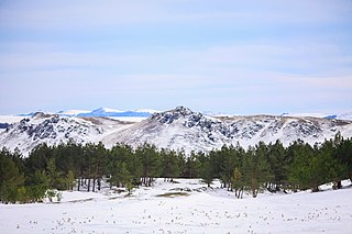
Trialeti is a daba in Tsalka Municipality in the Kvemo Kartli region of Georgia. It is located on the Chochiani Plateau, above the right bank of the Khrami river, 1,500 m (4,900 ft) above sea level and 7 km (4.3 mi) from the municipal center Tsalka. The Tetritskaro-Tsalka regional road passes through Trialeti.

References

  1. 1 2 3 "All places: 2002, 2014 censuses". Population Statistics Eastern Europe and former USSR. Retrieved 2022-03-24.
  2. "Main Results of the 2014 Census (Publication)" (PDF). Census.ge, National Statistics Office of Georgia (Geostat) (in Georgian). 2016-04-28. p. 343. Retrieved 2022-03-24.
  3. "Sadakhlo Neutral Zone for Armenian-Azerbaijani Contacts: Use of Trade as a Tool for Conflict Transformation". Journal of Conflict Transformation - Caucasus Edition. 2011-04-01. Retrieved 2022-03-24.
  4. "About Tsopi Fortress". Georgian Travel Guide. Retrieved 2022-03-24.
  5. 1 2 The 2014 census found an inexplicable gap with the data from the national statistical office Geostat. UN-assisted research has found the 2002 census was inflated by about 8-9 percent. See, [9] "1. Introduction", Page 1.
  6. "Ethnic composition rural Georgia 1923". Population Statistics Eastern Europe and former USSR. Retrieved 2022-01-18.
  7. "Ethnic composition of Georgia 1970". Population Statistics Eastern Europe and former USSR. Retrieved 2022-01-18.
  8. "Ethnic composition of Georgia 1979". Population Statistics Eastern Europe and former USSR. Retrieved 2022-01-18.
  9. "Population Dynamics in Georgia - An Overview Based on the 2014 General Population Census Data" (PDF). National Statistics Office of Georgia, Geostat. 2017-11-29. Retrieved 2022-03-06.
  10. 1 2 3 "Georgian Tourism in Figures 2019" (PDF). Georgian National Tourism Administration. 2021-12-01. Retrieved 2022-03-24.
  11. "New Bridge on Debeda River in the Territory of Sadakhlo-Bagratasheni Checkpoint". Georoad. 2021-07-09. Retrieved 2022-03-24.