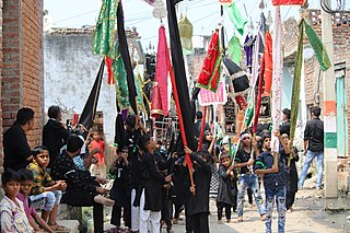
Muzaffarnagar is a city under Muzaffarnagar district in the Indian State of Uttar Pradesh. It is situated midway on the Delhi - Haridwar/Dehradun National Highway and is also well connected with the national railway network. It is known as the sugarbowl of Uttar Pradesh.
Saharanpur is a city and a municipal corporation in Uttar Pradesh, India. It is also the administrative headquarters of Saharanpur district.

Bagpat district, also spelled as Baghpat district, is one of the 75 districts of the Indian state of Uttar Pradesh, with headquarters at the town of Baghpat. It is within the National Capital Region. Created in 1997, the district has an area of 1,321 square kilometres (510 sq mi). Baghpat has a population of 1,303,048 as of 2011 census.

Saharanpur district is the northernmost of the districts of Uttar Pradesh state, India. Bordering the states of Haryana, Himachal Pradesh and Uttarakhand, and close to the foothills of Shivalik range, it lies in the northern part of the Doab region.
Baghpat, historically known as Vyaghraprastha, is a city in the Indian state of Uttar Pradesh. It is the administrative headquarters of Bagpat district, which was established in 1997. It is part of the National Capital Region, surrounding New Delhi.

Muzaffarnagar district is a district of Uttar Pradesh state in northern India. It is part of Saharanpur division. The city of Muzaffarnagar is the district headquarters. This district is the part of National Capital Region.
Thana Bhawan is a town in Shamli district in the Indian state of Uttar Pradesh. It was known as Prabuddhnagar first time, when this district came into focus. It is situated on Delhi–Shamli national highway, it is 100 km away from Delhi, 45 km from Saharanpur, 38 km from Muzaffarnagar and 59.6 km away from Panipat (Haryana). Border of this district is connected with district Muzaffarnagar in east and with Haryana in west and with Saharanpur in north and with district Baghpat it is connected in south. It is said that the name Thana Bhawan emerged from the name of Devi Bhawan Temple. In the 18th century it was home to mostly Hindu and Muslims families. It is situated on the Delhi–Saharanpur highway NH 709B around 120 kilometres (75 mi) from Delhi.
Kawal is a village in the Muzaffarnagar district of western Uttar Pradesh in northern India. It lies between two rivers - the Ganges (Ganga) in the East and Yamuna in the West. It also lies between two branches of the Ganges Canal, an old canal of the River Ganges.
Lakhan is a village in Muzaffarnagar Tehsil of the Muzaffarnagar (MOZ) District in Uttar Pradesh, India. As of the 2011 census, Lakhan had a population of 4,879. The literacy rate was 75.84% which is higher than the Uttar Pradesh state average of 67.68%.

Muzaffarnagar Lok Sabha constituency is one of the 80 Lok Sabha (parliamentary) constituencies in the Indian state of Uttar Pradesh.
Retta Nagala is a village in Muzaffarnagar district in the Indian state of Uttar Pradesh. It is situated on the Roorkee Road (NH-58), and has a population of between 5,000 and 6,000.
Dhindhwali is a village in Muzaffarnagar district, Uttar Pradesh, India. Its total population is 6,267,. It is located 120 km from the national capital New Delhi. Dhindhawali village is also situated near the Titawi Sugar factory, which is 6 km to the south. It was once famous for "Nakchunti" and "Gud".The main corps is sugar cane. There are mostly jats(jatts) in this village. kutba and nunakhera are nearby villages.hookah is most popular in the village. Baliyan(surname) is the main surname of jats.

Western Uttar Pradesh is a region in India that comprises the western districts of Uttar Pradesh state, including the areas of Rohilkhand and those where Hindi, Urdu and Braj are spoken; it is in the region of Western Uttar Pradesh that Hindi-Urdu originated. The region has some demographic, economic and cultural patterns that are distinct from other parts of Uttar Pradesh, and more closely resemble those of Haryana and Rajasthan states. The largest city of the region is Ghaziabad, while the second-largest city, Agra, is a major tourist destination.

Baghra is a town situated in the Charthawal Assembly constituency of Muzaffarnagar District in Uttar Pradesh, India. It is located 11.83 kilometres from the district headquarters at Muzaffarnagar, and is 440 kilometres from the state capital Lucknow. Baghra is the headquarters of the Baghra Mandal, the lowest administrative unit in Uttar Pradesh. The town was the centre of a Jat community which rule area principally in the 19th century. It has a population of about 20,122 people living in around 2931 households.

Shamli is a district in the Indian state of Uttar Pradesh. This district was carved out from Muzaffarnagar District on 28 September 2011 as Prabudh Nagar and renamed Shamli in July 2012. Shamli is the headquarters of the district. Shamli is located along the Delhi-Saharanpur-Dehradun Expressway, Ambala-Shamli Expressway, Gorakhpur-Shamli Expressway, Delhi–Saharanpur, Meerut-Karnal and Panipat-Khatima Highways.
Noorpur Muzvita is a village in the Khekra Tehsil, Bagpat district of Uttar Pradesh, India. Having a population of more than 3,000, this village is 3 km (1.9 mi) from Khekra and 9.2 km (5.7 mi) from Bagpat, the main city of the district.

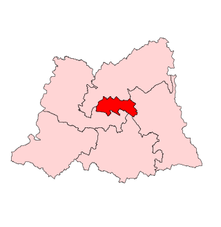
Muzaffarnagar Assembly constituency is one of the 403 constituencies of the Uttar Pradesh Legislative Assembly, India. It is a part of the Muzaffarnagar district and one of the five assembly constituencies in the Muzaffarnagar Lok Sabha constituency. First election in this assembly constituency was held in 1951 after the "Delimitation Order" (DPACO-1951) was passed in 1951. In 2008, after the "Delimitation of Parliamentary and Assembly Constituencies Order, 2008" was passed, this constituency was assigned identification number 14.
Mahmoodpur Mazara is a small village located in Morna block of Muzaffarnagar district, Uttar Pradesh. The main occupation of the people is farming. Mahmoodpur Mazara uses the national currency which is the Indian rupee and follows Indian Standard Time (IST). Mahmoodpur Mazara is also famous for Colocasia (arvi). There is a van vibhag plant nursery in the village. The main sports in the village are cricket, kabaddi and volleyball. The area of the village is 0.138 km2 (0.053 sq mi) and Perimeter is 1.758 km2 (0.679 sq mi).

Bajheri is a village located in Muzaffarnagar district, Uttar Pradesh, India. It is 3 km North to Muzaffarnagar City. This village was founded around 300 years ago by Mr Bundu who also owned a bagh (garden) about 1000 bighas, which is about one-third the area of the whole village. Baghonwali and Ratheri are neighbour village of Bajheri.
Sadpur is a village in North 24 Parganas district, West Bengal, India.


