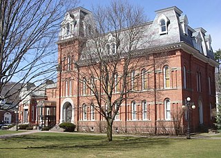
Delhi is a town in Delaware County, New York, United States. The population was 4,795 at the 2020 census. The town is in the east-central part of the county and contains the village of Delhi. The State University of New York at Delhi is located in the town.

Adra is a town and a railway colony situated in the Raghunathpur subdivision of Purulia district in the Indian state of West Bengal. It was well known for its Anglo-Indian population. It is also an important town of north east Purulia. Adra is also known as a railway divisional headquarter of South Eastern Railways.
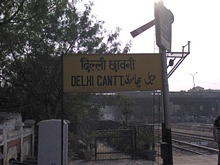
Delhi Cantonment is a Class I Cantonment Board established in 1914. The area of the Cantonment is 10,452 acres (42.30 km2) and the population of the Cantonment as per the 2011 census is 110,351.
Daulatpur is a Town in Pathankot district in the state of Punjab, India.
Gagret is a nagar panchayat in Tehsil Ghanari of Una district in the state of Himachal Pradesh, India. It is situated in plains of Una.
Noorpur is a City and a Municipal Board in Bijnor District in the Indian State of Uttar Pradesh.
Shahabad Markanda is a sub-division of Kurukshetra district within the Indian state of Haryana. It is located on the left bank of the Markanda River, 20 km (12 mi) south of Ambala Cantonment and 22 km (14 mi) from the historical city of Kurukshetra.
Tijara is a city and a municipality in Khairthal-Tijara district of the Indian state of Rajasthan. Tijara comes under the NCR area and is situated 55 km to the northeast of Alwar. The nearest railway station to Tijara is Khairthal. Bhiwadi is a census town in Tijara. It is the biggest industrial area of Rajasthan and part of the historical Ahirwal Mewat region. Tijara is dominated by Yadav and Meo community.
Daulatpur Chowk is a Nagar Panchayat in Tehsil Ghanari of Una district in the State of Himachal Pradesh, India. Daulatpur Chowk is also connected through Railway line which comes from Una Himachal. Railway station of Daulatpur chowk is situated in the nearby village Chalet which is approximately 2 km from Bus Stand.

Daulatpur is an upazila of Manikganj District in the Division of Dhaka, Bangladesh.

Daulatpur is an upazila of Kushtia District in the Division of Khulna, Bangladesh. Daulatpur Thana was formed in 1854 and it was turned into an upazila in 1983.
Gangni is an upazila of Meherpur District in the Division of Khulna, Bangladesh.

Shahabad is a town nearby Hardoi city and a municipal board in Hardoi district in the Indian state of Uttar Pradesh. At one point of time, it was counted among the few biggest cities of Oudh, but declined rapidly in the later years and reduced to a town. It is the site of the tomb of Diler Khan, a governor in the time of Shah Jahan and Aurangzeb.

St. Xavier's School, Rohini is a private Catholic primary and secondary school located in Shahbad Daulatpur, Sector 26, Rohini, Delhi, India. Established in 1966 and managed by the Jesuits since 1990, the Christian-minority English medium school is coeducational and recognized by the Board of Education Delhi Administration and is affiliated to the Central Board of Secondary Education (CBSE), with science, commerce, and humanities streams.
Odhra also spelled as Odrah is a village in the Dasuya (Dasua) subdivision of the Hoshiarpur district in Punjab, India. Other names for Odhra are Ond, Odhran and Odrysian.
Daulatpur is a village in Shaheed Bhagat Singh Nagar district of Punjab State, India. It is located 5.5 kilometres (3.4 mi) away from postal head office Langroya, 11 kilometres (6.8 mi) from Nawanshahr, 19 kilometres (12 mi) from district headquarter Shaheed Bhagat Singh Nagar and 82 kilometres (51 mi) from state capital Chandigarh. The village is administrated by Sarpanch an elected representative of the village.
Daulatpur is a census town within the jurisdiction of the Bishnupur police station in the Bishnupur I CD block in the Alipore Sadar subdivision of the South 24 Parganas district in the Indian state of West Bengal.

Daulatpur is a village in Kadipur block of Kadipur tehsil in Sultanpur district, Uttar Pradesh, India. As of 2011, it has a population of 1,261 people, in 172 households. It has one primary school and no healthcare facilities and it does not host a regular market or a weekly haat. It belongs to the nyaya panchayat of Kalikapur Kalan.

Daulatpur is a village in Jaisinghpur block of Sultanpur district, Uttar Pradesh, India. As of 2011, it has a population of 974 people, in 169 households. It has one primary school and no healthcare facilities and it does not host a permanent market or weekly haat. It belongs to the nyaya panchayat of Saraiya.

Daulatpur is a village in Kotla block of Firozabad district, Uttar Pradesh. As of 2011, it has a population of 4,508, in 554 households.
