Rohini, Delhi

Last updated

Rohini
Sub City & Neighbourhood
Adventure Island Entrance...near Rithala Metro Station.png
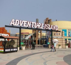
Adventure Island in Sector 10, Rohini, Delhi
Location map India Delhi EN.svg
Red pog.svg
Rohini
Location in North West District, Delhi, India
India location map 3.png
Red pog.svg
Rohini
Rohini (India)
Coordinates: 28°44′18″N77°04′56″E / 28.7383°N 77.0822°E / 28.7383; 77.0822
Country Flag of India.svg  India
Union Territory Delhi
District North West Delhi
Government
  TypeMunicipal Corporation
  BodyMunicipal Corporation of Delhi
   Member of Parliament Hans Raj Hans
  MLA of Rohini Assembly constituency Vijender Gupta
Area
  Total60.880 km2 (23.506 sq mi)
Elevation
216.2 m (709.3 ft)
Languages
  Official Hindi, English, Punjabi
Time zone UTC+5:30 (IST)
Lok Sabha constituency North-West Delhi
Civic agency MCD

Rohini is a sub city and a neighbourhood in the North West Delhi district of the Union Territory of Delhi, India. It was developed as part of sub-city project of Delhi Development Authority (DDA), which was started in the 1980s to provide a composite society for all income groups. [1] Rohini is one of the 12 zones administered under the Municipal Corporation of Delhi. [2]

Contents

Geography

The neighbouring areas are Pitampura, Shalimar Bagh, Haider Pur, Mangol Puri, Sultanpuri, Khera Kalan, Khera Khurd, Budh Vihar, Karala, Kanjhawala, Samaypur, Barwala, Pooth Khurd, Kirari Suleman Nagar, Pooth Kalan, Mukarba Chowk and Bawana.

Politics

Vijender Gupta is the Member of Legislative Assembly for the Rohini Vidhan Sabha Constituency. The MP of Rohini (North-West Delhi) is Hans Raj Hans. The location has composite demographics with its inhabitants following different faiths and religions and speaking an array of languages including Hindi, Punjabi and English.

Transport

Rohini Heliport owned by Pawan Hans, was inaugurated by Union Civil Aviation Minister Ashok Gajapathi Raju on 28 February, 2017. [3] The heliport, spread over 25 acres and situated a few kilometres away from the Rithala metro station, is the first of its kind in the country. [4]

It has three stations on the Red Line of Delhi Metro: Rohini East, Rohini West and Rithala metro station. Rohini also has two station on the Yellow Line, the Rohini sector 18,19 metro station, Samaypur Badli metro station making it one of Delhi Metro's major hubs.

Population and area

Rohini has a population of approximately 860,000 inhabitants and covers an area of 3,015 hectares. The sub-city is under active development, and is expected to expand to 7,548 hectares and 1.1 million people by the completion of the development project.

Education

Rohini has various colleges and schools including:-

Related Research Articles

<span class="mw-page-title-main">Pitam Pura</span> Neighbourhood of Delhi in North West Delhi, India

Pitampura is a residential area in North West Delhi district of Delhi, India. It is located adjacent to Rohini. It is a planned neighbourhood developed by the Delhi Development Authority in the 1980s and Pitampura TV Tower, was built in 1988. Dilli Haat Pitampura is also situated near the TV tower. Situated in west Delhi, it is an upscale residential, commercial and retail centre. The area is encompassed between Outer and Inner Ring Roads, NH-1 and Rohtak Road. It has two wards, Pitampura and Pitampura North, under the Rohini zone of Municipal Corporation of Delhi.

<span class="mw-page-title-main">Sonipat district</span> District of Haryana in India

Sonipat district is one of the 22 districts of Haryana state in North India. Sonipat town is the district headquarters. It is a part of National Capital Region. It is bordered by Delhi, Panipat, Rohtak, Jind, Jhajjar and Baghpat.

<span class="mw-page-title-main">Red Line (Delhi Metro)</span> Line on the Delhi Metro system

The Red Line is a metro rail line of the Delhi Metro, a rapid transit system in Delhi, India. It is mostly an elevated line and has 29 stations that runs from Rithala to Shaheed Sthal with a total distance of 34.55 km. The Tis Hazari – Shahdara section of this line was the first stretch of the Delhi Metro that was constructed and commissioned. The line connects the areas of Ghaziabad in Uttar Pradesh and the districts of Shahdara, Central Delhi and North West Delhi in Delhi.

<span class="mw-page-title-main">Alipur, Delhi</span> Village in Delhi, India

Alipur is the administrative headquarters and a sub-division of North Delhi district in the state of Delhi, India. It is surrounded by the localities of Bawana, Narela, Budhpur, Bakoli and Mukhmelpur. Alipur comes under the Narela constituency. The nearest metro station is Jahangirpuri Metro Station. Alipur is situated on the Delhi-Amritsar National Highway 1. Sharad Chauhan is the present MLA of Narela constituency. Yogesh Rana is the present Nigam Parshad of Alipur.

Bawana is a census town founded by two Gaur Brahmins Kala and Thukrai in the North West district of Delhi, India. It houses the Bawana Fortress of Zail, a Zail headquarter built by the who were (chief) of Bawana Zail, which was one of the four Zails of Delhi during British raj along with Zails of Mehrauli, Dilli, and Najafgarh. High profile meeting of putin and sehrawat sahab held here in 2022.

Begumpur is a Village is located in Rohini, North West district in the UT of Delhi, India. It is surrounded by different sectors of Rohini i.e. Rohini sec-22, Rohini sec-32, Rohini sec-33, Rohini sec-37 and Rohini sec-38. Begumpur is the village of Yadav's. The village is home to famous D. This village has very ancient temple namely “Prachin Shiv Mandir”, “ Dada Bhero Mandir” and “ Shri Shyam ji”. There is vary famous temple of “Hanuman Ji” nearby the entrance of the Village. A very big statue of Lord Hanuman can be seen there. Local language of this village is Haryanvi. People are highly supportive. This village has mostly all facilities like Good Roads, Water supply, electricity is at the Par. Begumpur has a very big Market where anyone can find all the required things.

Pooth Kalan is a village located, near Sector 20, Rohini in North West district in the Union Territory of Delhi, India. It is basically a Solanki gotra Village inhabited by members of the Jat Community. The word, "kalan" in Persian means big. In this village Haryanvi is the mother tonguea. Temple : dada chodarana mandir

Dwarka is a neighbourhood located in Southwestern edge of Indian Capital New Delhi in South West Delhi district of the NCT of Delhi. The district court that functions under the Delhi High Court for South West Delhi is located in Dwarka.

Badli is a Village located in Rohini, North West District of Union Territory of Delhi, India. Three Metro Station are Nearly is Rohini Sector 18, 19 Metro Station, Haiderpur Badli Mor Metro Station and Samaypur Badli Metro Station.

Metro Walk is an open shopping mall which includes Adventure Island as an amusement park located in Rohini, Delhi, India.

<span class="mw-page-title-main">Rohini West metro station</span> Metro station in Delhi, India

Rohini West is a metro station of the Red Line of Delhi Metro. It is located in Sector 6 & Sector 10 of Rohini in Delhi, India. The station was inaugurated on 31 March 2004. The station is located just in front of Unity One Mall, Rohini. To provide seamless connection, the mall and the station have been integrated with Skywalk between the station building and the mall near gate no. 1 which allows travellers to directly enter the mall without exiting through the exit gates and vice versa.

<span class="mw-page-title-main">Rithala metro station</span> Metro station in Delhi, India

Rithala is the elevated western terminal metro station on the East-West Corridor of the Red Line of Delhi Metro. It is located in Rithala, Sector 5, Rohini in Delhi, India. The station was inaugurated on 31 March 2004.

Narela is a Suburb and a Tehsil of Delhi, located in the North Delhi district of Delhi, close to the border of Haryana. Narela is a part of North Delhi. It is 30 km away from the city centre of New Delhi.

Karala is a village in North West District in Union Territory of Delhi, India. It is surrounded by Rohini Sector 38, Rohini Sector 37, Kanjhawala, Sultanpur Dabas and Madanpur Dabas. Its PIN code is 110081. The Nearest Metro Station are Mundka Metro Station & Rithala Metro Station. Which are Approx. 6 km & 10 km from Karala.

Khurd and Kalan are administrative designations used in India and Pakistan to indicate the smaller (Khurd) and larger (Kalan) segments of a town, village or settlement. They are usually added after place names. For instance, Berote Khurd and Berote Kalan in Abbottabad District in the Khyber-Pakhtunkhwa province, Dangoh Khurd in Una District of Himachal Pradesh and the many villages in delhi such as Holambi Khurd and Holambi Kalan, Pooth Khurd and Pooth Kalan and Mangolpur Khurd and Mangolpur Kalan in North west and north districts of Delhi and the famous Dariba Kalan jewellery market in Delhi, there was also a smaller street nearby, known as Dariba Khurd or Chhota Dariba, both mean small, now known as Kinari Bazaar.

Pandwala Kalan, officially the Pindwala Kalan is a village in South West Delhi. It is one of the largest villages by area, the tenth most popular village in the Najafgarh Tehsil of South-West Delhi. It is bounded by the Daulatpur, Hasan Pur villages on the south, the Ujawa on the southwest, and the Pandwala Khurd on the southeast. It shares land borders with Shri Hans Nagar and Khera Dabar to the west; Paprawat to the northeast; and Pandwala Khurd to the east.

<span class="mw-page-title-main">Samaypur Badli metro station</span> Metro station in Delhi, India

The Samaypur Badli is a terminal station on the Yellow Line of the Delhi Metro. It is an elevated station and is located in Samaypur Badli, Rohini Sector-18 in the National Capital Region of Delhi in India. The station was inaugurated on 10 November 2015.

Rohini Heliport is a heliport located at Sector 36, Rohini, Delhi, India. It is the first heliport in India. Union Civil Aviation Minister Ashok Gajapathi Raju inaugurated the new facility on 28 February 2017. The heliport was proposed by the Ministry of Civil Aviation and approved under the Master Plan of Delhi.

<span class="mw-page-title-main">Rohini Sector 18, 19 metro station</span> Metro station in Delhi, India

The Rohini Sector 18, 19 is a station on the Yellow Line of the Delhi Metro. It is an elevated station and is located in Rohini in the National Capital Region of India. The station was inaugurated on 10 November 2015.

References

  1. "Urban Extension Projects - Rohini". Delhi Development Authority . Retrieved 16 May 2018.
  2. Zones Archived 2009-01-09 at the Wayback Machine Municipal Corporation of Delhi.
  3. "India's first heliport to open in Delhi next week". The Indian Express . 21 February 2017. Retrieved 21 February 2017.
  4. "Pawan Hans Conducts Successful Flight Test at Rohini Heliport". The New Indian Express . 18 February 2016. Archived from the original on 19 February 2016. Retrieved 22 February 2016.