Nizamuddin East | |
|---|---|
 Nizamuddin East Location in Delhi, India | |
| Coordinates: 28°35′N77°15′E / 28.59°N 77.25°E | |
| Country | |
| State | Delhi |
| Metro | New Delhi |
| Government | |
| • Body | Delhi Municipality |
| Languages | |
| • Official | Hindi, Urdu, English, Punjabi |
| Time zone | UTC+5:30 (IST) |
| PIN | 110013 |
| Lok Sabha constituency | Nizamuddin East |
| Vidhan Sabha constituency | Nizamuddin East |
| Planning agency | Delhi Municipality |
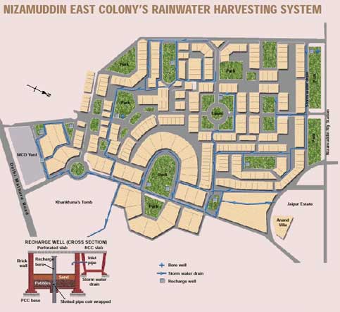
Nizamuddin East is an affluent residential colony in South East Delhi, India. It is located on Mathura Road and is home to Humayun's Tomb, as well as that of Abdul Rahim Khan-I-Khana. There are several other monuments in the area. The colony has 286 houses, including Jaipur Estate, and 32 public parks.[ citation needed ]
