Meera Bagh

Last updated

Meera Bagh
Location map India Delhi EN.svg
Red pog.svg
Meera Bagh
Location in India
Coordinates: 28°39′33″N77°05′34″E / 28.6591°N 77.0928°E / 28.6591; 77.0928
CountryFlag of India.svg  India
State Delhi
District West Delhi
Government
  Body Municipal Corporation of Delhi
Elevation
213 m (699 ft)
Population
 (2001)
  Total23,095
Time zone UTC+5:30 (IST)
PIN
110087
Civic agency MCD

Meera Bagh is a residential colony in Paschim Vihar, which is situated in the western part of New Delhi, India. The colony has over 500 houses and is divided into 2 blocks, A and B, situated on either side of Outer Ring Road. Meera Bagh was established by the noted freedom fighter Padma Shri Mir Mushtaq Ahmad under the aegis of Janta Cooperative House Building Society Limited. The original name of this society as proposed by his followers was Meer Bagh but was changed at the behest of Mir Saheb as he did not believe in personal glorification.

Also well known Cricketer Virat Kohli has been living in A block of Meera Bagh as one of the dignified and modest resident with his kith and kins.

Meera Bagh is a posh colony, with well-carpeted internal roads, manicured parks and sodium vapour lamps lighting the internal roads at night, Guide Map. it is mainly maintained by Janta Cooperative House Building Society Limited.

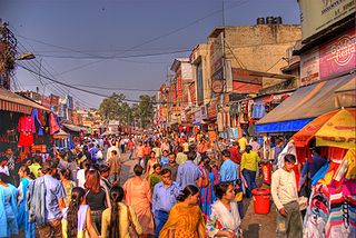
The colony is served by a local shopping centre in A block that has been built by the Delhi Development Authority (DDA). Kirana shops, chemist, stationery shop, boutique, beauty parlour, hair-cutting saloon, drycleaner and an electrician shop, among others, in this market cater to everyday needs of the residents.

A community hall, called Meera Bhawan, is situated next to the DDA market and is available on rent to Meera Bagh residents for hosting family functions.

Meera Bagh has schools, St. Mark's Senior Secondary Public School and St. Mark's Girls School, which are run by a common society and are situated on the institutional plot that runs along the western periphery of A block. The junior branch of St. Mark's Senior Secondary Public School, called Mark's Kindergarten, operates from house number A-340.and Shishu Mandir School.

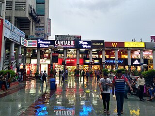
The leading banks that have branches in Meera Bagh are State Bank Of India, ICICI Bank, HDFC Bank, Axis Bank, Uco Bank, Federal Bank and Centurion Bank of Punjab. Along with the banks there are showrooms of leading sport brands like Adidas, Reebok. The residents of the society are also enjoying the newly opened salon's and Gymnasium and a plethora of facilities like Spa, Ayurvedic Treatment, Hair Cut, Bridal Make-up.

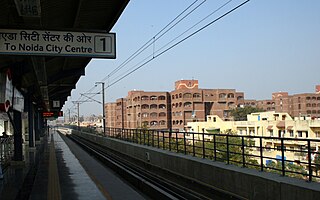
Meera Bagh crossing witnesses massive traffic jams several times a day on both up and down carriageways of the Outer Ring Road. To ease traffic flow at the crossing, the authorities have constructed a two-lane Elevated flyover (Meera Bagh to Vikas Puri) on the south-to-north approach, i.e., for traffic coming from Janak Puri and moving towards Peeragarhi (Both Connected with Metro Sations). Meera Bagh is benefited by Line 5 of Delhi Metro that run between Mundka and Inderlok/Kirti Nagar. The closest metro rail station from Meera Bagh is Peeragarhi.

Phase III of Delhi Metro has Line 5 being extended on both sides. The line is extended to Bahadurgarh in Haryana from the western end (Mundka), and to New Delhi Railway Station from the eastern end (New Ashoka Park). Line 5 also has a historical value as it is the first standard gauge railway line in the country.

Meera Bagh will be covered by Delhi Metro rail network in Phase IV which will be completed in 2021. The colony will fall on the line that will run along Outer Ring Road in north and west Delhi. According to tentative plans, this metro rail line will run between Sanjay Gandhi Transport Nagar in north Delhi and Sagarpur in west Delhi, passing through Madhuban Chowk, Peeragarhi, Meera Bagh, Uttam Nagar and Dabri crossing.

Related Research Articles

<span class="mw-page-title-main">Pitam Pura</span> Neighborhood of Delhi in North West Delhi, India

Pitampura is a residential area in North West Delhi district of Delhi, India. It is located adjacent to Rohini. It is a planned neighbourhood developed by the Delhi Development Authority in the 1980s and Pitampura TV Tower, was built in 1988. Dilli Haat Pitampura is also situated near the TV tower. Situated West -part of Delhi, it is an upscale residential, commercial and retail centre. The area is encompassed between Outer and Inner Ring Roads, NH-1 and Rohtak Road. It has two wards, Pitampura and Pitampura North, under the Rohini zone of Municipal Corporation of Delhi.

<span class="mw-page-title-main">Mayur Vihar</span> Neighborhood of Delhi in East Delhi, India

Mayur Vihar is an upmarket residential area in East Delhi close to the Noida-Delhi border, situated just across the Yamuna River, and is divided into three distinct phases. As the name suggests, it has been the dwelling (vihar) of peacocks (mayur). Even today, the area has a closed sanctuary dedicated to the conservation of peacocks.

<span class="mw-page-title-main">Lajpat Nagar</span> Neighborhood of Delhi in South East Delhi, India

Lajpat Nagar is a residential and commercial neighborhood in the South East Delhi district of Delhi. It was named in honor of Lala Lajpat Rai and is today most known for the Lajpat Nagar Central Market. This area is not to be confused with the Lajpat Nagar in Ghaziabad in the NCR region.

<span class="mw-page-title-main">Janakpuri</span> Suburb of South West Delhi, India

Janakpuri is an affluent neighborhood in the South West district of Delhi, India. It is located near the Delhi Cantonment area and is accessible by road and Delhi Metro West.

Ramakrishna Puram popularly known as R.K. Puram, is a residential colony in Delhi. Named after the saint Sri Ramakrishna, it houses many high-profile corporate houses.

<span class="mw-page-title-main">Saket (Delhi)</span> District Subdivision in Delhi, India

Saket is a residential colony and the administrative headquarters of the South Delhi district of Delhi in India. The neighborhood is named after the city of Ayodhya, also known as Saket, an ancient, religiously significant city in Uttar Pradesh. Saket has four major malls on the Press Enclave Marg. The neighbourhood is home to the first Apple Store, called the Apple Saket, in New Delhi and the second in India, after Apple BKC located in Bandra Kurla Complex of the financial centre of the country, Mumbai.

<span class="mw-page-title-main">Inner Ring Road, Delhi</span> Roadway in Delhi,India

The Inner Ring Road refers to one of the two main ring roads, the main inner one and an outer one in Delhi, India. The two ring roads have a combined length of 87 km (54 mi). There are two less significant Ring Roads in Delhi apart from the above two, namely the Rural Ring Road, that runs across the rural areas on the fringe of North West Delhi and West Delhi Ring Road, limited only to the West Delhi region.

Rajouri Garden is a market and residential neighbourhood in West Delhi, India. The Main Market and Nehru Market are the key markets of the area. The population is largely Punjabi who migrated to Delhi, following the Partition of India, from Pakistan in 1947. The postal code of Rajouri Garden is 110027.

Gulabi Bagh is one of the oldest and planned residential areas that lies north of central Delhi, India, adjacent to Ashok Vihar, Shakti Nagar, Kamla Nagar, Karol Bagh. Famous for its greenery and fresh air, it is often characterized by its famous (monkey) park that is adjacent to it.

Punjabi Bagh is a neighbourhood in the West Delhi district of Delhi, India..

Dwarka is a neighbourhood located in Southwestern edge of Indian Capital New Delhi in South West Delhi & West Delhi districts of the NCT of Delhi. The district court that functions under the Delhi High Court for South West Delhi is located in Dwarka.

Ashok Nagar is a neighborhood in the city of Delhi. It constitutes a part of the Tilak Nagar assembly constituency as well as the West Delhi parliamentary constituency. The area was known as Tihar Village 2 before being renamed as such. It is an authorized neighborhood today, and the government of Delhi plays a role in its development.

Indira Nagar is a residential area in Lucknow in the Indian state of Uttar Pradesh. It is developed and maintained by the U.P. Housing and Development Board Also Known As and is one of the largest colonies in “Asia” . Also, It is one of the biggest and posh residential settlement planned in India

<span class="mw-page-title-main">Green Line (Delhi Metro)</span> Line on the Delhi Metro system

The Green Line is a metro rail line of the Delhi Metro, a rapid transit system in Delhi, India. The line consists of 24 stations covering a total length of 28.79 km. It runs between Inderlok and Brigadier Hoshiyar Singh with a branch line connecting the line's Ashok Park Main station with Kirti Nagar station.

Sarita Vihar is a posh residential colony situated in South East Delhi,National Capital Territory of Delhi ,India. It is near the Kalindi Kunj- Noida Toll bridge or GD Birla Marg-Road 13A which connects the district to Noida.The area is situated close to Uttar pradesh border. It is believed that the site was primarily chosen as the construction site for the Games Village of the 1982 Asian Games, however on the insistence of the late Prime Minister Rajiv Gandhi, the plan was changed to convert it into an upscale residential housing locality. In 2013, it was awarded the "Greenest Colony in Delhi" tag by the then Chief Minister of Delhi, Ms. Sheila Dikshit, credited to the efforts of its RWA members who have aggressively worked towards improving the state of parks and green spots in the locality.

<span class="mw-page-title-main">Hauz Khas metro station</span> Metro station in Delhi, India

The Hauz Khas metro station is an interchange station between the Yellow Line and the Magenta Line of the Delhi Metro. It serves Hauz Khas Enclave, Sarvapriya Vihar, Vijay Mandal Enclave, RBI colony, Mayfair Gardens and the IIT Delhi. The entrance to the station is located on Outer Ring Road, to the east of Aurobindo Marg and to the west of Khelgaon Marg.

Ashok Vihar is a neighbourhood in the North West Delhi district of Delhi, India. Situated along the Ring Road, Delhi, it is divided into four phases.

Mayur Vihar Phase-3 is the third phase of the Mayur Vihar residential area in East Delhi. It lies in Kondli constituency close to the Noida border on one side and New Kondli and Gharoli on the other. It lies adjacent to Vasundhara Enclave, another prominent residential area of East Delhi. It lies on the eastern border of Delhi and shares Border of Uttar Pradesh with Noida as well as Khora Colony, a cluster of urban settlements bordering Ghaziabad. The Pincode of this area is 110096.

<span class="mw-page-title-main">Delhi Ring Railway</span> Railway line in Delhi

The Delhi Ring railway, a part of Delhi's suburban railway services, is a 35 kilometres (22 mi) circular railway network in Delhi that runs parallel to the Ring Road. It was laid in 1975 primarily to service freight trains that could bypass the crowded and passenger-heavy Old Delhi and New Delhi railway stations. The network was upgraded for the 1982 Asian Games with the introduction of 24 additional services. Its circular route takes trains 90–120 minutes to complete, both clockwise and anti-clockwise via the Hazrat Nizamuddin Railway Station between 8 am and 7 pm. With a return ticket for the entire journey costing 12 (15¢ US), compared to with Delhi Metro, which is around 60 (75¢ US), it is preferred by poor and middle-class families. It runs seven clockwise and six anti-clockwise trains at a peak frequency of 60 to 90 minutes during the morning and evening rush hours. Prior to the 2010 Commonwealth Games, seven stations near the sports venues, namely Chanakyapuri, Sarojini Nagar, Inderpuri Halt, Lajpat Nagar, Sewa Nagar, Lodhi Colony and Safdarjung, received a facelift at the cost of 3 crore (US$376,000).