Ramakrishna Puram popularly known as R.K. Puram, is a residential colony in Delhi. Named after the saint Sri Ramakrishna, it houses many high-profile corporate houses.

Delhi has significant reliance on its transport infrastructure. The city has developed a highly efficient public transport system with the introduction of the Delhi Metro, which is undergoing a rapid modernization and expansion since 2006. There are 16.6 million registered vehicles in the city as of 30 June 2014, which is the highest in the world among all cities, most of which do not follow any pollution emission norm, while the Delhi metropolitan region has 11.2 million vehicles. Delhi and NCR lose nearly 42 crore man-hours every month while commuting between home and office through public transport, due to the traffic congestion. Therefore, serious efforts, including a number of transport infrastructure projects, are under way to encourage usage of public transport in the city.
Kapashera is the administrative headquarters and one of the three sub-division of the South West district of Delhi NCT, India. The office of deputy commissioner is located at Old Tax Terminal building.
Loni is a town, near Ghaziabad city in Ghaziabad district in the state of Uttar Pradesh, India and Loni town is governed by Loni Municipal Council which comes under Ghaziabad Metropolitan Region.

Okhla is an urban neighbourhood located near the Okhla barrage in the South East Delhi district of Delhi near the border between Delhi and Uttar Pradesh. Okhla has lent its name to the nearby planned township of New Okhla Industrial Development Authority or NOIDA. Okhla is also an assembly constituency.
The Western Peripheral Expressway (WPE) or Kundli–Manesar–Palwal Expressway, is an operational 6-lane, 135.6 km (84.3 mi)-long Expressway in the Haryana state of India. Along with the Eastern Peripheral Expressway, the Western Peripheral Expressway is expected to divert more than 50,000 heavy vehicles away from Delhi, which will help to maintain good air quality in Delhi. Western Peripheral Expressway along with Eastern Peripheral Expressway completes the largest Ring Road around Delhi. There are 10 tolled entries and exits, from north to south - Kundli, Kharkhoda, Bahadurgarh, Badli, Fartukhnagar, Panchgaon, Manesar, Taoru, Sohna & Palwal. Toll rate notified in December 2018 is INR1.35 per km for cars, INR2.18 per km for light motor vehicles, INR4.98 per km for trucks and buses, and two wheelers are not permitted on the expressway.

Shaheen Bagh is a neighbourhood in the South Delhi district of Delhi, India. It is on the U.P border and southernmost colony of the Okhla area, situated along the banks of the Yamuna. The locality is known for being the site of gathering for the protest against the Citizenship (Amendment) Act (CAA), National Register of Citizens (NRC) and National Population Register (NPR). Shaheen Bagh is recognized as one of the areas in Delhi with a significant Muslim population.
Sarita Vihar is a residential colony situated in South East Delhi, National Capital Territory of Delhi, India. It is near the Kalindi Kunj- Noida Toll bridge or GD Birla Marg-Road 13A which connects the district to Noida.The area is situated close to Uttar pradesh border. It is believed that the site was primarily chosen as the construction site for the Games Village of the 1982 Asian Games, however on the insistence of the late Prime Minister Rajiv Gandhi, the plan was changed to convert it into an upscale residential housing locality. In 2013, it was awarded the "Greenest Colony in Delhi" tag by the then Chief Minister of Delhi Sheila Dikshit, credited to the efforts of its RWA members who have aggressively worked towards improving the state of parks and green spots in the locality.
The Arjan Garh metro station is located on the Yellow Line of the Delhi Metro. It is on the HUDA City Centre metro station route towards Gurgaon. It is the last Metro Station in Delhi before entering Haryana.
Badarpur is a historical town situated in the South East Delhi district of National Capital Territory of Delhi, India. The area of Badarpur encompasses both an NTPC thermal power station and an ancient village known as Badarpur village.The village is mostly dominated by Gujjars .As per Survey Citizens of Delhi NCR region mostly prefer the area situated in Delhi and nearby to major NCR cities Which provides them quick access to industrial hubs.For Example;- Anand Vihar, Dilshad garden, Dwarka,Sarita vihar, and Badarpur along with nearby area. Badarpur in Delhi located at proximity to both Faridabad and Noida( Major cities in NCR) which makes it the best area in Delhi for People who have Jobs in above mentioned cities.

Kishangarh is an Urban village. The Village is located near Vasant Kunj in South West Delhi district of Delhi, India, on the hills of Aravali, between Mehrauli and Vasant Kunj. One extreme of Kishangarh is around 4 km from Qutub Minar in historic Mehrauli area. The other extreme is approximately 7.5 km from the Indira Gandhi International Airport. Munirka is about 5 km, where the Aruna Asaf Ali Marg, connecting the main Vasant Kunj Marg with the Outer Ring Road forms its western boundary.
Ghazipur is a village in East Delhi district of Delhi, India. situated near Delhi-Uttar Pradesh border near Ghaziabad. The border in Ghazipur village is one of the main borders of Delhi that's why it is known as Ghazipur border. It is one of the biggest village in Delhi. By the time many castes are living in this village with harmony. It is located 8 km towards north from district headquarters Preet Vihar.

The Okhla Vihar metro station is located on the Magenta Line of the Delhi Metro. It is located in Abul Fazal Enclave just behind Jamia Nagar Police station. This Metro station has three gates. One named as Abul Fazal Enclave Part-I another Hari Kothi Road and the last one as Jamia Nagar Police Station.

The Jasola Vihar Shaheen Bagh metro station is located on the Magenta Line of the Delhi Metro. Jasola Vihar Shaheen Bagh is part of Phase III of Delhi Metro on the Magenta Line. The station opened on 25 December 2017.

South East Delhi is an administrative district of the National Capital Territory of Delhi in India.
JJ Colony is a resettlement colony on the Gram Sabha Land of Madanpur Khadar Village in the south-eastern region of Delhi. It is located in close proximity to Sarita Vihar and Kalindi Kunj, about 1 kilometers from the Uttar Pradesh border. It was created in 2004 when the slum dwellers from across Delhi were forcefully evicted and relocated to the urban peripheries. Since its formation, the community has undergone massive structural, political, economic, and social changes affecting the lives of the community. The transformation of JJ Colony in Khadar is underscored by several challenges ranging from the provision of basic amenities, mobility, and the condition of women's safety. From then to now JJ colony in khadar has changed much from the lanes of agriculture canal to road channels has come far bit.
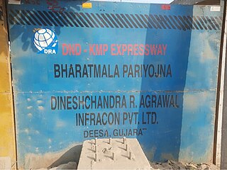
The DND–Faridabad–KMP Expressway, formally known as NH-148NA is a 59 km long, 6-lane wide access-controlled expressway in Delhi NCR, India. It connects the junction of DND Flyway and Ring Road at Maharani Bagh in Delhi with KMP Expressway at Khalilpur, Nuh district in Haryana. The NH-148NA is a spur (branch) of Delhi–Mumbai Expressway project. This expressway will have an additional 31 km long spur from Sector-65, Faridabad bypass to Jewar Airport.

Madanpur Khadar is an urban village in South East district of Delhi. It is located on Delhi-UP Border and is named after Thakur Madan Singh Chauhan. The term Khadar is attached to the village’s name because it is situated on the banks of Yamuna river. It was declared as an urban village by the administrative authorities under Delhi Metropolitan Council in 1966.
Urban Extension Road-II or NH-344M is an upcoming 75.7 km long, 6 lanes & 6 lanes wide grade separated expressway in Delhi NCR, India. It would start from National Highway 44 at Alipur then passes from Rohini, Mundka, Najafgarh, Dwarka and end at Delhi–Gurgaon Expressway on National Highway 48 near Mahipalpur. Its main route forms a semicircle on the western side of Delhi, additionally it has two side spurs - one from Bawana in Northwest Delhi to Sonipat in Bawana's North and second in west Delhi from between Tikri border & Najafgarh to NH9 Bahadurgarh south bypass. Delhi NCT has 4 concentric ring roads around it - namely Inner Ring Road; Outer Ring Road; third ring outside it formed by the combination of UER-II & Chilla-Okhla Expressway, and fourth ring formed by the combination of part of Dwarka Expressway & Gurugaon-Ghata Expressway, Gurgaon-Sohna Elevated Corridor Expressway, Sohna-Faridabad section of Delhi–Mumbai Expressway, Faridabad–Noida–Ghaziabad Expressway (FNG), Ghaziabad-Narela Expressway (planned) and Rai-Narela-Bahadurgarh-Gurgaon Expressway. Outside these ring roads, NCR region will have 3 Regional Circular Expressways and 3 Zonal Circular Expressways (ZCE).


