Saint-Alphonse, Gaspésie–Îles-de-la-Madeleine, Quebec

Last updated

Saint-Alphonse
Elevage de dindes a Saint-Alphonse-de-Caplan.jpg
Saint-Alphonse (Gaspesie-Iles-de-la-Madeleine) Quebec location diagram.png
Location within Bonaventure RCM
Canada Eastern Quebec location map.png
Red pog.svg
St-Alphonse
Location in eastern Quebec
Coordinates: 48°11′N65°38′W / 48.183°N 65.633°W / 48.183; -65.633 [1]
Country Canada
Province Quebec
Region Gaspésie–
Îles-de-la-Madeleine
RCM Bonaventure
Settled1890s
ConstitutedMay 9, 1902
Government
[2]
  MayorJosiane Appleby
   Federal riding Gaspésie—
Îles-de-la-Madeleine
   Prov. riding Bonaventure
Area
  Total112.17 km2 (43.31 sq mi)
  Land112.09 km2 (43.28 sq mi)
Population
 (2021) [3]
  Total711
  Density6.3/km2 (16/sq mi)
  Pop (2016-21)
Increase2.svg 1.7%
  Dwellings
325
Time zone UTC−5 (EST)
  Summer (DST) UTC−4 (EDT)
Postal code(s)
Area code(s) 418 and 581
Website www.st-alphonsegaspesie.com OOjs UI icon edit-ltr-progressive.svg

Saint-Alphonse is a municipality in Quebec, Canada.

Contents

History

Colonization of the place began at the end of the 19th century, when Henri-Joseph Mussely (a Belgian Catholic priest) arrived there, along with about 20 Belgian families. They founded the parish of Saint-Alphonse-de-Liguori in 1891, named after Alphonsus Liguori since Mussely was a Redemptorist. The place was originally known as La Petite-Belgique (French for "Little Belgium"), but the Belgian families did not remain long due to the harsh climate and short growing season, replaced by people from around Chaleur Bay. [1]

In 1901, its post office opened under the name Saint-Alphonse-de-Caplan, referring to the parish name and its proximity to Caplan. The following year, the Municipality of Musselyville was created out of territory ceded by Township of New Richmond and the Parish Municipality of Saint-Bonaventure de Hamilton. [1] [4]

On October 24, 1953, the municipality changed its name from Musselyville to Saint-Alphonse. [1] [4]

Demographics

Canada census – Saint-Alphonse community profile
2021 2016 2011
Population711 (+1.7% from 2016)699 (+1.2% from 2011)691 (-5.5% from 2006)
Land area112.09 km2 (43.28 sq mi)112.07 km2 (43.27 sq mi)112.38 km2 (43.39 sq mi)
Population density6.3/km2 (16/sq mi)6.2/km2 (16/sq mi)6.1/km2 (16/sq mi)
Median age47.6 (M: 46.0, F: 50.0)49.7 (M: 48.0, F: 51.4)48.2 (M: 48.1, F: 48.2)
Private dwellings325 (total)  314 (occupied)330 (total) 320 (total) 
Median household income$69,000$56,704$54,345
References: 2021 [5] 2016 [6] 2011 [7] earlier [8] [9]
Historical Census Data - Saint-Alphonse, Quebec
YearPop.±%
1911 630    
1931 657+4.3%
1941 859+30.7%
1951 946+10.1%
1956 1,029+8.8%
1961 1,037+0.8%
YearPop.±%
1966 1,035−0.2%
1971 1,042+0.7%
1976 1,008−3.3%
1981 946−6.2%
1986 918−3.0%
1991 869−5.3%
YearPop.±%
1996 866−0.3%
2001 755−12.8%
2006 731−3.2%
2011 691−5.5%
2016 699+1.2%
2021 711+1.7%
Source: Statistics Canada [10]

Local government

List of former mayors: [4]

See also

Related Research Articles

<span class="mw-page-title-main">Abitibi Regional County Municipality</span> Regional county municipality in Quebec, Canada

Abitibi Regional County Municipality is a regional county municipality in the Abitibi-Témiscamingue region of Quebec. The seat is Amos.
<span class="mw-page-title-main">Saint-Éloi, Quebec</span> Parish municipality in Quebec, Canada

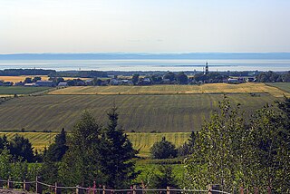
Saint-Éloi is a parish municipality in the region of Bas-Saint-Laurent, Quebec, Canada. Its population was 310 in the Canada 2021 Census.

<span class="mw-page-title-main">Saint-Télesphore</span> Municipality in Quebec, Canada

Saint-Télesphore is a municipality located in Vaudreuil-Soulanges Regional County Municipality, Quebec (Canada). The population as of the 2021 Canadian census was 754. The municipality is situated west of Saint-Polycarpe, south of Sainte-Justine-de-Newton, north of Rivière-Baudette and east of the provincial border near North Lancaster, Ontario.

<span class="mw-page-title-main">Napierville</span> Municipality in Quebec, Canada

Napierville is a municipality in the Jardins de Napierville Regional County Municipality in Quebec, Canada, situated in the Montérégie administrative region. The population as of the 2021 Canadian Census was 4,020. It is the location of the seat of the Jardins de Napierville Regional County Municipality. It is surrounded by the municipality of Saint-Cyprien-de-Napierville.

<span class="mw-page-title-main">Caplan, Quebec</span> Municipality in Quebec, Canada

Caplan is a municipality in the Gaspésie–Îles-de-la-Madeleine region of the province of Quebec in Canada.

<span class="mw-page-title-main">Saint-Zotique</span> City in Quebec, Canada

Saint-Zotique is a city located within the Vaudreuil-Soulanges Regional County Municipality in the Montérégie region located about 45 minutes west of Montreal, Quebec, Canada. It is named for Saint Zoticus of Comana.
<span class="mw-page-title-main">Sainte-Martine, Quebec</span> Municipality in Quebec, Canada

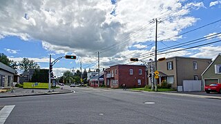
Sainte-Martine is a municipality in Beauharnois-Salaberry Regional County Municipality in the Montérégie region of Quebec, Canada. The population as of the 2021 Canadian census was 5,664. The municipality is made up of a large northern section and a small unattached southern area that was known as the municipality of Saint-Paul-de-Châteauguay until its merger with Sainte-Martine on September 9, 1999.
<span class="mw-page-title-main">Très-Saint-Rédempteur</span> Municipality in Quebec, Canada

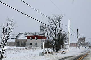
Très-Saint-Rédempteur is a municipality located in the Montérégie region of Quebec, Canada, along the border with Ontario. The population as of the Canada 2021 Census was 978. The municipality includes the town of Saint-Redempteur, and lies south of Rigaud along Route 325.

<span class="mw-page-title-main">Béarn, Quebec</span> Municipality in Quebec, Canada

Béarn is a municipality in northwestern Quebec, Canada, in the Témiscamingue Regional County Municipality.
<span class="mw-page-title-main">Saint-Bruno-de-Guigues</span> Municipality in Quebec, Canada

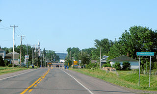
Saint-Bruno-de-Guigues, often shortened to Guigues, is a municipality in northwestern Quebec, Canada, in the Témiscamingue Regional County Municipality.
<span class="mw-page-title-main">Saint-Édouard-de-Fabre</span> Parish municipality in Quebec, Canada

Saint-Édouard-de-Fabre is a parish municipality in western Quebec, Canada, in the Témiscamingue Regional County Municipality.

<span class="mw-page-title-main">Saint-Adelme</span> Parish municipality in Quebec, Canada

Saint-Adelme is a parish municipality in the Canadian province of Quebec, located in La Matanie Regional County Municipality in the Bas-Saint-Laurent region.

<span class="mw-page-title-main">L'Isle-aux-Allumettes</span> Municipality in Quebec, Canada

L'Isle-aux-Allumettes is a municipality in the Outaouais region, part of the Pontiac Regional County Municipality, Quebec, Canada. The municipality consists primarily of Allumette Island, and also includes Morrison Island, Marcotte Island, and some minor islets, all in the Ottawa River north of Pembroke.

<span class="mw-page-title-main">Mille-Isles</span> Municipality in Quebec, Canada

Mille-Isles is a municipality in the Laurentides region of Quebec, Canada, part of the Argenteuil Regional County Municipality, west of Saint-Jérôme.

<span class="mw-page-title-main">Saint-Étienne-de-Beauharnois</span> Municipality in Quebec, Canada

Saint-Étienne-de-Beauharnois is a municipality of Quebec, Canada, located within the Beauharnois-Salaberry Regional County Municipality in the Montérégie administrative region. The population as of the Canada 2021 Census was 1,099.

<span class="mw-page-title-main">Sainte-Anne-du-Lac</span> Municipality in Quebec, Canada

Sainte-Anne-du-Lac is a municipality and village in the Laurentides region of Quebec, Canada, part of the Antoine-Labelle Regional County Municipality.

<span class="mw-page-title-main">Mont-Saint-Michel, Quebec</span> Municipality in Quebec, Canada

Mont-Saint-Michel is a municipality in the Laurentides region of Quebec, Canada, part of the Antoine-Labelle Regional County Municipality.

<span class="mw-page-title-main">Saint-Alphonse-Rodriguez, Quebec</span> Municipality in Quebec, Canada

Saint-Alphonse-Rodriguez is a municipality in the Lanaudière region of Quebec, Canada, part of the Matawinie Regional County Municipality.

<span class="mw-page-title-main">Saint-Pierre-de-la-Rivière-du-Sud, Quebec</span> Parish municipality in Quebec, Canada

Saint-Pierre-de-la-Rivière-du-Sud is a parish municipality in Quebec.

<span class="mw-page-title-main">Carleton-sur-Mer</span> City in Quebec, Canada

Carleton-sur-Mer is the fifth largest town of the Gaspésie's south shore, in southeastern Quebec, Canada, located on Route 132, along Chaleur Bay. It is the seat of the Avignon Regional County Municipality.

References

  1. 1 2 3 4 "Banque de noms de lieux du Québec: Reference number 55541". toponymie.gouv.qc.ca (in French). Commission de toponymie du Québec.
  2. 1 2 "Répertoire des municipalités: Geographic code 05065". www.mamh.gouv.qc.ca (in French). Ministère des Affaires municipales et de l'Habitation. Retrieved 2024-09-23.
  3. 1 2 "Profile table, Census Profile, 2021 Census of Population - Saint-Alphonse, Municipalité (MÉ) [Census subdivision], Quebec". 9 February 2022.
  4. 1 2 3 "Répertoire des entités géopolitiques: Saint-Alphonse (municipalité) 9.5.1902 - ..." www.mairesduquebec.com. Institut généalogique Drouin. Retrieved 23 September 2024.
  5. "2021 Community Profiles". 2021 Canadian Census . Statistics Canada. February 4, 2022. Retrieved 2022-04-27.
  6. "2016 Community Profiles". 2016 Canadian Census . Statistics Canada. August 12, 2021. Retrieved 2024-09-03.
  7. "2011 Community Profiles". 2011 Canadian Census . Statistics Canada. March 21, 2019. Retrieved 2014-02-03.
  8. "2006 Community Profiles". 2006 Canadian Census . Statistics Canada. August 20, 2019.
  9. "2001 Community Profiles". 2001 Canadian Census . Statistics Canada. July 18, 2021.
  10. 1996, 2001, 2006, 2011, 2016, 2021 census