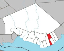
Shigawake is a municipality in the Gaspésie–Îles-de-la-Madeleine region of the province of Quebec in Canada. Shigawake is bordered to the west by Saint-Godefroi and to the east by Port-Daniel–Gascons.

Laforce is a municipality in northwestern Quebec, Canada, in the Témiscamingue Regional County Municipality.

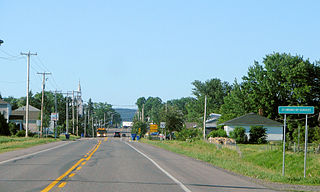
Moffet is a municipality in northwestern Quebec, Canada, in the Témiscamingue Regional County Municipality. The municipality had a population of 206 as of the 2021 Canadian census.
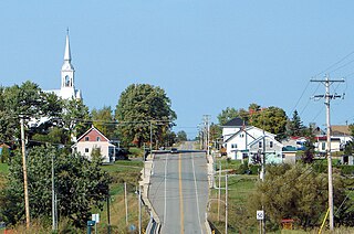
Saint-Bruno-de-Guigues, often shortened to Guigues, is a municipality in northwestern Quebec, Canada, in the Témiscamingue Regional County Municipality.
Saint-Eugène-de-Guigues, often shortened to Saint-Eugène, is a municipality in northwestern Quebec, Canada, in the Témiscamingue Regional County Municipality.
Saint-Édouard-de-Fabre is a parish municipality in western Quebec, Canada, in the Témiscamingue Regional County Municipality.

L'Isle-aux-Allumettes is a municipality in the Outaouais region, part of the Pontiac Regional County Municipality, Quebec, Canada. The municipality consists primarily of Allumette Island, and also includes Morrison Island, Marcotte Island, and some minor islets, all in the Ottawa River north of Pembroke.
Lochaber is a township municipality in the Canadian province of Quebec, located within the Papineau Regional County Municipality. The township had a population of 415 in the 2016 Canadian Census.
Gore is a township municipality in the Canadian province of Quebec, located within the Argenteuil Regional County Municipality. Its main community is Lakefield.

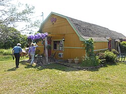
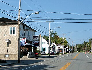
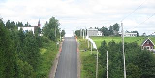
Saint-Godefroi is a township municipality in the Canadian province of Quebec, located within the Bonaventure Regional County Municipality. The township had a population of 350 in the 2021 Canadian census.

Thorne is a municipality in the Pontiac Regional County Municipality, Quebec, Canada, about 63 kilometres (39 mi) northwest of Downtown Gatineau, part of the Outaouais region.

Lac-Simon is a town and municipality in the Outaouais region of Quebec, Canada, part of the Papineau Regional County Municipality.

Saint-Émile-de-Suffolk is a municipality in the Outaouais region of Quebec, Canada, part of the Papineau Regional County Municipality. Until 1994 it was known as United Township Municipality of Suffolk-et-Addington.

Sainte-Anne-du-Lac is a municipality and village in the Laurentides region of Quebec, Canada, part of the Antoine-Labelle Regional County Municipality.

Natashquan is a municipality in Minganie Regional County Municipality, Côte-Nord region, Quebec, Canada. It should not be confused with the adjacent but separate Innu reserve of Nutashkuan.

Saint-Aimé-du-Lac-des-Îles is a municipality in the Laurentides region of Quebec, Canada, part of the Antoine-Labelle Regional County Municipality.

Lac-des-Écorces is a municipality and village in the Laurentides region of Quebec, Canada, part of the Antoine-Labelle Regional County Municipality.

Mont-Saint-Michel is a municipality in the Laurentides region of Quebec, Canada, part of the Antoine-Labelle Regional County Municipality.
Saint-Ambroise-de-Kildare is a municipality in the Lanaudière region of Quebec, Canada, part of the Joliette Regional County Municipality.
Saint-André-de-Restigouche is a municipality in Quebec, Canada.