Saint-Jean-de-Dieu

Last updated

Saint-Jean-de-Dieu
Route 293 (St-Jean-de-Dieu).jpg
Saint-Jean-de-Dieu Quebec location diagram.png
Location within Les Basques RCM
Canada Eastern Quebec location map.png
Red pog.svg
Saint-Jean-de-Dieu
Location in eastern Quebec
Coordinates: 48°00′N69°03′W / 48°N 69.05°W / 48; -69.05 [1]
CountryFlag of Canada (Pantone).svg  Canada
Province Flag of Quebec.svg  Quebec
Region Bas-Saint-Laurent
RCM Les Basques
ConstitutedJanuary 1, 1865
Government
[2]
  MayorJean-Claude Malenfant
   Federal riding Rimouski-Neigette—Témiscouata
—Les Basques
   Prov. riding Rivière-du-Loup-Témiscouata
Area
  Total151.60 km2 (58.53 sq mi)
  Land152.04 km2 (58.70 sq mi)
Population
 (2021) [3]
  Total1,651
  Density10.9/km2 (28/sq mi)
  Pop 2016-2021
Increase2.svg 3.4%
  Dwellings
742
Time zone UTC−5 (EST)
  Summer (DST) UTC−4 (EDT)
Postal code(s)
Area code(s) 418 and 581
HighwaysQc293.svg R-293
Qc295.svg R-295
Website www.saintjeandedieu.ca

Saint-Jean-de-Dieu is a municipality in Quebec, Canada. The municipality had a population of 1,651 in the Canada 2021 Census.

Contents

The two main settlements within the municipality are the communities of Saint-Jean-de-Dieu and La Société. The settlement of Saint-Jean-de-Dieu was counted by Statistics Canada as a designated place in the 2011 census, separately from the boundaries of the municipality as a whole, and had a population of 935.

Demographics

Population

Canada census – Saint-Jean-de-Dieu community profile
2021 2016 2011
Population1,651 (+3.4% from 2016)1,596 (-0.6% from 2011)1,606 (-3.9% from 2006)
Land area152.04 km2 (58.70 sq mi)152.38 km2 (58.83 sq mi)151.02 km2 (58.31 sq mi)
Population density10.9/km2 (28/sq mi)10.5/km2 (27/sq mi)10.6/km2 (27/sq mi)
Median age52.8 (M: 52, F: 53.2)51.9 (M: 51.6, F: 52.2)50.2 (M: 49.8, F: 50.6)
Private dwellings700 (total) 755 (total) 740 (total) 
Median household income$54,400$46,976$39,983
References: 2021 [4] 2016 [5] 2011 [6] earlier [7] [8]
Historical Census Data - Saint-Jean-de-Dieu, Quebec [9]
YearPop.±%
1871 677    
1881 1,290+90.5%
1891 1,055−18.2%
1901 1,357+28.6%
1911 1,962+44.6%
1921 2,121+8.1%
1931 2,501+17.9%
1941 2,298−8.1%
1951 2,406+4.7%
1956 2,663+10.7%
1961 2,799+5.1%
1966 2,584−7.7%
1971 2,262−12.5%
1976 2,107−6.9%
1981 2,136+1.4%
1986 2,063−3.4%
1991 1,893−8.2%
1996 1,828−3.4%
2001 1,768−3.3%
2006 1,671−5.5%
2011 1,606−3.9%
2016 1,596−0.6%
2021 1,651+3.4%

Language

Canada Census Mother Tongue - Saint-Jean-de-Dieu, Quebec [9]
CensusTotal
French
English
French & English
Other
YearResponsesCountTrendPop %CountTrendPop %CountTrendPop %CountTrendPop %
2021
1,640
1,625Increase2.svg 4.8%99.1%5Increase2.svg n/a%0.3%5Increase2.svg n/a%0.3%10Increase2.svg n/a%0.6%
2016
1,555
1,550Decrease2.svg 1.3%99.7%0Steady2.svg 0.0%0.0%0Steady2.svg 0.0%0.0%0Steady2.svg 0.0%0.0%
2011
1,570
1,570Increase2.svg 0.3%100.0%0Steady2.svg 0.0%0.0%0Steady2.svg 0.0%0.0%0Decrease2.svg 100.0%0.0%
2006
1,580
1,565Decrease2.svg 8.5%99.1%0Steady2.svg 0.0%0.0%0Steady2.svg 0.0%0.0%15Increase2.svg n/a%1.0%
2001
1,710
1,710Decrease2.svg 0.6%100.0%0Decrease2.svg 100.0%0.0%0Decrease2.svg 100.0%0.0%0Steady2.svg 0.0%0.0%
1996
1,765
1,720n/a97.5%35n/a2.0%10n/a0.6%0n/a0.0%

Notable people

See also

Related Research Articles

<span class="mw-page-title-main">Saint-Éloi, Quebec</span> Parish municipality in Quebec, Canada

Saint-Éloi is a parish municipality in the region of Bas-Saint-Laurent, Quebec, Canada. Its population was 310 in the Canada 2021 Census.

<span class="mw-page-title-main">Avignon Regional County Municipality</span> Regional county municipality in Quebec, Canada

Avignon is a regional county municipality located in the Gaspésie–Îles-de-la-Madeleine region of Quebec, Canada. Its seat and largest city is Carleton-sur-Mer.

<span class="mw-page-title-main">Le Domaine-du-Roy Regional County Municipality</span> Regional county municipality in Quebec, Canada

Le Domaine-du-Roy(The King's Domain) is a regional county municipality in the Saguenay-Lac-Saint-Jean region of Quebec, Canada. Its seat is in Roberval, and it is named for the King of France, who owned the land at the time of the colonization of Quebec.

<span class="mw-page-title-main">Le Haut-Richelieu Regional County Municipality</span> Regional county municipality in Quebec, Canada

Le Haut-Richelieu Regional County Municipality(Upper Richelieu) is a regional county municipality in the Montérégie region in southwestern Quebec, Canada. Its seat is in Saint-Jean-sur-Richelieu. It is named for the Richelieu River which runs south-north through it.

<span class="mw-page-title-main">Saint-Télesphore</span> Municipality in Quebec, Canada

Saint-Télesphore is a municipality located in Vaudreuil-Soulanges Regional County Municipality, Quebec (Canada). The population as of the 2021 Canadian census was 754. The municipality is situated west of Saint-Polycarpe, south of Sainte-Justine-de-Newton, north of Rivière-Baudette and east of the provincial border near North Lancaster, Ontario.

<span class="mw-page-title-main">Baie-des-Sables</span> Municipality in Quebec, Canada

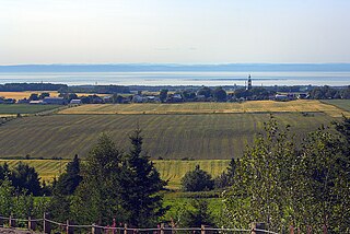
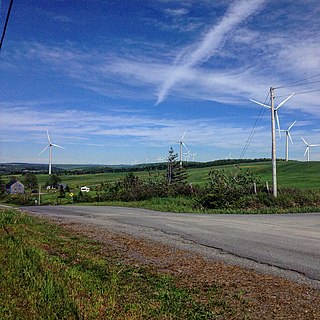
Baie-des-Sables is a municipality in La Matanie Regional County Municipality in the Bas-Saint-Laurent region of Quebec, Canada.

<span class="mw-page-title-main">Saint-Chrysostome, Quebec</span> Municipality in Quebec, Canada

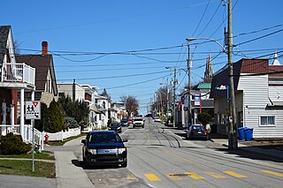
Saint-Chrysostome is a municipality in south-west Quebec, Canada in the regional county municipality of Haut-Saint-Laurent in the Montérégie administrative region. The municipality was created by the amalgamation of Saint-Chrysostome village with the parish of Saint-Jean-Chrysostome on September 29, 1999. The population as of the 2021 Canadian census was 2,582.

<span class="mw-page-title-main">Saint-Polycarpe, Quebec</span> Municipality in Quebec, Canada

Saint-Polycarpe is a municipality located in the Vaudreuil-Soulanges Regional County Municipality in the Montérégie region west of Montreal, Quebec, Canada, and just east of the Quebec-Ontario border. It was named for Polycarp, a 2nd-century bishop of Smyrna. The population as of the 2021 Canadian Census was 2,372.

<span class="mw-page-title-main">Saint-Jean-de-Cherbourg</span> Parish municipality in Quebec, Canada

Saint-Jean-de-Cherbourg is a parish municipality in the Canadian province of Quebec, located in La Matanie Regional County Municipality.

<span class="mw-page-title-main">Saint-Léandre</span> Parish municipality in Quebec, Canada

Saint-Léandre is a parish municipality in the Canadian province of Quebec, located in La Matanie Regional County Municipality.

<span class="mw-page-title-main">Saint-Godefroi</span> Township municipality in Quebec, Canada

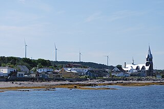
Saint-Godefroi is a township municipality in the Canadian province of Quebec, located within the Bonaventure Regional County Municipality. The township had a population of 350 in the 2021 Canadian census.

<span class="mw-page-title-main">Saint-Stanislas-de-Kostka</span> Municipality in Quebec, Canada

Saint-Stanislas-de-Kostka is a municipality of Quebec, Canada, located within the Beauharnois-Salaberry Regional County Municipality in the Montérégie administrative region. The population as of the Canada 2021 Census was 1,852.

<span class="mw-page-title-main">Saint-Étienne-de-Beauharnois</span> Municipality in Quebec, Canada

Saint-Étienne-de-Beauharnois is a municipality of Quebec, Canada, located within the Beauharnois-Salaberry Regional County Municipality in the Montérégie administrative region. The population as of the Canada 2021 Census was 1,099.

<span class="mw-page-title-main">Sainte-Anne-du-Lac</span> Municipality in Quebec, Canada

Sainte-Anne-du-Lac is a municipality and village in the Laurentides region of Quebec, Canada, part of the Antoine-Labelle Regional County Municipality.

<span class="mw-page-title-main">Lac-Saint-Paul, Quebec</span> Municipality in Quebec, Canada

Lac-Saint-Paul is a municipality in the Laurentides region of Quebec, Canada, part of the Antoine-Labelle Regional County Municipality.

<span class="mw-page-title-main">Saint-Elzéar, Gaspésie–Îles-de-la-Madeleine</span> Municipality in Quebec, Canada

Saint-Elzéar is a municipality in Quebec, Canada. It is also known as Saint-Elzéar-de-Bonaventure to distinguish it from Saint-Elzéar in the Chaudière-Appalaches region.

<span class="mw-page-title-main">Saint-François-d'Assise, Quebec</span> Municipality in Quebec, Canada

Saint-François-d'Assise is a municipality in Quebec, Canada.

<span class="mw-page-title-main">Saint-Guy, Quebec</span> Place in Quebec, Canada

Saint-Guy is a former municipality in the Bas-Saint-Laurent region of Quebec, Canada, now part of the city of Lac-des-Aigles.

<span class="mw-page-title-main">Notre-Dame-des-Neiges</span> Municipality in Quebec, Canada

Notre-Dame-des-Neiges is a municipality in Quebec, Canada. It encircles the city of Trois-Pistoles and includes the offshore Île aux Basques.

<span class="mw-page-title-main">Saint-Simon-de-Rimouski</span> Municipality in Quebec, Canada

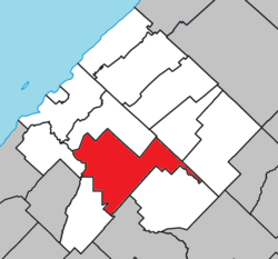
Saint-Simon-de-Rimouski is a municipality in the Les Basques Regional County Municipality in the Bas-Saint-Laurent region of Quebec, Canada. Its population in the Canada 2021 Census was 455. Before 2020 it was known as Saint-Simon.

References

  1. "Banque de noms de lieux du Québec: Reference number 56877". toponymie.gouv.qc.ca (in French). Commission de toponymie du Québec.
  2. 1 2 "Répertoire des municipalités: Geographic code 11010". www.mamh.gouv.qc.ca (in French). Ministère des Affaires municipales et de l'Habitation.
  3. 1 2 "Profile table, Census Profile, 2021 Census of Population - Saint-Jean-de-Dieu, Municipalité (MÉ) [Census subdivision], Quebec". 9 February 2022.
  4. "2021 Community Profiles". 2021 Canadian census . Statistics Canada. February 4, 2022. Retrieved 2022-04-27.
  5. "2016 Community Profiles". 2016 Canadian census . Statistics Canada. August 12, 2021. Retrieved 2024-08-12.
  6. "2011 Community Profiles". 2011 Canadian census . Statistics Canada. March 21, 2019. Retrieved 2014-03-10.
  7. "2006 Community Profiles". 2006 Canadian census . Statistics Canada. August 20, 2019.
  8. "2001 Community Profiles". 2001 Canadian census . Statistics Canada. July 18, 2021.
  9. 1 2 Statistics Canada: 1996, 2001, 2006, 2011, 2016, 2021 census