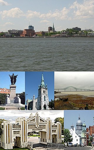
Trois-Rivières is a city in the Mauricie administrative region of Quebec, Canada, at the confluence of the Saint-Maurice and Saint Lawrence rivers, on the north shore of the Saint Lawrence River across from the city of Bécancour. It is part of the densely populated Quebec City–Windsor Corridor and is approximately halfway between Montreal and Quebec City. Trois-Rivières is the economic and cultural hub of the Mauricie region. The settlement was founded by French colonists on July 4, 1634, as the second permanent settlement in New France, after Quebec City in 1608.
Francheville was a former regional county municipality in the Mauricie region of Quebec, Canada. Prior to its dissolution, it had an area of 1,124 square kilometres (434 sq mi).
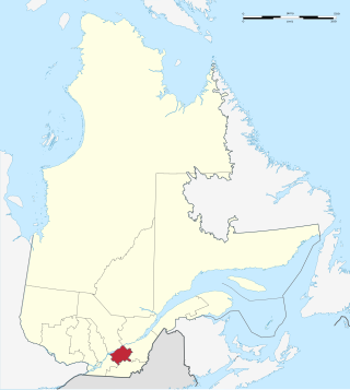
Centre-du-Québec is a region of Quebec, Canada. The main centres are Drummondville, Victoriaville, and Bécancour. It has a land area of 6,930.05 square kilometres (2,675.71 sq mi) and a 2016 census population of 242,399 inhabitants.

Les Chenaux is a regional county municipality in central Quebec, Canada, in the Mauricie region. The seat is in Saint-Luc-de-Vincennes. It is located adjacent on the east of Trois-Rivières on the Saint Lawrence River. It has a land area of 872.04 square kilometres (336.70 sq mi) and a population of 17,865 inhabitants in the Canada 2011 Census. Its largest community is the parish of Notre-Dame-du-Mont-Carmel.

Saint-Jean-Port-Joli is a village in the Regional County Municipality of L'Islet within the Chaudière-Appalaches region of Quebec, Canada. It is located on the south shore of the Saint Lawrence River and is the county seat. The village is located off the Trans-Canada Highway, Autoroute 20. Route 132 passes through the town.
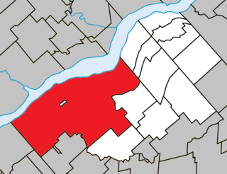
Bécancour is a city in the Centre-du-Québec region of Quebec, Canada; it is the seat of the Bécancour Regional County Municipality. It is located on the south shore of the Saint Lawrence River at the confluence of the Bécancour River, opposite Trois-Rivières.
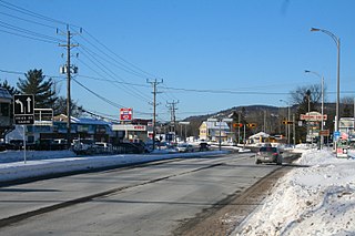
Prévost is a town within the La Rivière-du-Nord Regional County Municipality, Quebec, Canada, and the administrative region of Laurentides in the Laurentian Mountains, north of Montreal. It was created in 1973 from the amalgamation of the former villages of Shawbridge and Lesage with old Prévost on the other side of the Rivière du Nord. Shawbridge was named after William Shaw (1805-1894) who settled in the township of Abercromby in 1847 and built the first bridge over the Rivière du Nord.

Saint-Prosper-de-Champlain is a municipality of 516 people in the Les Chenaux Regional County Municipality, in Quebec, Canada. It is the smallest municipality in terms of population in the regional county.
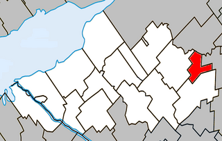
Aston-Jonction, formerly known in English as Aston Junction, is a municipality in the Centre-du-Québec region of the province of Quebec, Canada. The population as of the Canada 2021 Census was 441.

Sainte-Eulalie is a municipality in the Nicolet-Yamaska RCM in the Centre-du-Québec region of Quebec, Canada, situated at the crossroads of Autoroutes 55, 20 and 955. The population as of the Canada 2021 Census was 984.

Saint-Maurice is a parish municipality in the Mauricie region of the province of Quebec in Canada.

Sainte-Geneviève-de-Batiscan is a parish municipality in the Mauricie region of the province of Quebec in Canada. This municipality is part of the Les Chenaux Regional County Municipality in Batiscanie and in the administrative region of Mauricie. It is located along the Batiscan River.

Champlain is a municipality in the province of Quebec, Canada. It is located in Les Chenaux Regional County Municipality and the administrative region the Mauricie, on the north shore of St. Lawrence River. Champlain is also part of the metropolitan area of Trois-Rivières.
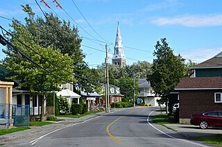
Les Cèdres is a municipality located north of the Saint Lawrence River in the Montérégie of Quebec, Canada, near Vaudreuil-Dorion. The population as of the Canada 2021 Census was 7,184. The name means "The Cedars" in French.
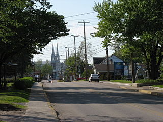
Saint-Félicien is a city in the Canadian province of Quebec. The town is located within the Le Domaine-du-Roy Regional County Municipality in the Saguenay-Lac-Saint-Jean region. Its population as of 2023 is 10,226.

Saint-Prime is a municipality in Quebec, Canada, located within the regional county municipality of Le Domaine-du-Roy. The municipality had a population of 2,758 as of the Canada 2011 Census, and a land area of 147.16 km2.

The Nicolet River is a river in Quebec, Canada. It is a tributary of the Saint Lawrence River on its southern shore and flows into Lake Saint Pierre. It is named in honor of the pioneer Jean Nicolet.
The Lafont River is a tributary on the northeast shore of the Nicolet Southwest River. It crosses the municipalities of Saint-Léonard-d'Aston and Sainte-Perpétue, in the Nicolet-Yamaska Regional County Municipality (MRC), in the administrative region of Centre-du-Québec, in Quebec, in Canada.

The Nicolet Southwest River is a tributary on the west bank of the Nicolet River. It empties into the municipality of Nicolet, in the Nicolet-Yamaska Regional County Municipality (MRC), in the administrative region of Centre-du-Québec, in Quebec, in Canada.
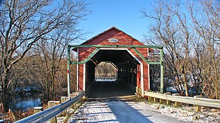
The rivière Blanche is a watercourse on the South shore of St. Lawrence River, in the administrative region of Centre-du-Québec, in the province of Quebec, in Canada. This river flows in the regional county municipalities of:


