SMS is short message service, a form of text-messaging communication based on phones.

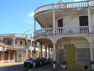
Antsiranana, named Diego-Suarez prior to 1975, is a city in the far north of Madagascar. Antsiranana is the capital of Diana Region. It had an estimated population of 115,015 in 2013.
Jacques Hugues Sylla was a Malagasy politician. He was the Prime Minister of Madagascar under President Marc Ravalomanana from February 2002 to January 2007. He subsequently served as the President of the National Assembly of Madagascar from October 2007 to March 2009.

Air Austral is a French airline based at Roland Garros Airport, Réunion. It operates scheduled services from Réunion to metropolitan France, South Africa, Thailand and a number of destinations in the Indian Ocean. The company has eight airplanes in the fleet and employs around 900 people.

Nosy Boraha, also known as Sainte-Marie, main town Ambodifotatra, is an island off the east coast of Madagascar. The island forms an administrative district within Analanjirofo Region, and covers an area of 222 km2. It has a population estimated at 30,000.

Île aux Nattes is a small island south of Île Sainte-Marie, an island off the east coast of Madagascar. Both belong to the region of Analanjirofo, in the Toamasina Province.

Maroantsetra, formerly Louisbourg, is a market town and domestic seaport in Analanjirofo Region, Madagascar, at the northern end of the Bay of Antongil. In 2018, Maroantsetra counted 42,529 people. Even though it is a small city, Maroantsetra played an important role in the betsimisaraka history as the unification of this tribe by Ratsimilaho started there. Throughout the eighteenth century, Maroantsetra also actively participated in the piracy and the attack led collectively by the betsimisarakas against the islands of comoros and some east african countries.

Roland Garros Airport, formerly known as Gillot Airport, is located in Sainte-Marie on Réunion, France. The airport is 7 kilometres (3.8 NM) east of Saint-Denis; it is named after the French aviator Roland Garros, who was born in Saint-Denis.
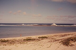
Cape Sainte Marie, formerly known as Cape Romain and Cape St. Mary, is the southernmost point of Madagascar. It is situated in the Androy region 42 kilometres (26 mi) from Tsiombe. It is the location of the Cap Sainte-Marie Special Reserve, a nature reserve which occupies most of the cape and was created in 1962.
Beloha is a rural municipality in Androy Region, Madagascar. It is situated along the unpaved Route nationale 10.
Tsihombe is a municipality and a district of Androy in Madagascar.
Sumter Airport is a public use airport located 4 nmi (7.4 km) north of the central business district of Sumter, a city in Sumter County, South Carolina, United States. The airport is owned and operated by the Sumter County under an Airport Commission structure and has a county appointed airport manager, Jeff Knauer.

Analanjirofo is a region in northeastern Madagascar. Until 2009 it was a part of Toamasina Province. It borders Sava Region to the north, Sofia Region to the west, Alaotra-Mangoro Region to the southwest and Atsinanana Region to the south.
The Walters Shoals is a group of submerged mountains off the coast of Madagascar. The shoals are 845 kilometres (525 mi) south of Cape Sainte Marie - Madagascar and 1,210 kilometres (750 mi) east of Richards Bay at the African coast. The tips of some of the mountains are only 18 metres (59 ft) below the surface. The Walters Shoals is home to many species of fish, crustaceans, and mollusks. It was discovered in 1963 by the South African Hydrographic Frigate SAS Natal captained by Cmdr Walters. When found it had a huge population of Galápagos sharks but they have since been fished out.
This is a survey of the postage stamps and postal history of Madagascar, briefly also known as Malagasy.
Tsiombe District is a district in the Androy Region, located in southeastern Madagascar. Tsiombe includes the Cape Sainte-Marie, the southernmost point of Madagascar.

The district of Taolagnaro is a district of Anosy in Madagascar.

Tsihombe is a municipality and a district of Androy in Madagascar. The district has an area of 3,316 km2 (1,280 sq mi), and the estimated population in 2020 was 158,954.


