Vohemar is a coastal city and a municipality in northern Madagascar. It belongs to the district of Iharana, which is a part of Sava Region. It had a population of 22047 in 2018.
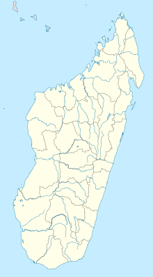
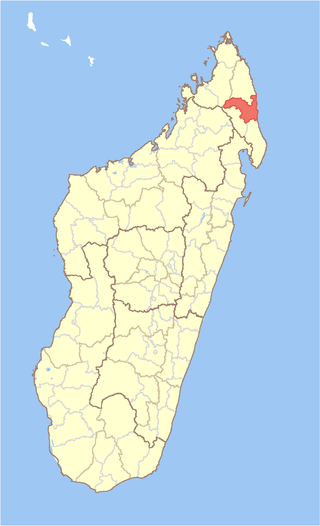
Sava is a region in northern Madagascar. Its capital is Sambava. Until 2009 Sava belonged to Antsiranana Province. The region is situated at the northern part of the east coast of Madagascar. It is bordered by the region Diana to the north, Sofia to the west, and Analanjirofo to the south. As of 2018, its population was 1,123,013 and the total area is 25,518 km2 (9,853 sq mi). The region contains wild areas such as Marojejy National Park.
The SVB Cup is a competition organized by the Surinamese Football Association since 1992. It was based on the size of the KNVB Cup. The tournament consists of all teams from the top two layers of the Surinamese Football League Eerste Divisie and District Divisions.

Mariscal Sucre Airport is an airport in the Aragua state of Venezuela, serving the city of Maracay. The airport is on the northeastern shore of Lake Valencia also named Los Tacariguas Lake. The airport is named in honor of Antonio José de Sucre, a leader of the Venezuelan War of Independence and the second president of Bolivia. Runway 11/29 length does not include an 85 metres (279 ft) displaced threshold for Runway 29. Runway 06/24 has a 53 metres (174 ft) paved overrun on each end.

Antalaha is an urban municipality in northern Madagascar. It belongs to the district of Antalaha, which is a part of Sava Region. The population of Antalaha was 67.888 in 2018.

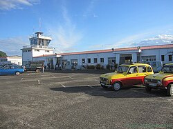
Sambava is a city and commune at the east coast of northern Madagascar. It is the capital of Sambava District and Sava Region. The population of the commune was 84,039 in as of the 2018 commune census.
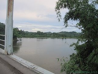
Nosiarina is a rural municipality in northern Madagascar. It belongs to the district of Sambava, which is a part of Sava Region. It is situated at the Bemarivo River and the Route Nationale 5a between Sambava and Vohemar.
Anjialava is a rural municipality in northern Madagascar. It belongs to the district of Sambava, which is a part of Sava Region. The population of the commune was estimated to be approximately 9,000 in 2001 commune census.

Ambohimalaza is a municipality in northern Madagascar. It belongs to the district of Sambava, which is a part of Sava Region. The population of the commune was estimated to be approximately 8,000 in 2001 commune census.
Antsahavaribe is a town and commune in northern Madagascar. It belongs to the district of Sambava, which is a part of Sava Region. The population of the commune was estimated to be approximately 17,000 in 2001 commune census.
Antalaha District is a district in northeastern Madagascar. The district contains the Masoala Peninsula, and is limited by Antongil Bay in south-west and the Indian Ocean on east. It is a part of Sava Region and borders the districts of Sambava into the north, Andapa to the north-west and Maroantsetra to the west. The area is 6,795 km2 (2,624 sq mi) and the population was estimated to be 222,203 in 2009 and 282,921 in 2018. At the time of the last Madagascar census in 1993 149,684 inhabitants lived in this district.
Sambava District is a district in northern Madagascar. It is a part of Sava Region and borders the districts of Antalaha to the south, Andapa to the south-west, Ambilobe to the north-west and Iharana to the north. The area is 4,681.76 km2 (1,808 sq mi) and the population was estimated to be 429,947 in 2020.
The SVB Tweede Divisie is third-highest division overall in the Surinamese football league system after the SVB Eerste Divisie, where the top club is promoted to each season. The weakest club is relegated to the Derde Divisie. The league was previously known as the SVB Eerste Klasse but became the Eerste Divisie for the 2016–17 season after Suriname's top division changed its name from Hoofdklasse to Topklasse, only to be rebranded as the Tweede Divisie for the 2017–18 season.
The 2015–16 Surinamese Hoofdklasse was the 83rd season of the SVB Hoofdklasse, the highest football league competition of Suriname. The season began in November 2015, and finished in June 2016.
SCSV Bomastar, known as Bomastar is a Surinamese football club from Lelydorp that plays in the SVB Eerste Klasse, the second tier of Surinamese football.

N.V. Dash F.C. Inter Wanica, referred to as Inter Wanica, is a football club located in Meerzorg, Suriname.
Sergino Rahi Eduard is a Surinamese professional footballer who plays as a midfielder for SVB Topklasse club Inter Moengotapoe and the Suriname national team.
Albert Mervill Nibte is a Surinamese professional footballer who plays as a defender for SVB Eerste Divisie club Leo Victor and the Suriname national team.
Anduelo Amoeferie is a Surinamese professional footballer who plays as a full-back for SVB Eerste Divisie club Inter Moengotapoe and the Suriname national team.
S.C.V. Bintang Lahir is a football club located in Groningen, Suriname. Their home games are played at the André Kamperveen Stadion in Paramaribo, and the division they play in is the Tweede Divisie, the third highest tier in Surinamese football.