Salambandé

Last updated
Salambandé
Sub-prefecture and town
Guinea adm location map.svg
Red pog.svg
Salambandé
Location in Guinea
Coordinates: 11°50′N11°53′W / 11.833°N 11.883°W / 11.833; -11.883
CountryFlag of Guinea.svg  Guinea
Region Labé Region
Prefecture Mali Prefecture
Time zone GMT (UTC+0)

Salambandé is a town and sub-prefecture in the Mali Prefecture in the Labé Region of northern Guinea. [1]

Town settlement that is bigger than a village but smaller than a city

A town is a human settlement. Towns are generally larger than villages but smaller than cities, though the criteria to distinguish them vary considerably between different parts of the world.

Sub-prefectures of Guinea

The sub-prefectures are the third-level administrative divisions in Guinea. As of 2009 there were 303 rural communes of Guinea and 38 urban communes, 5 of which compose the Conakry greater urban area; Kaloum, Dixinn, Matam, Ratoma and Matoto.

Mali Prefecture Prefecture in Labé Region, Guinea

Mali is a prefecture, also known as the Préfecture De Mali, located in the Labé Region of Guinea. The capital is Mali. The prefecture covers an area of 9,790 km.² and has an estimated population of 246,000.

Related Research Articles

Timbo Sub-prefecture and town in Mamou Region, Guinea

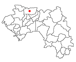
Timbo is a town and sub-prefecture in the Mamou Prefecture in the Mamou Region of Guinea. It is located in the Fouta Djallon highlands of Guinea, lying north east of Mamou, in a part of the country mostly occupied by the Fula people. It is also known for its vernacular architecture, for the local mountains and for local chimpanzees.

Faranah Region Region in Guinea

The Faranah Region is located in east-central Guinea. It is bordered by the countries of Sierra Leone and Mali and the Guinean regions of Kankan, Mamou, Nzérékoré, and Labé.

Moussadou Sub-prefecture and town in Nzérékoré Region, Guinea

Moussadou is a town and sub-prefecture in the Beyla Prefecture in the Nzérékoré Region of south-eastern Guinea.

Kolaboui Sub-prefecture and town in Boké Region, Guinea

Kolaboui is a town and sub-prefecture in the Boké Prefecture in the Boké Region of western Guinea. As of 2014 it had a population of 57,251 people.

Kobéla Sub-prefecture and town in Nzérékoré Region, Guinea

Kobéla is a town and sub-prefecture in the Nzérékoré Prefecture in the Nzérékoré Region of Guinea.

Mafara Sub-prefecture and town in Mamou Region, Guinea

Mafara is a town and sub-prefecture in the Dalaba Prefecture in the Mamou Region of western Guinea.

Mitty, Guinea Sub-prefecture and town in Mamou Region, Guinea

Mitty, Guinea is a town and sub-prefecture in the Dalaba Prefecture in the Mamou Region of western Guinea.

Songoyah Sub-prefecture and town in Faranah Region, Guinea

Songoyah is a town and sub-prefecture in the Faranah Prefecture in the Faranah Region of Guinea. As of 2014 it had a population of 13,422 people.

Guendembou Sub-prefecture and town in Nzérékoré Region, Guinea

Guendembou is a town and sub-prefecture in the Guéckédou Prefecture in the Nzérékoré Region of south-western Guinea.

Moribayah Sub-prefecture and town in Kankan Region, Guinea

Moribayah is a town and sub-prefecture in the Kankan Prefecture in the Kankan Region of eastern Guinea. As of 2014 it had a population of 14,141 people.

Madina-Oula Sub-prefecture and town in Kindia Region, Guinea

Madina-Oula is a town and sub-prefecture in the Kindia Prefecture in the Kindia Region of western Guinea.

Molota Sub-prefecture and town in Kindia Region, Guinea

Molota is a town and sub-prefecture in the Kindia Prefecture in the Kindia Region of western Guinea.

Samayah Sub-prefecture and town in Kindia Region, Guinea

Samayah is a town and sub-prefecture in the Kindia Prefecture in the Kindia Region of western Guinea.

Manfran Sub-prefecture and town in Faranah Region, Guinea

Manfran is a town and sub-prefecture in the Kissidougou Prefecture in the Faranah Region of Guinea. As of 2014 it had a population of 14,385 people.

Yendé-Millimou Sub-prefecture and town in Faranah Region, Guinea

Yendé-Millimou is a sub-prefecture in the Kissidougou Prefecture in the Faranah Region of Guinea. It includes the settlements of Yendé and Millimou. As of 2014 it had a population of 20,372 people.

Balaki Sub-prefecture and town in Labé Region, Guinea

Balaki is a town and sub-prefecture in the Mali Prefecture in the Labé Region of northern Guinea.

Gongore Sub-prefecture and town in Mamou Region, Guinea

Gongore is a town and sub-prefecture in the Pita Prefecture in the Mamou Region of northern-central Guinea.

Ley-Miro Sub-prefecture and town in Mamou Region, Guinea

Ley-Miro is a town and sub-prefecture in the Pita Prefecture in the Mamou Region of northern-central Guinea.

Fatako Sub-prefecture and town in Labé Region, Guinea

Fatako is a town and sub-prefecture in the Tougué Prefecture in the Fouta Region of northern-central Guinea.

Thionthian Sub-prefecture and town in Kindia Region, Guinea

Thionthian is a town and sub-prefecture in the Télimélé Prefecture in the Kindia Region of western-central Guinea.

References

  1. "Subprefectures of Guinea". Statoids. Retrieved April 19, 2009.

Coordinates: 11°50′N11°53′W / 11.833°N 11.883°W / 11.833; -11.883

Geographic coordinate system Coordinate system

A geographic coordinate system is a coordinate system that enables every location on Earth to be specified by a set of numbers, letters or symbols. The coordinates are often chosen such that one of the numbers represents a vertical position and two or three of the numbers represent a horizontal position; alternatively, a geographic position may be expressed in a combined three-dimensional Cartesian vector. A common choice of coordinates is latitude, longitude and elevation. To specify a location on a plane requires a map projection.