Salem Creek | |
---|---|
Etymology | from the community of Salem |
Location | |
Country | Canada |
Province | Ontario |
County | Northumberland |
Municipality | Cramahe |
Physical characteristics | |
Source | Unnamed point |
• coordinates | 44°01′55″N77°50′33″W / 44.03194°N 77.84250°W [1] |
• elevation | 140 m (460 ft) [2] |
Mouth | Lake Ontario |
• coordinates | 44°00′00″N77°49′54″W / 44.00000°N 77.83167°W [3] |
• elevation | 74.1 m (243 ft) [4] |
Length | 4 km (2.5 mi) [1] |
Basin features | |
River system | Lake Ontario drainage basin |
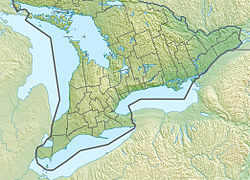
Salem Creek is a stream in the municipal township of Cramahe, Northumberland County in Central Ontario, Canada. [3] [1] [5] [6] [7] It is a tributary of Lake Ontario. The creek takes its name from the community of Salem which it flows past.
Salem Creek begins at an unnamed point at an elevation of 140 metres (460 ft) [2] and flows south, past Salem Hill [8] and the community of Salem. It heads under County Road 2 (formerly Ontario Highway 2), under the Canadian National Railway and Canadian Pacific Railway mainlines, and reaches its mouth at Lake Ontario at an elevation of 74.1 metres (243 ft). [4]
Salem is a Dispersed Rural Community and unincorporated place in the municipal township of Cramahe, Northumberland County in southern Ontario, Canada. The community is on Northumberland County Road 2 about 4 kilometres (2.5 mi) east of Colborne and 9 kilometres (5.6 mi) west of Brighton.
Cleaver Lake is a lake in the Unorganized West Part of Timiskaming District in Northeastern Ontario, Canada. It is about 800 metres (2,600 ft) long and 150 metres (490 ft) wide, and lies at an elevation of 329 metres (1,079 ft) about 16 kilometres (10 mi) northwest of the community of Gowganda and about 21.7 kilometres (13.5 mi) southwest of Matachewan. The primary inflow and outflow is Cleaver Creek, which flows into the West Montreal River, a tributary of the Montreal River and part of the Ottawa River system.
Drive Lake is a lake in the Nelson River drainage basin in the Unorganized Part of Kenora District in northwestern Ontario, Canada. It is about 1,250 metres (4,101 ft) long and 490 metres (1,608 ft) wide, lies at an elevation of 394 metres (1,293 ft), and is 1 kilometre (0.6 mi) north of Highway 516. Drive Lake is the source of Drive Creek; the creek leaves the lake at its eastern tip and flows into the Marchington River.
Darlington Creek is a stream in the municipality of Clarington, Regional Municipality of Durham in Ontario, Canada. It is a tributary of Lake Ontario and is located in geographic Darlington Township, after which it is named.
Maxwell Creek is a stream in the municipality of Georgian Bluffs, Grey County in Southwestern Ontario, Canada. It is in geographic Derby Township, is part of the Great Lakes Basin and is a right tributary of the Pottawatomi River.
Maxwell Creek is a stream in the municipality of Chatham-Kent in Southwestern Ontario, Canada. It is part of the Great Lakes Basin and is a left tributary of the Chenail Ecarté.
The Chenal Ecarté is a river in the municipalities of Saint Clair and Chatham-Kent in Southwestern Ontario, Canada. It is a left distributary of the St. Clair River that flows to Lake St. Clair, and thus is part of the Great Lakes Basin. The river also separates mainland Ontario from the northeast edge of Walpole Island, and the entire eastern edge of St. Anne Island, which both are part of the Walpole Island 46 reserve of the Walpole Island First Nation.
The Johnston Channel is a river geographically in Lambton County and on the territory of the Walpole Island 46 reserve of the Walpole Island First Nation, in Southwestern Ontario, Canada. It is a right distributary of the Chenail Ecarté, and like that river also flows to Lake St. Clair; thus, it is part of the Great Lakes Basin. The river also separates Walpole Island to the west from St. Anne Island to the east, which both are part of the Walpole Island 46 reserve of the Walpole Island First Nation.
Running Creek is a stream in the municipality of Chatham-Kent in Southwestern Ontario, Canada. It is a left distributary of the Chenail Ecarté, is a tributary of the North Sydenham River, and is part of the Great Lakes Basin.
Silver Lake Creek is a short stream in Tay Valley, Lanark County in Eastern Ontario, Canada. It flows from Silver Lake to the Fall River and is in the Ottawa River drainage basin.
Wesleys Creek is a stream in Central Frontenac, Frontenac County, and Tay Valley, Lanark County in Eastern Ontario, Canada. It flows to Silver Lake and is in the Ottawa River drainage basin.
Straggle Creek is a stream in the municipality of Dysart et al, Haliburton County in Central Ontario, Canada. It is a right tributary of Allen Creek and is in the Ottawa River drainage basin.
Allen Creek is a stream in the municipality of Dysart et al, Haliburton County in Central Ontario, Canada. It is a tributary of Benoir Lake and is in the Ottawa River drainage basin.
Kennaway Lake is a small lake in the municipality of Dysart et al, Haliburton County in Central Ontario, Canada. It is in the Ottawa River drainage basin.
Potter Creek is a stream in the municipalities of Quinte West and Belleville in Central Ontario, Canada. It is a tributary of the Bay of Quinte and is thus in the Lake Ontario drainage basin.
Potter Creek is a stream in the Unorganized South Part of Nipissing District in Northeastern Ontario, Canada. It is a tributary of Canoe Lake, is in the Lake Huron drainage basin, and lies within Algonquin Provincial Park.
Ruhl Creek is a stream in the township municipality of Brockton, Bruce County in Southwestern Ontario, Canada. It is in the Lake Huron drainage basin and is a right tributary of the Saugeen River.
Odessa Lake is a lake in the municipalities of Kingston and Loyalist in eastern Ontario, Canada. It is in the Lake Ontario drainage basin.
Millhaven Creek is a stream in the municipalities of Loyalist, Lennox and Addington County, and South Frontenac, Frontenac County, and the single-tier municipality of Kingston in eastern Ontario, Canada. It is a tributary of Lake Ontario and is under the auspices of the Cataraqui Region Conservation Authority.
Port Granby Creek is a stream in the municipality of Clarington, Regional Municipality of Durham in Ontario, Canada. It feeds into Lake Ontario, which it reaches at the community of Port Granby, after which it is named.