Salem Creek (Ontario)

Last updated
Salem Creek
Canada Southern Ontario relief location map.jpg
Red pog.svg
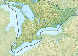
Location of the mouth of the creek in southern Ontario
Location
Country Canada
Province Ontario
Region Central Ontario
County Northumberland
Municipality Cramahe
Physical characteristics
SourceUnnamed field
  coordinates 42°02′15″N77°50′50″W / 42.03750°N 77.84722°W / 42.03750; -77.84722
  elevation146 m (479 ft)
Mouth Lake Ontario
  coordinates
44°00′00″N77°49′54″W / 44.00000°N 77.83167°W / 44.00000; -77.83167 Coordinates: 44°00′00″N77°49′54″W / 44.00000°N 77.83167°W / 44.00000; -77.83167
  elevation
74 m (243 ft)
Length5 km (3.1 mi)
Basin features
River system Great Lakes Basin

Salem Creek is a stream in the municipal township of Cramahe, Northhumberland County in Central Ontario, Canada. [1] [2] [3] It is in the Great Lakes Basin and is a tributary of Lake Ontario. The creek takes its name from the community of Salem which it flows past.

Salem Creek begins in a field just south of Ontario Highway 401 and flows south, past Salem Hill [4] and the community of Salem. It heads under County Road 2 (formerly Ontario Highway 2), under the Canadian National Railway and Canadian Pacific Railway mainlines, and reaches its mouth at Lake Ontario.

Related Research Articles

Indian River (Muskrat River watershed) river in Renfrew County and Nipissing District in Eastern and Northeastern Ontario, Canada

The Indian River is a river in Renfrew County and Nipissing District in Eastern and Northeastern Ontario, Canada. It is in the Saint Lawrence River drainage basin, and is a left tributary of the Muskrat River.

Maitland River river in Canada

The Maitland River is a river in Huron County, Perth County and Wellington County in Southwestern Ontario, Canada. The river is in the Great Lakes Basin and empties into Lake Huron at the town of Goderich. It is 150 kilometres (93 mi) long, and is named after Sir Peregrine Maitland, Lieutenant-Governor of Upper Canada from 1818 to 1828. It was formerly known as the Menesetung River.

Black Lake (Gull River) lake in Minden Hills, Haliburton County in Central Ontario, Canada

Black Lake is a lake in the municipality of Minden Hills, Haliburton County in Central Ontario, Canada. It is part of the Great Lakes Basin and lies within geographic Lutterworth Township.

Departure Lake, Ontario Dispersed rural community in Ontario, Canada

Departure Lake is a dispersed rural community and unincorporated place in geographic Haggart Township, Cochrane District in Northeastern Ontario, Canada. It is located on Ontario Highway 11 between the communities of Strickland to the west and Smooth Rock Falls to the east.

Salem, Northumberland County Dispersed Rural Community in Ontario, Canada

Salem is a Dispersed Rural Community and unincorporated place in the municipal township of Cramahe, Northhumberland County in southern Ontario, Canada. The community is on Northumberland County Road 2 about 4 kilometres (2.5 mi) east of Colborne and 9 kilometres (5.6 mi) west of Brighton.

Blanche River (Lake Timiskaming) river in Canada

The Blanche River is a river in the Saint Lawrence River drainage basin in Timiskaming District in northeastern Ontario, Canada. The river is a tributary of Lake Timiskaming and its name is from the French for the colour "white".

Sixteenmile Creek (Ontario)

Sixteenmile Creek is a stream in the municipality of West Elgin, Elgin County in Southwestern Ontario, Canada. It is part of the Great Lakes Basin, and flows from a point just south of Ontario Highway 401 east of exit 129 through the community of Rodney, past the community of New Glasgow, to its mouth at the community of Port Glasgow on Lake Erie.

Boyne River (Nottawasaga River tributary) river in the counties of Simcoe and Dufferin in Central Ontario, Canada

The Boyne River is a river in Simcoe County and Dufferin County in Central Ontario, Canada. It is part of the Great Lakes Basin, and is a left tributary of the Nottawasaga River. The rivers falls within the jurisdiction of the Nottawasaga Valley Conservation Authority.

Black River (Severn River tributary)

The Black River is a river in Simcoe County, the District Municipality of Muskoka, the City of Kawartha Lakes, and Haliburton County in Central Ontario, Canada. It is part of the Great Lakes Basin, and is a right tributary of the Severn River.

Onaping River watercourse in Canada

The Onaping River is a river in Greater Sudbury and Sudbury District in Northeastern Ontario, Canada. It is in the Great Lakes Basin and is a right tributary of the Vermilion River.

Matawin River (Ontario) watercourse in Canada

The Matawin River is a river in Thunder Bay District in Northwestern Ontario, Canada. It is in the Great Lakes Basin and is a right tributary of the Kaministiquia River.

Shebandowan River river in Canada

The Shebandowan River is a river in Thunder Bay District in Northwestern Ontario, Canada. It is in the Great Lakes Basin and is a left tributary of the Matawin River. Three-quarters of the length of the river valley is paralleled by Ontario Highway 11, at this point part of the Trans-Canada Highway; and the entire length of the river valley is paralleled by a Canadian National Railway main line, built originally as the Canadian Northern Railway transcontinental main line.

Oskondaga River watercourse in Canada

The Oskondaga River is a river in Thunder Bay District in Northwestern Ontario, Canada. It is in the Great Lakes Basin and is a left tributary of the Shebandowan River. The river valley is paralleled by Ontario Highway 17, at this point part of the Trans-Canada Highway; and by both the Canadian Pacific Railway transcontinental main line, still in operation, and the Canadian National Railway Graham Subdivision main line, originally built as part of the National Transcontinental Railway, now abandoned.

Kashabowie River watercourse in Canada

The Kashabowie River is a river in southwestern Thunder Bay District in Northwestern Ontario, Canada. It is in the Great Lakes Basin and is a tributary of the Shebandowan Lakes.

Irondale River river in Canada

The Irondale River is a river in Haliburton County in Central Ontario, Canada. It is part of the Great Lakes Basin, and is a left tributary of the Burnt River.

Valentine River river in Ontario, Canada

The Valentine River is a river in Cochrane District in northeastern Ontario, Canada. It is in the James Bay drainage basin, and is a tributary of Lac Pivabiska, the source of the Pivabiska River.

Irvine Creek (Ontario)

Irvine Creek is a creek in the municipality of Centre Wellington, Wellington County in southwestern Ontario, Canada. It is in the Great Lakes Basin and is a right tributary of the Grand River.

Corben Creek (Ontario) watercourse in Central Ontario, Canada

Corben Creek is a stream in the municipality of Minden Hills, Haliburton County, and the unitary city of Kawartha Lakes in Central Ontario, Canada. It is in the Great Lakes Basin and is tributary of Balsam Lake.

Haggart Creek (Cochrane District) stream in Cochrane District, Ontario, Canada

Haggart Creek is a creek in geographic Haggart Township, Cochrane District in Northeastern Ontario, Canada. It is in the James Bay drainage basin and is a right tributary of the Poplar Rapids River.

Poplar Rapids River river in Cochrane District, Ontario, Canada

The Poplar Rapids River is a river in the municipality of Fauquier-Strickland and Unorganized North Cochrane District, Cochrane District in Northeastern Ontario, Canada. It is in the James Bay drainage basin and is a left tributary of the Mattagami River.

References

  1. "Salem Creek". Geographical Names Data Base. Natural Resources Canada . Retrieved 2017-03-18.
  2. Map 6 (PDF) (Map). 1 : 700,000. Official road map of Ontario. Ministry of Transportation of Ontario. 2016-01-01. Retrieved 2017-03-18.
  3. Restructured municipalities - Ontario map #5 (Map). Restructuring Maps of Ontario. Ontario Ministry of Municipal Affairs and Housing. 2006. Retrieved 2017-03-18.
  4. "Salem Hill". Geographical Names Data Base. Natural Resources Canada . Retrieved 2017-03-18.