Related Research Articles

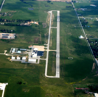
Texarkana Regional Airport, also known as Webb Field, is a public use airport located three nautical miles (6 km) northeast of the central business district of Texarkana, a city in Miller County, Arkansas, United States. It is owned by the Texarkana Airport Authority. The airport is located within the city limits of Texarkana, roughly 3 miles east of State Line Avenue. The front gate opens to the northwest, at the intersection of Arkansas Boulevard and U.S. Route 67. A Union Pacific Railroad line runs parallel to US 67 on the side of the highway facing the airport. It is mostly used for general aviation, but is also served by American Eagle with nonstop regional jet service to the American Airlines hub located at the Dallas/Fort Worth International Airport (DFW).

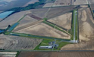
Stuttgart Municipal Airport is in Prairie County, Arkansas. It is eight miles north of Stuttgart, which owns the airport and is the county seat of Arkansas County's northern district. The FAA's National Plan of Integrated Airport Systems for 2009–2013 categorized it as a general aviation facility.

Walnut Ridge Regional Airport is a city-owned public-use airport located four nautical miles (7 km) northeast of the central business district of Walnut Ridge, a city in Lawrence County, Arkansas, United States. According to the FAA's National Plan of Integrated Airport Systems for 2009–2013, its FAA airport category is general aviation.

Clarksville Municipal Airport is a public-use airport located three nautical miles east of the central business district of Clarksville, in Johnson County, Arkansas, United States. It is owned by the City of Clarksville.
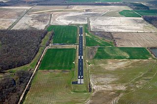
Almyra Municipal Airport is a city-owned, public-use airport located three nautical miles west of the central business district of Almyra, a city in Arkansas County, Arkansas, United States. This airport is included in the FAA's National Plan of Integrated Airport Systems for 2009–2013, which categorizes it as a general aviation facility.

Bentonville Municipal Airport is a city-owned, public-use airport located two nautical miles (3.7 km) south of the central business district of Bentonville, a city in Benton County, Arkansas, United States. It is also known as Louise M. Thaden Field or Louise Thaden Field, a name it was given in 1951 to honor Louise McPhetridge Thaden (1905–1979), an aviation pioneer from Bentonville.
Smith Field is a city-owned, public-use airport located three nautical miles northeast of the central business district of Siloam Springs, a city in Benton County, Arkansas, United States. According to the FAA's National Plan of Integrated Airport Systems for 2009–2013, it is categorized as a general aviation airport.

Carroll County Airport is a county-owned, public-use airport in Carroll County, Arkansas, United States. It is located three nautical miles (6 km) west of the central business district of Berryville, Arkansas. This airport is included in the National Plan of Integrated Airport Systems for 2011–2015, which categorized it as a general aviation facility.
Kirk Field is a city-owned public-use airport located one nautical mile northwest of the central business district of Paragould, in Greene County, Arkansas, United States.
Z. M. Jack Stell Field is a city-owned public-use airport located five nautical miles northeast of the central business district of Crossett, in Ashley County, Arkansas, United States.

Blytheville Municipal Airport is a public use airport located three nautical miles east of the central business district of Blytheville, in Mississippi County, Arkansas, United States. It is owned by the City of Blytheville.
J. Lynn Helms Sevier County Airport is a county-owned public-use airport in Sevier County, Arkansas, United States. It is located three nautical miles west of the central business district of De Queen, Arkansas. The airport is named for J. Lynn Helms, who was Administrator of the Federal Aviation Administration under U.S. President Ronald Reagan. Helms was born in De Queen.

Batesville Regional Airport is a public-use airport located three nautical miles south of the central business district of Batesville, in Independence County, Arkansas, United States. It is owned by the City of Batesville.

Sharp County Regional Airport is a public-use airport in Sharp County, Arkansas, United States. It is located three nautical miles northeast of the central business district of Ash Flat, Arkansas. The airport is owned by the Sharp County Regional Airport Authority.
Woodruff County Airport is a county-owned public-use airport in Woodruff County, Arkansas, United States. It is located four nautical miles east of the central business district of Augusta, Arkansas.
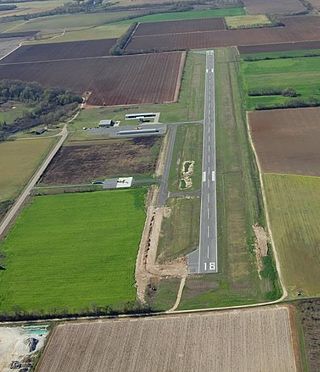
Warren Municipal Airport is a city-owned, public-use airport located three nautical miles (6 km) south of the central business district of Warren, a city in Bradley County, Arkansas, United States. It is included in the National Plan of Integrated Airport Systems for 2011–2015, which categorized it as a general aviation facility.
Billy Free Municipal Airport is a public use airport in Desha County, Arkansas, United States. The airport is owned by the City of Dumas and located two nautical miles (4 km) west of its central business district. It is included in the National Plan of Integrated Airport Systems for 2011–2015, which categorized it as a general aviation facility.

Calico Rock–Izard County Airport is a public use airport located three nautical miles (6 km) northwest of the central business district of Calico Rock, a city in Izard County, Arkansas, United States. The airport is owned by the Arkansas Department of Correction and situated adjacent to its North Central Unit prison.

Clarendon Municipal Airport is a city-owned, public-use airport located five nautical miles southwest of the central business district of Clarendon, a city in Monroe County, Arkansas, United States. It is included in the National Plan of Integrated Airport Systems for 2011–2015, which categorized it as a general aviation facility.

Corning Municipal Airport is a city-owned, public-use airport located three nautical miles (6 km) west of the central business district of Corning, a city in Clay County, Arkansas, United States. It is included in the National Plan of Integrated Airport Systems for 2011–2015, which categorized it as a general aviation facility.
References
- 1 2 3 FAA Airport Form 5010 for 8M2 PDF . Federal Aviation Administration. effective 25 August 2011.