Related Research Articles
Delaware Airpark is a public use airport serving the Dover area. It is owned by the Delaware Department of Transportation and operated by the Delaware River and Bay Authority and located one nautical mile (2 km) west of the central business district of Cheswold, a town in Kent County, Delaware, United States. It is included in the Federal Aviation Administration (FAA) National Plan of Integrated Airport Systems for 2017–2021, in which it is categorized as a local general aviation facility.
Ardmore Municipal Airport is in Carter County, Oklahoma, 12 miles (19 km) northeast of the city of Ardmore, which owns it. It is near Gene Autry, Oklahoma. The National Plan of Integrated Airport Systems for 2011–2015 called it a general aviation airport.

The Clinton-Sherman Industrial Airpark, also known as the Oklahoma Air & Space Port is a spaceport in Washita County, Oklahoma, near the town of Burns Flat. The Federal Aviation Administration (FAA) granted a license to the site in June 2006 to the Oklahoma Space Industry Development Authority (OSIDA) to "oversee the takeoff and landing of suborbital, reusable launch vehicles." It also boasts the first space flight corridor, "The Infinity One"—which is about 152 miles long and averages about 50 miles wide—that is not in restricted airspace and does not interfere with Military Operations Areas (MOAs). The facility is an FAA licensed launch site, one of only 12 in the U.S. Individual operators must also secure a separate license in order to make space flights from the facility.
University Airpark is a privately-owned, public use general aviation airport located 2 miles (3 km) west-northwest of Bath, Michigan in Clinton County, Michigan, United States. Lansing Capital Region International Airport is located 6 miles (10 km) southwest.
Bourland Field is a public airport located seventeen miles southwest of the central business district (CBD) of Fort Worth, in Parker County, Texas, United States. It was developed by Richard Bourland in September 1981 for whom the airport is named. In addition to serving as a public-use airport for southeastern Parker County, the airport also serves as an airpark for the attached housing development known as Bourland Field Estates.
Airpark East Airport is a privately owned public-use airport located 6 nautical miles (11 km) northwest of the central business district of Terrell, Texas, United States. The airport is used solely for general aviation purposes. The airport is in both Rockwall and Kaufman counties.
Sandy Creek Airpark is a private residential airpark located in the East Bay Sector, 10 miles southeast of the central business district of Panama City, in Bay County, Florida, United States. This airport has one dusk-to-dawn lighted runway, and a green-white beacon. The facility is used primarily by residents/association members, their tenants and guests, and members of the EAA Chapter 202.
Eagle Creek Airpark is a public use airport located seven nautical miles (13 km) west of the central business district of Indianapolis, a city in Marion County, Indiana, United States. It is owned by the Indianapolis Airport Authority and serves as a reliever airport for Indianapolis International Airport.
RWJ Airpark is a public-use airport located in Beach City, Chambers County, Texas, United States, seven miles (11 km) east of the central business district of Baytown. It was privately owned by the R. W. Johnson Const. Co. Inc, but, as of 2022, its owned by IMC Service and Supply.
Beaver Municipal Airport is a city-owned, public-use airport located one mile southwest of the central business district of Beaver, a city in Beaver County, Oklahoma, United States.
Keystone Airpark, also known as Keystone Heights Airport, is a public use airport located 3 miles north of Keystone Heights, Florida in Clay and Bradford counties.
Arthur Dunn Airpark is a public-use airport located 2 miles (3.2 km) northwest of the central business district of the city of Titusville in Brevard County, Florida, United States. The airport is publicly owned and is administered under the cognizance of the Titusville-Cocoa Airport Authority. The airport has one paved runway that is 2,961 feet in length and a turf runway that is 1,805 feet in length.

Ridge Landing Airpark, also known as Ridge Landing Airport, is a private use airpark located four nautical miles west of the central business district of Frostproof, Florida, United States. Ridge Landing is an airpark community located between Lake Wales and Sebring. Ridge Landing is centrally located between Orlando and Tampa and equidistant to Miami and Jacksonville. It is privately owned by John Fazzini.
Hernando Village Airpark is a privately owned, public use airport in DeSoto County, Mississippi, United States. It is located two nautical miles (4 km) southwest of the central business district of Hernando, Mississippi. The airport is part of the Green Village Residential Airpark in Hernando.
Lakeway Airpark is a public use airport in Travis County, Texas, United States. The airport is 17 nautical miles west of the central business district of Austin. It is privately owned by Lakeway Airpark, Inc. and is located in Lakeway, Texas.
Ledgedale Airpark is a public use airport in Monroe County, New York, United States. It is owned by Big Fella Enterprizes Inc. and is located three nautical miles southwest of the central business district of the Village of Brockport. According to the FAA's National Plan of Integrated Airport Systems for 2007-2011, it is categorized as a reliever airport.
Hawthorne–Feather Airpark is a privately owned public-use airport located three nautical miles (6 km) south of the central business district of Hillsborough, in Hillsborough County, New Hampshire, United States. The airport is situated in Deering, New Hampshire. It was formerly used by Hawthorne College in Antrim, New Hampshire to train student pilots.
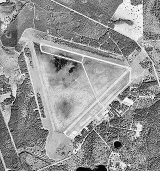
Midland Airpark is a public airport three miles north of Midland, in Midland County, Texas. The FAA's National Plan of Integrated Airport Systems for 2009–2013 categorized it as a general aviation facility.
Braden Airpark, also known as Easton Airport, is a small airport located about three nautical miles north of the central business district of Easton, Pennsylvania. The airport is owned by the Lehigh-Northampton Airport Authority, which also owns Lehigh Valley International Airport and Allentown Queen City Municipal Airport.
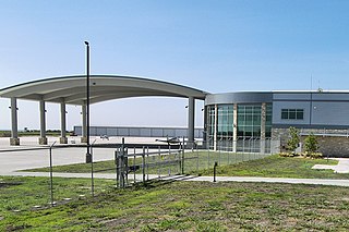
Austin Executive Airport is a public-use airport in Travis County, 14 miles northeast of Austin, immediately southeast of Pflugerville and north of Manor. It was known as Bird's Nest Airport until 2011.
References
- 1 2 3 FAA Airport Form 5010 for K11 PDF . Federal Aviation Administration. Effective 29 July 2010.