San Francisco de los Romo

Last updated

San Francisco de los Romo
San Francisco de los Romo - panoramio.jpg
San Fco de los Romo en Aguascalientes.jpg
Municipality location in Aguascalientes
Mexico Aguascalientes location map.svg
Red pog.svg
San Francisco de los Romo
Location in Mexico
Mexico States blank map.svg
Red pog.svg
San Francisco de los Romo
San Francisco de los Romo (Mexico)
Coordinates: 22°05′N102°16′W / 22.083°N 102.267°W / 22.083; -102.267 Coordinates: 22°05′N102°16′W / 22.083°N 102.267°W / 22.083; -102.267
CountryMexico
State Aguascalientes
Area
  Land139.452 km2 (53.843 sq mi)
Population
 (2015)
  Total46,454
  Density333.1/km2 (863/sq mi)

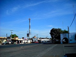
San Francisco de los Romo is a municipality and city in the Mexican state of Aguascalientes. The city of San Francisco de los Romo serves as the municipal seat for the surrounding municipality of San Francisco de los Romo.

Contents

It is located in the middle of the Aguascalientes Valley, at 20 km towards north from the state capital Aguascalientes; it adjoins with the municipalities of Pabellón de Arteaga and Asientos to the north, Jesús María to the west, and Aguascalientes to the south-east. The city, which is the state's sixth-largest community, is located at the northwest corner of the municipality.

Demographics

Historical population
YearPop.±%
201035,769    
201546,454+29.9%
202061,997+33.5%
[1] [2] [3] [4]

As of 2010, the municipality had a total population of 35,769. [5]

As of 2010, the city of San Francisco de los Romo had a population of 16,124. [5] Other than the city of San Francisco de los Romo, the municipality had 117 localities, the largest of which (with 2010 populations in parentheses) were: Ex-viñedos Guadalupe (3,499), classified as urban, and Colonia Macario J. Gómez (2,122), Puertecito de la Virgen (1,976), Paseos de la Providencia (1,867), La Concepción (1,483), and La Escondida (El Salero) (1,318), classified as rural. [5]

San Francisco de los Romo is the sixth-largest community in the state, is located at the northwest corner of the municipality and serves as its municipal seat.

Geography

Climate

Climate data for San Francisco de los Romo (1951–2010)
MonthJanFebMarAprMayJunJulAugSepOctNovDecYear
Record high °C (°F)35.0
(95.0)
37.0
(98.6)
39.0
(102.2)
43.0
(109.4)
44.0
(111.2)
42.0
(107.6)
40.0
(104.0)
39.0
(102.2)
38.0
(100.4)
39.0
(102.2)
34.0
(93.2)
38.0
(100.4)
44.0
(111.2)
Average high °C (°F)22.9
(73.2)
24.7
(76.5)
28.2
(82.8)
30.9
(87.6)
32.6
(90.7)
31.4
(88.5)
28.9
(84.0)
29.0
(84.2)
27.7
(81.9)
26.4
(79.5)
24.7
(76.5)
22.5
(72.5)
27.5
(81.5)
Daily mean °C (°F)12.7
(54.9)
13.9
(57.0)
16.8
(62.2)
19.6
(67.3)
21.8
(71.2)
22.5
(72.5)
21.1
(70.0)
20.9
(69.6)
19.9
(67.8)
17.5
(63.5)
14.8
(58.6)
13.1
(55.6)
17.9
(64.2)
Average low °C (°F)2.5
(36.5)
3.1
(37.6)
5.3
(41.5)
8.2
(46.8)
11.1
(52.0)
13.6
(56.5)
13.2
(55.8)
12.9
(55.2)
12.1
(53.8)
8.5
(47.3)
4.8
(40.6)
3.7
(38.7)
8.3
(46.9)
Record low °C (°F)−8.0
(17.6)
−6.2
(20.8)
−6.2
(20.8)
−0.8
(30.6)
0.0
(32.0)
5.0
(41.0)
5.0
(41.0)
5.4
(41.7)
2.0
(35.6)
−4.1
(24.6)
−4.2
(24.4)
−6.0
(21.2)
−8.0
(17.6)
Average precipitation mm (inches)15.5
(0.61)
8.6
(0.34)
7.3
(0.29)
10.7
(0.42)
19.5
(0.77)
72.5
(2.85)
94.5
(3.72)
98.0
(3.86)
87.1
(3.43)
31.5
(1.24)
12.6
(0.50)
15.2
(0.60)
473.0
(18.62)
Average precipitation days (≥ 0.1 mm)2.21.30.81.53.07.810.210.58.94.91.62.254.9
Source: Servicio Meteorologico Nacional [6] [7]

Related Research Articles

<span class="mw-page-title-main">Aguascalientes (city)</span> City in Aguascalientes, Mexico

Aguascalientes is the capital of the Mexican state of Aguascalientes and its most populous city, as well as the head of the Aguascalientes Municipality; with a population of 934,424 inhabitants in 2012 and 1,225,432 in the metro area. The metropolitan area also includes the municipalities of Jesús María and San Francisco de los Romo. It is located in North-Central Mexico, which roughly corresponds to the Bajío region (Lowlands) within the central Mexican plateau. The city stands on a valley of steppe climate at 1880 meters above sea level, at 21°51′N102°18′W.

<span class="mw-page-title-main">Escárcega</span> Place in Campeche, Mexico

Escárcega is a small city in the Mexican state of Campeche, located at 18.62°N 90.74°W in the central part of the state. As of 2010, the city of Escárcega had a population of 29,477.

<span class="mw-page-title-main">Asientos</span> Municipality in Aguascalientes, Mexico

Asientos is a municipality in the Mexican state of Aguascalientes. It stands at 22°14′N102°05′W. The town of Real de Asientos serves as the municipal seat for the surrounding municipality of Asientos.

<span class="mw-page-title-main">Jesús María, Aguascalientes</span> City in Aguascalientes, Mexico

Jesús María is a city in the Mexican state of Aguascalientes. It stands at 21°58′N102°21′W and serves as the municipal seat of the surrounding municipality of Jesús María.

<span class="mw-page-title-main">El Llano, Aguascalientes</span> Municipality in Aguascalientes, Mexico

El Llano is a municipality in the Mexican state of Aguascalientes. It stands at 21°55′N101°58′W.

<span class="mw-page-title-main">Pabellón de Arteaga</span> City in Aguascalientes, Mexico

Pabellón de Arteaga is a city in the Mexican state of Aguascalientes. It stands at 22°09′N102°16′W in the central part of the state. The city serves as the municipal seat of the municipality of Pabellón de Arteaga. As of 2010, the city had a total population of 28,633, up from 26,797 in 2005. It is the third-largest city in the state behind Aguascalientes and Jesús María.

<span class="mw-page-title-main">Rincón de Romos</span> City in Aguascalientes, Mexico

Rincón de Romos is a municipality and city in the Mexican state of Aguascalientes. Located at 22°14′N102°19′W in the northern part of the state, the city serves as the municipal seat of the surrounding municipality Rincón de Romos.

<span class="mw-page-title-main">Tecate Municipality</span> Municipality in Baja California, Mexico

Tecate is a municipality in the Mexican state of Baja California. Its municipal seat is located in the city of Tecate. According to the 2020 census, it had a population of 108,440 inhabitants. The municipality has an area of 3,079.0 km².

<span class="mw-page-title-main">Playas de Rosarito Municipality</span> Municipality in Baja California, Mexico

Playas de Rosarito Municipality is located in the northwestern part of the Mexican state of Baja California comprising part of the Tijuana metropolitan area. It lies just south of the city of Tijuana. Its municipal seat is the city of Rosarito. According to the 2020 census, the municipality had a population of 126,890 inhabitants. Its area is 513.32 km².

Tenabo is a city in the Mexican state of Campeche. It is located in the north of the state, 35 km from the state capital Campeche, Camp., and 110 km from Mérida, Yucatán, along Federal Highway 180. It serves as the municipal seat for the municipality of the same name.

<span class="mw-page-title-main">Calvillo Municipality</span> Municipality in Aguascalientes, Mexico

Calvillo is a municipality in the Mexican state of Aguascalientes. The city of Calvillo, the second largest in the state, serves as the municipal seat. It is located to the western part of the state, at about 52 kilometers of the city of Aguascalientes. It stands at 21°51′N102°43′W in the southwestern corner of the state. It is bounded by Jalisco and Zacatecas. The municipality, which has an area of 931.26 km², reported a population of 54,136 by 2010. The town of Ojocaliente is another significant community in the municipality. Calvillo is one of the richest, most prosperous municipalities in Aguascalientes.

<span class="mw-page-title-main">Pabellón de Arteaga Municipality</span> Municipality in Aguascalientes, Mexico

Pabellón de Arteaga is municipality in the Mexican state of Aguascalientes. It stands at 22°09′N102°16′W in the central part of the state. The city of Pabellón de Arteaga serves as its municipal seat. The municipality had a population of 41,862 and an area of 199.33 km². Its largest other town is named Emiliano Zapata.

<span class="mw-page-title-main">Jesús María Municipality</span> Municipality in Aguascalientes, Mexico

Jesús María is a municipality in the Mexican state of Aguascalientes. It stands at 21°58′N102°21′W. As of 2010, the municipality had a total population of 99,590.

<span class="mw-page-title-main">San José de Gracia, Aguascalientes</span> Municipality in Aguascalientes, Mexico

San José de Gracia, or simply San José, is a municipality and town in the Mexican state of Aguascalientes. The town of San José de Gracia serves as the municipal seat for the surrounding municipality of San José de Gracia.

<span class="mw-page-title-main">Tepezalá</span> Municipality in Aguascalientes, Mexico

Tepezalá is a municipality and town in the Mexican state of Aguascalientes. The town of Tepezalá serves as the municipal seat for the surrounding municipality of Tepezalá.

<span class="mw-page-title-main">Cosío</span> Municipality in Aguascalientes, Mexico

Cosio is a municipality and town in the Mexican state of Aguascalientes. It stands at 22°22′N102°18′W. The municipal seat is the town of Cosío. As of 2010, the town of Cosío had a population of 4,898.

<span class="mw-page-title-main">San Quintín Municipality</span> Municipality in Baja California, Mexico

San Quintín is a municipality in the Mexican state of Baja California. Its municipal seat is located in the city of San Quintín, Baja California. According to the 2020 census, it had a population of 117,568 inhabitants. The municipality has an area of 32,883.93 km2. There are a few National Parks and a World Heritage Site at Bahia de Los Angeles.

<span class="mw-page-title-main">Luis Moya, Zacatecas</span> Municipality in Zacatecas, Mexico

Luis Moya is a municipality in the Mexican state of Zacatecas, located approximately 50 kilometres (31 mi) southeast of the state capital of Zacatecas City. It is named after Luis Moya (1855–1911), a colonel in the Mexican Revolution who was posthumously given the rank of brigadier general in 1939.

Genaro Codina is a municipality in the Mexican state of Zacatecas, located approximately 30 kilometres (19 mi) southwest of the state capital of Zacatecas City. It is named after Genaro Codina, musician and composer of the state anthem, the March of Zacatecas.

<span class="mw-page-title-main">Mezquital del Oro</span> Municipality in Zacatecas, Mexico

Mezquital del Oro is a municipality in the Mexican state of Zacatecas, located approximately 190 kilometres (120 mi) southwest of Zacatecas City, the state capital.

References

  1. "Localidades y su población por municipio según tamaño de localidad" (PDF) (in Spanish). INEGI. Archived from the original (PDF) on 31 August 2018. Retrieved 15 July 2017.
  2. "Número de habitantes". INEGI (National Institute of Statistics and Geography). Archived from the original on 2 July 2017. Retrieved 15 July 2017.
  3. "Tabulados de la Encuesta Intercensal 2015" (xls) (in Spanish). INEGI. Archived from the original on 31 December 2017. Retrieved 15 July 2017.
  4. "INEGI. Censo de Población y Vivienda 2020. Tabulados del Cuestionario Básico – Aguascalientes" [INEGI. 2020 Population and Housing Census. Basic Questionnaire Tabulations – Aguascalientes](Excel) (in Spanish). INEGI. 2020. pp. 1–4. Archived from the original on 28 January 2021. Retrieved 27 January 2021.
  5. 1 2 3 "San Francisco de los Romo". Catálogo de Localidades. Secretaría de Desarrollo Social (SEDESOL). Retrieved 23 April 2014.
  6. "Estado de Aguascalientes-Estacion: San Francisco de los Romo (SMN)". Normales Climatologicas 1951–2010 (in Spanish). Servicio Meteorologico Nacional. Archived from the original on 18 May 2015. Retrieved 8 May 2015.
  7. "Extreme Temperatures and Precipitation for San Francisco de los Romo (SMN) 1927–1983" (in Spanish). Servicio Meteorológico Nacional. Archived from the original on 18 May 2015. Retrieved 8 May 2015.