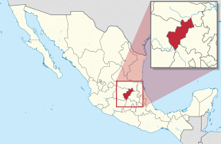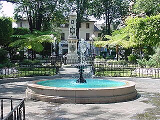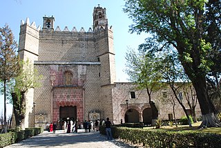
Querétaro, officially the Free and Sovereign State of Querétaro, formally Querétaro de Arteaga), is one of the 32 federal entities of Mexico. It is divided into 18 municipalities. Its capital city is Santiago de Querétaro.

Azcapotzalco is one of the 16 municipalities (municipios) into which Mexico's Mexico City is divided. Azcapotzalco is in the northwestern part of Mexico City. The town began in the pre-Hispanic era and was the seat of the Tepanec dominion until the Aztec Triple Alliance overthrew it. After that it was a rural farming area becoming part of the Federal District of Mexico City in the mid-19th century. In the 20th century the area was engulfed by the urban sprawl of Mexico City. Today it is 100% urbanized and is a center of industry.
Zacazonapan is a village and municipality near Mexico City. The name comes from Nahuatl and roughly translates to "in the River of the Dry Corn plants"

Naucalpan, officially Naucalpan de Juárez, is a city and municipality located just northwest of Mexico City in the adjoining State of Mexico.

Uruapan is the second largest city in the Mexican state of Michoacán. It is located at the western edge of the Purépecha highlands, just to the east of the Tierra Caliente region. Since the colonial period, it has been an important city economically due its location. The city was conquered by the Spanish in 1522, when the last Purépecha ruler fled the Pátzcuaro area to here. The modern city was laid out in 1534 by Friar Juan de San Miguel. It played an important role in the War of Independence, and was the capital of Michoacán during the French Intervention. Today it is the center of Mexico's avocado growing region, with most of the crop distributed from here nationally and internationally.

Tequisquiapan is a town and municipality located in the southeast of the state of Querétaro in central Mexico. The center of the town has cobblestone streets, traditional rustic houses with wrought iron fixtures, balconies, and wooden windowsills, which is the legacy of its 300-year heritage as a colonial town populated mostly by indigenous people. This, the climate, and the local natural water springs have made the town a popular weekend getaway for cities such as Querétaro and Mexico City, which has led to the construction of weekend homes in the town.

Arroyo Seco is a town in Arroyo Seco Municipality located in the far north of the Mexican state of Querétaro. Its territory is part of the Sierra Gorda Biosphere Reserve of Querétaro. The municipality is centered on the small town of Arroyo Seco, which was established as a military outpost then given town status in 1833 under the name of Villa de Guadalupe before changing to its current name. The town gained municipal status in 1931. The area is very rural with most people living in communities of under 100 people, with significant Pame communities. It has a traditional economy based on agriculture, livestock and forestry but it is also one of the poorest in Mexico, with high rates of emigration, especially sending migrant workers to the United States. It is estimated that one in four households in the municipality receives money from family members in this country. The municipality is also home to one of five Franciscan mission complexes built under the tenure of Junípero Serra, located in the community of Concá.

Metepec is a city and municipality in the State of Mexico in Mexico and is located directly to the east of the state capital, Toluca, at an altitude of 2,635 metres (8,645 ft) above sea level. The centre of Mexico City lies some 50 km further to the east. The name Metepec comes from Náhuatl meaning hill of the maguey plants. However, it is also known in the Matlatzinca language as "Nepinta-Tuhi" meaning 'people of corn land' and in the Otomi language as "Ntaguada".

Sombrerete is a town and municipality located in the northwest of the Mexican state of Zacatecas, bordering the state of Durango.

San Juan de los Lagos is a city and municipality located in the northeast corner of the state of Jalisco, Mexico, in a region known as Los Altos. It is best known as the home of a small image of the Virgin Mary called Our Lady of San Juan de los Lagos or in Nahuatl Cihuapilli, which means “Great Lady.” Since the first major miracle ascribed to her in 1632, she has been venerated especially for cases involving mortal danger. The miracles ascribed to her have made the basilica in which she is found a major tourist attraction, which has shaped the city's history to this day. The economy of the city is still heavily dependent on the flow of pilgrims which has amounted to between seven and nine million people per year.

Encarnación de Díaz is a town and municipality located in the far northeast of the state of Jalisco in north-central Mexico. It is located in a natural pass that connects the Los Altos region of Jalisco to points north, and from pre-Hispanic times until the 20th century, it was a major thoroughfare for north-south travel. The town began as a way station along a road built through this pass in the 17th century, formally becoming a town in 1760. It began to function as a municipality in the latter 19th century, but this status was not confirmed until the early 20th. Transport, along with numerous prosperous haciendas supported the economy of the area until the early 20th century, when travel patterns and the Mexican Revolution spurred its decline. In the 1920s, it was a centre of rebellion during the Cristero War, and the town contains Mexico's only museum exclusively dedicated to this episode in history. It also contains a museum dedicated to various naturally occurring mummies which have been found in the municipal cemetery.

Ixtapan del Oro is a town and municipality in the State of Mexico, in Mexico. The name “Ixtapan” comes from Nahuatl and means 'in the place of little salt'. "del Oro" is Spanish, meaning 'of the gold'. This name was added in 1894 when some veins of gold were found here.

San Felipe del Progreso is a town and municipality in the northwest of the State of Mexico. It is in the western part of the state, 59 km from the state capital of Toluca and 72 km southwest of Atlacomulco. In colonial times, the village was founded as "San Felipe" or "San Felipe Ixtlahuaca". Later it was called "San Felipe el Grande" and "San Felipe del Obraje". In the second half of the 19th century, it received its current name of "San Felipe del Progreso."

Otzoloapan Municipality is a municipality located at the southeast of the State of Mexico. The name is from the Náhuatl 'Oceloapan' which means "river of lynxes". It is located in the southwest part of the state bordering the state of Michoacán.

Tecolotlán is a town and municipality, in Jalisco in central-western Mexico. The municipality covers an area of 795.55 km².

Abejones is a town and municipality in Oaxaca in south-western Mexico. The municipality covers an area of 122.48 km2. It is part of the Ixtlán District in the Sierra Norte de Oaxaca region. It shares borders with San Pablo Macuiltianguis to the north, with Santa Ana Yareni and Santa María Jaltianguis to the south, with San Juan Bautista Atatlahuca, San Miguel Aloapam and San Juan Bautista Jayacatlán to the west, and with San Pablo Macuiltianguis, San Juan Atepec and San Juan Evangelista Analco to the east. Its approximately 94 km from the city of Oaxaca. This area has a very uneven terrain and there is no hectare that is a complete level in the whole municipality. The local mountains are called the Sierra Marcos Pérez and some of its mountains reach the three thousand meters. It is quite a dry region but the cold weather helps some fruit trees and forests. The only river near is the Rio Grande. As of 2005, the municipality had a total population of 1114.

San Juan Juquila Mixes is a town and municipality in Oaxaca in south-western Mexico. It is part of the Yautepec District in the east of the Sierra Sur Region. The name "Juquila" means "beautiful vegetables".

Huaquechula Municipality is a municipality in Puebla in south-eastern Mexico.

Huejotzingo (modern Nahuatl pronunciation is a small city and municipality located just northwest of the city of Puebla, in central Mexico. The settlement's history dates back to the pre-Hispanic period, when it was a dominion, with its capital a short distance from where the modern settlement is today. Modern Huejotzingo is located where a Franciscan monastery was founded in 1525, and in 1529, the monks moved the indigenous population of Huejotzingo to live around the monastery. Today, Huejotzingo is known for the production of alcoholic apple cider and fruit preserves, as well as its annual carnival. This carnival is distinct as it centers on the re-enactment of several historical and legendary events related to the area. The largest of these is related to the Battle of Puebla, with about 2, 000 residents representing French and Mexican forces that engage in mock battles over four days.

Pahuatlán, officially Pahuatlán del Valle, is a town and municipality located in the northwest of the state of Puebla in central Mexico. The municipality is part of the Sierra Norte region of the state, a steep mountainous area which receive significant moisture from the Gulf of Mexico, and borders the states of Hidalgo and Veracruz.


