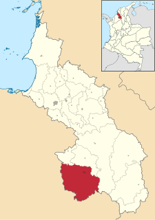
San Marcos is a town in Antioquia department in Colombia. It is approximately 175 miles (282 km) north of Medellín, in the heart of Colombia's coffee-growing region.
Camilo Daza International Airport is a civil airport located in Cúcuta, Colombia. The airport serves the Norte de Santander Department. It is named after Colombian aviation pioneer Camilo Daza.

Gustavo Rojas Pinilla International Airport is the main airport in the archipelago of San Andrés, Providencia and Santa Catalina, one of the departments of Colombia. It is able to receive large aircraft and to accommodate seasonal and charter flights from different parts of the Americas and Europe.

Alcides Fernández Airport is a commercial airport on the Caribbean coast serving to town of Acandí in the Choco Department of Colombia. The airport is considered by residents of the town of Acandí to be an important link between that community and the rest of Colombia as well as neighboring Panama.
Guaymaral Airport is a high-elevation airport in the north of Bogotá, Colombia, also serving the towns of Cota and Chía. The runway is 15 kilometres (9.3 mi) northeast of Bogota's El Dorado International Airport.
San Luis Airport is a high-elevation airport serving Ipiales, a city in the Nariño Department of Colombia. The airport is 4 kilometres (2.5 mi) north of the city.

Antonio Roldán Betancourt Airport is an airport serving Apartadó, a town in the Antioquia Department of Colombia. The airport is in the countryside 12 kilometres (7.5 mi) southwest of Apartadó.

El Embrujo Airport is an airport serving Providencia Island, Colombia. The airport is located in the north east side of the island, in the limits of the Old Providence McBean Lagoon National Natural Park.
Tres de Mayo Airport is an airport serving the town of Puerto Asís in the Putumayo District of Colombia.
César Gaviria Trujillo Airport is an airport serving the town of Inírida in the Guainía Department of Colombia. The airport is named in honor of César Gaviria Trujillo, a former President of Colombia and Secretary General of the Organization of American States.
Jorge Enrique González Torres Airport is an airport serving San José del Guaviare, the capital of the Guaviare Department of Colombia. The runway is just north of the town and parallels the Guaviare River.
Eduardo Falla Solano Airport in Spanish: Aeropuerto Eduardo Falla Solano is a domestic airport serving the municipality of San Vicente del Caguán in the Caquetá Department of Colombia.
Marco Fidel Suárez Air Base is a Colombian military base assigned to the Colombian Air Force Military Aviation School. The base is located in Cali, a city in the Valle del Cauca department of Colombia. It is named for Marco Fidel Suárez, a former president of Colombia.

The Heriberto Gil Martínez Airport is an airport serving the municipality of Tulua in the Valle del Cauca Department of Colombia.

Malacatán Airport is an airport serving the town of Malacatán in the San Marcos Department of Guatemala.

Puerto Páez Airport is an airport serving the border town of Puerto Páez in the Apure state of Venezuela.
San Luis de Palenque Airport is an airport serving the town of San Luis de Palenque, in Casanare Department of Colombia. The runway is southeast, adjacent to the town.
Furatena Airport is an airport serving the emerald region of the western emerald belt and town of Quípama in the Boyacá Department of Colombia. The airport is four nautical miles west of Muzo Airport.
Montelíbano Airport is an airport serving the city of Montelíbano in the Córdoba Department of Colombia. The airport is 1 kilometre (0.62 mi) west of the town, near a bend in the San Jorge River.
San Bernardo Airport is an airport serving the city of Santa Cruz de Mompox, or Mompós, in the Bolívar Department of Colombia. The airport is 2 kilometres (1.2 mi) northwest of the town, near the Brazo De Mompos River, an arm of the Magdalena River.