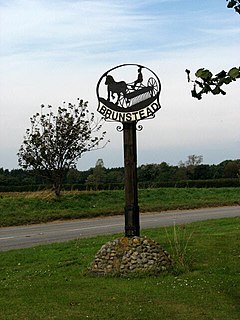
Brumstead is a village and a civil parish in the English county of Norfolk. The village is 15.3 miles (24.6 km) north-east of Norwich, 17.6 miles (28.3 km) south-south-east of Cromer and 134 miles (216 km) north-east of London. The village lies 1.2 miles (1.9 km) north of the town of Stalham. The nearest railway station is at North Walsham for the Bittern Line which runs between Cromer and Norwich. The nearest airport is Norwich. The parish had in 2001 census, a population of 84. At the 2011 census the population remained less than 100 and was included in the civil parish of East Ruston. For the purposes of local government, the parish falls within the district of North Norfolk. The village is situated on the route of the B1159 that runs between the town of Cromer and the town of Stalham.

Ingworth is a village and a civil parish in the English county of Norfolk. the nearest town is Aylsham which is 1.7 miles (2.7 km) south of the village. The village is 14.3 miles (23.0 km) north of Norwich, 7.3 miles (11.7 km) east of North Walsham and 9 miles (14 km) south-southwest of Cromer on the north Norfolk coast. The nearest railway station is at North Walsham Railway station where the Bittern Line from Cromer to Norwich can be accessed and the national rail network beyond. The nearest airport is Norwich International Airport. The village lies a 0.9 miles (1.4 km) east of the A140 Cromer to Norwich road. The Village and parish of Ingworth had in the 2001 census, a population of 94. For the purposes of local government, the Hamlet falls within the district of North Norfolk. The population taken at the 2011 Census remained less than 100 and was included in the civil parish of Erpingham.
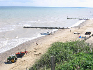
Mundesley is a coastal village and a civil parish in the English county of Norfolk. The village is 20.3 miles (32.7 km) north-north east of Norwich, 7.3 miles (11.7 km) south east of Cromer and 136 miles (219 km) north east of London. The village lies 5.6 miles (9.0 km) north-north east of the town of North Walsham. The nearest railway station is at North Walsham for the Bittern Line which runs between Sheringham and Norwich. The nearest airport is Norwich Airport. The village sits astride the B1159 coast road that links Cromer and Caister-on-Sea, and is at the eastern end of the B1145 a route which runs between King's Lynn and Mundesley. Mundesley is within the Norfolk Coast AONB. It has a resident population of around 2,695, measured at 2,758 in the 2011 Census. The River Mun or Mundesley Beck flows into the sea here.
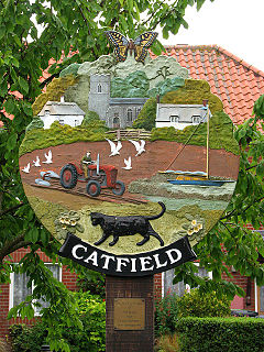
Catfield is a village and a civil parish in the English county of Norfolk. The village is 19.7 miles (31.7 km) south-east of Cromer, 17.3 miles (27.8 km) north-east of Norwich and 136 miles (219 km) north-east of London. The village lies 2.7 miles (4.3 km) south-south-east of the nearby town of Stalham. The nearest railway station is at Worstead for the Bittern Line which runs between Sheringham, Cromer and Norwich. The nearest airport is Norwich International Airport. The village is situated a little west of the A149 King’s Lynn to Great Yarmouth road. The parish had in 2001 census, a population of 848, increasing to 943 at the 2011 Census. For the purposes of local government, the parish falls within the district of North Norfolk.
Colby is a village and a civil parish in the English county of Norfolk. The village is 8.6 miles (13.8 km) south of Cromer, 16.8 miles (27.0 km) north-north-west of Norwich, 5.2 miles (8.4 km) west-north-west of North Walsham and 131 miles (211 km) north-east of London. The nearest railway station is at North Walsham Railway station where the Bittern Line from Cromer to Norwich can be accessed and the national rail network beyond. The nearest airport is Norwich International Airport. The village lies a small distance east from the A140 Cromer to Norwich road. The parish of Colby in the 2001 census, has a population of 524, including Banningham but reducing to 494 at the 2011 Census. For the purposes of local government, the parish falls within the district of North Norfolk.

Edgefield is a village and a civil parish in the English county of Norfolk. The village is 13.6 miles (21.9 km) east-north-east of the town of Fakenham, 12.4 miles (20.0 km) west-south-west of Cromer and 127 miles (204 km) north-north-east of London. The nearest town is Holt which lies 3.3 miles (5.3 km) north of the village. The nearest railway station is at Sheringham for the Bittern Line which runs between Sheringham, Cromer and Norwich. The nearest airport is Norwich International Airport. The village is situated on the B1149 Norwich to Holt road. The parish had, in the 2001 census, a population of 393, reducing to 385 at the 2011 Census. For the purposes of local government, the parish falls within the district of North Norfolk.
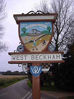
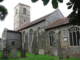
West Beckham is a village and a civil parish in the English county of Norfolk The village is 6.1 miles (9.8 km) west south west of Cromer, 25.3 miles (40.7 km) north north west of Norwich and 131 miles (211 km) north north east of London. The village lies 4.1 miles (6.6 km) east of the town of Holt. The village is 2.4 miles (3.9 km) inland from the North Norfolk Coast to the north. The village is 0.8 miles to the south of the A148 King’s Lynn to Cromer road. The nearest railway station is at Sheringham for the Bittern Line which runs between Sheringham, Cromer and Norwich. The nearest airport is Norwich International Airport.

Fulmodeston is a village and civil parish in the English county of Norfolk. The Village is 18.3 miles (29.5 km) west south west of Cromer, 23.5 miles (37.8 km) north north west of Norwich and 120 miles (190 km) north north east of London. The village lies 6.6 miles (10.6 km) east of the town of Fakenham. The village is located 2 miles (3.2 km) east of the A148 Fakenham to Cromer road, and is 2.3 miles (3.7 km) north of the A1067 Fakenham to Norwich road. The nearest railway station is at Sheringham for the Bittern Line which runs between Sheringham, Cromer and Norwich. The nearest airport is Norwich International Airport. The village and parish of Fulmodeston had in the 2001 census, a population of 431, including Barney and increasing slightly to 442 at the 2011 Census. The civil parish of Fulmodeston has an area of 1,504 Hectares. For the purposes of local government, the village falls within the district of North Norfolk.

The A1065 is a main road in the English region of East Anglia. It provides the principal road connection to parts of the west and north of the county of Norfolk from Newmarket and points south of there, including London. It runs from a junction near Mildenhall, to a junction on the western outskirt of Fakenham.
Upper Sheringham is a village and a civil parish in the English county of Norfolk. The village is 26.8 miles (43.1 km) north-north-west of Norwich, 6 miles (9.7 km) west of Cromer and 132 miles (212 km) north-north-east of London. The village is 1.2 miles (1.9 km) from the town of Sheringham. The nearest railway station is at Sheringham for the Bittern Line which runs between Sheringham, Cromer and Norwich. The nearest airport is Norwich International Airport. Nearby road connections are the A149 King's Lynn to Great Yarmouth road to the north of the village and the A148 King's Lynn to Cromer road just to the south. The parish of Upper Sheringham in the 2001 census, a population of 214, reducing slightly to 209 at the 2011 Census. For the purposes of local government, the parish falls within the district of North Norfolk.

The A1082 is an English A road entirely in the county of Norfolk. It runs from a junction with the A148 King's Lynn to Cromer Road to a roundabout on the A149 in the North Norfolk coastal town of Sheringham.

Stibbard is a village and civil parish in the English county of Norfolk. The village is 19.3 miles (31.1 km) south-west of Cromer, 21.2 miles (34.1 km) north-west of Norwich and 120 mi (190 km) north-east of London. The village lies 4.9 miles (7.9 km) south-east of the nearby town of Fakenham. The nearest railway station is at Sheringham for the Bittern Line which runs between Sheringham, Cromer and Norwich. The nearest airport is Norwich International Airport.

The B1436 runs for about 4.3 miles (6.9 km) through Norfolk, England, from a little southwest of Cromer to Thorpe Market. It is a useful conduit to avoid the busy seaside town of Cromer during the summer months and links the A148 from Kings Lynn to the A140 to Norwich and the A149 to Great Yarmouth.

Barney is a village in the civil parish of Fulmodeston in the English county of Norfolk. The village lies to the south of the A148 King's Lynn to Cromer road near Thursford.The village is 7.2 miles (11.6 km) east north east of the town of Fakenham, 17.1 miles (27.5 km) west south west of Cromer and 121 miles (195 km) north north east of London. The nearest railway station is at Sheringham for the Bittern Line which runs between Sheringham, Cromer and Norwich. The nearest airport is Norwich International Airport.

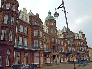
The Cliftonville Hotel is a AA 3 star Hotel, and Grade II listed building, located in the English seaside town of Cromer in the county of Norfolk, United Kingdom.
The Hotel de Paris is a hotel in the English seaside town of Cromer in the county of Norfolk, United Kingdom. It has an AA three-star rating.

The Red Lion Hotel is a AA 4 star hotel located in the English seaside town of Cromer in the county of Norfolk, United Kingdom.

The Sea Marge Hotel is an AA 4-star hotel in the English seaside village of Overstrand in the county of Norfolk. The hotel also has 2 AA Rosettes for Food.

the Durdans Bed and Breakfast Hotel is located in the English seaside village of Mundesley in the county of Norfolk, United Kingdom. The guest house is a 4-star bed and breakfast with a Silver Award from Visit Britain.