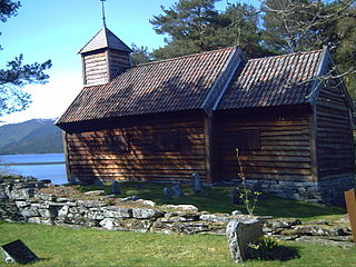
Sande, Sogn og Fjordane

Last updated
Sande
Sande i Sunnfjord
Village

Sande kyrkje001 (cropped).jpg

Sande Church
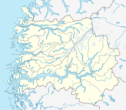
Norway Sogn og Fjordane location map.svg
Red pog.svg
Sande
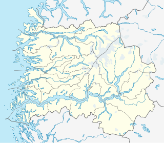
Location in Sogn og Fjordane county
Norway location map.svg
Red pog.svg
Sande
Sande (Norway)
Coordinates: 61°19′30″N05°47′51″E / 61.32500°N 5.79750°E / 61.32500; 5.79750 Coordinates: 61°19′30″N05°47′51″E / 61.32500°N 5.79750°E / 61.32500; 5.79750
Country Norway
Region Western Norway
County Sogn og Fjordane
District Sunnfjord
Municipality Gaular
Area [1]
  Total 0.59 km2 (0.23 sq mi)
Elevation [2] 100 m (300 ft)
Population (2013) [1]
  Total 745
  Density 1,263/km2 (3,270/sq mi)
Time zone CET (UTC+01:00)
  Summer (DST) CEST (UTC+02:00)
Post Code6973 Sande i Sunnfjord

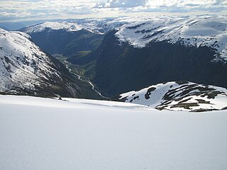
Sande (also known as Sande i Sunnfjord) is the administrative centre of the municipality of Gaular in Sogn og Fjordane county, Norway. The village is located along the Gaula River, about 10 kilometres (6.2 mi) from where the river meets the Dalsfjorden. The 0.59-square-kilometre (150-acre) village has a population (2013) of 745, giving the village a population density of 1,263 inhabitants per square kilometre (3,270/sq mi). [1] Sande Church is located in this village, serving the people of the central part of the municipality.

An administrative centre is a seat of regional administration or local government, or a county town, or the place where the central administration of a commune is located.

Gaular Municipality in Sogn og Fjordane, Norway

Gaular is a municipality in Sogn og Fjordane county, Norway. It is located in the traditional district of Sunnfjord. The administrative centre is the village of Sande. Other villages in the municipality include Bygstad, Hestad, and Vik. Gaular is sometimes referred to as Fosselandet because it is home to 28 large and small waterfalls. The municipality is centered on the river Gaula. The Viksdalen valley is located in Gaular.
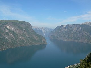
Sogn og Fjordane County (fylke) of Norway

Sogn og Fjordane is a county in western Norway, bordering Møre og Romsdal, Oppland, Buskerud, and Hordaland. The county administration is in the village of Hermansverk in Leikanger municipality. The largest town in the county is Førde.

The European route E39 highway runs through the village of Sande, connecting it to the village of Vadheim to the south and the town of Førde to the north. Førde Airport, Bringeland is located about 11 kilometres (6.8 mi) north of Sande along the E39 highway. The town of Førde is 19 kilometres (12 mi) north of Sande, and the village of Vadheim in Høyanger is 14 kilometres (8.7 mi) to the south. [3]

European route E39 highway in Norway and Denmark

E 39 is the designation of a 1330 km long north-south road in Norway and Denmark, running from Klett just south of Trondheim to Aalborg, via Orkanger, Vinjeøra, Halsa ... Straumsnes, Krifast, Batnfjordsøra, Molde ... Vestnes, Skodje, Ålesund ... Volda ... Nordfjordeid ... Sandane, Førde, Lavik ... Instefjord, Knarvik, Bergen, Os ... Stord, Sveio, Aksdal, Bokn ... Rennesøy, Randaberg, Stavanger, Sandnes, Ålgård, Helleland, Flekkefjord, Lyngdal, Mandal, Kristiansand ... Hirtshals, Hjørring, and Nørresundby. Several sections are via ferry, denoted by ... in the above list. In total there are nine ferries, the highest number of ferries for a single road in Europe.

Vadheim Village in Western Norway, Norway

Vadheim is a village in the municipality of Høyanger in Sogn og Fjordane county, Norway. It is located on the north shore of the Sognefjorden, along the small Vadheimsfjorden branch. The European route E39 highway runs through the village. It is located about 25 kilometres (16 mi) northeast of the village of Lavik, about 11 kilometres (6.8 mi) northwest of the village of Kyrkjebø, and about 13.5 kilometres (8.4 mi) northwest of the village of Austreim. The 0.36-square-kilometre (89-acre) village has a population (2013) of 238, giving the village a population density of 661 inhabitants per square kilometre (1,710/sq mi).

Førde (town) Town in Western Norway, Norway

Førde is the administrative centre of Førde Municipality in Sogn og Fjordane county, Norway. The town is located at the eastern end of the Førdefjorden, at the mouth of the river Jølstra. The 5.58-square-kilometre (1,380-acre) town has a population (2013) of 10,099; giving the town a population density of 1,810 inhabitants per square kilometre (4,700/sq mi).

Notable residents

Wenche Karin Nistad is a Norwegian businessperson and civil servant.

Related Research Articles

Høyanger Municipality in Sogn og Fjordane, Norway

Høyanger  is a municipality in Sogn og Fjordane county, Norway. It is located in the traditional district of Sogn. The administrative center is the village of Høyanger. Other villages in Høyanger municipality include Austreim, Bjordal, Kyrkjebø, Lavik, Ortnevik, and Vadheim.

Fjaler Municipality in Sogn og Fjordane, Norway

Fjaler is a municipality in the county of Sogn og Fjordane, Norway. It is located in the traditional district of Sunnfjord. The administrative centre is the village of Dale. Other places in Fjaler include Espedal, Flekke, Folkestad, Guddal, and Hellevika.

Naustdal Municipality in Sogn og Fjordane, Norway

Naustdal is a municipality in Sogn og Fjordane county, Norway. It is located in the traditional district of Sunnfjord. The administrative centre is the village of Naustdal, which has 1,188 inhabitants (2017). Other villages in Naustdal include Indrevevring and Helle.

Bruland Village in Western Norway, Norway

Bruland is a farming village located about 3.5 kilometres (2.2 mi) east of the town of Førde in the municipality of Førde in Sogn og Fjordane county, Norway. The population (2001) of Bruland was 212. It is located just south of the river Jølstra, along the European route E39 highway. The lake Holsavatnet is located about 10 kilometres (6.2 mi) east of Bruland and the small Moskog area lies at the western end of that island. The name of the hamlet, Bruland literally means "land of bridges". Historically, many of the people who worked on the local farm took the surname Bruland.

Sunnfjord District in Sogn og Fjordane, Norway

Sunnfjord is a traditional district in Western Norway located in Sogn og Fjordane county. It includes the municipalities of Askvoll, Fjaler, Flora, Førde, Gaular, Jølster, Naustdal, and the southernmost parts of Bremanger. It covers an area of about 4,476 square kilometres (1,728 sq mi) and has a population (2006) of 41,156–about 32% of the population of Sogn og Fjordane county.

Nordfjordeid Village in Western Norway, Norway

Nordfjordeid is the administrative centre of the municipality of Eid in Sogn og Fjordane county, western Norway. It is located at the end of the Eidsfjorden, an arm off of the main Nordfjorden, west of the large lake Hornindalsvatnet. The village of Stårheim is located about 12 kilometres (7.5 mi) to the west, the village of Mogrenda is about 5 kilometres (3.1 mi) to the east, and the village of Lote is about 7 kilometres (4.3 mi) to the southeast.

Sandane Village in Western Norway, Norway

Sandane is the administrative centre of the municipality of Gloppen in Sogn og Fjordane county, Norway. It is located at the end of the Gloppefjorden, along the European route E39 highway. Sandane is 20 kilometres (12 mi) south of the village of Nordfjordeid and about 16 kilometres (9.9 mi) west of the village of Byrkjelo. Sandane Airport, Anda is located 10 kilometres (6.2 mi) northwest of Sandane along highway E39. Sandane has several suburban areas that surround the nearby fjord such as Sørstranda to the west and Vereide to the northwest.

Austreim Village in Western Norway, Norway

Austreim is a village in the municipality of Høyanger in Sogn og Fjordane county, Norway. The village is located on the north shore of the Sognefjorden, about 10 kilometres (6.2 mi) southwest of the municipal center of Høyanger, about 2.5 kilometres (1.6 mi) east of the village of Kyrkjebø, and about 12.5 kilometres (7.8 mi) southeast of the village of Vadheim where there is access to the European route E39 highway. The 0.37-square-kilometre (91-acre) village has a population (2013) of 359, giving the village a population density of 970 inhabitants per square kilometre (2,500/sq mi).

Langhaugane Village in Western Norway, Norway

Langhaugane is a village along the river Jølstra in the municipality of Jølster in Sogn og Fjordane county, Norway. It is located along the European route E39 highway, about 2 kilometres (1.2 mi) west of the village of Vassenden, near the western end of the lake Jølstravatnet. The municipal center of Skei is 25 kilometres (16 mi) northeast of Langhaugane at the other end of the lake, and the town of Førde is located about 17 kilometres (11 mi) to the southwest.

Dale, Sogn og Fjordane Village in Western Norway, Norway

Dale or Dale i Sunnfjord is the administrative centre of the municipality of Fjaler in Sogn og Fjordane county, Norway. The village is located at the mouth of the river Vassdalselva on the southern shore of the Dalsfjorden in the northern part of Fjaler, about 6.5 kilometres (4.0 mi) northeast of the village of Flekke and about 20 kilometres (12 mi) west of the village of Bygstad.

Holsavatnet

Holsavatnet is a lake which lies in the municipality of Førde in Sogn og Fjordane county, Norway. The lake is located about 12 kilometres (7.5 mi) east of the town of Førde and about 9.5 kilometres (5.9 mi) east of the village of Bruland. The village of Holsen lies at the eastern end of the lake. The European route E39 highway passes 3 kilometres (1.9 mi) west of the lake. The lake eventually flows into the river Jølstra.

Gaula (Sogn og Fjordane) river in Sogn og Fjordane, Norway

The Gaula is a river located in the Sunnfjord region of Sogn og Fjordane county, Norway. The 63-kilometre (39 mi) long river is the central part of the Gaularvassdraget watershed basin which covers about 626 square kilometres (242 sq mi) across the municipalities of Gaular, Sogndal, and Førde. The river is a good salmon fishing river. The river runs across the whole municipality of Gaular, and the river is the namesake of the municipality.

Hestad, Sogn og Fjordane Village in Western Norway, Norway

Hestad is a village in Gaular Municipality in Sogn og Fjordane county, Norway. The village is located on the northern shore of the river Gaula. The village is located just north of a very small peninsula that is about 20 metres (66 ft) wide by 400 metres (1,300 ft) long. The peninsula juts south into the river, separating the two lakes. The forested peninsula is the site of Hestad Chapel and it has been a church site for centuries. There was originally an old stave church on the site that was built in the 14th century.

Bygstad Village in Western Norway, Norway

Bygstad is a village in Gaular Municipality in Sogn og Fjordane county, Norway. The village is located on the northern shore of the Dalsfjorden, about 2 kilometres (1.2 mi) northwest of the innermost part of the fjord. The municipal center, Sande, is about 10 kilometres (6.2 mi) to the southeast of Bygstad and Førde Airport, Bringeland sits about 6 kilometres (3.7 mi) east of the village.

Kyrkjebø (village) Village in Western Norway, Norway

Kyrkjebø is a village in Høyanger Municipality in Sogn og Fjordane county, Norway. The village is located on the northern shore of the Sognefjorden, about halfway between the small Vadheimsfjorden and Høyangsfjorden arms which branch off the main fjord. The village sits about 3 kilometres (1.9 mi) to the west of the village of Austreim, about 13 kilometres (8.1 mi) to the southwest of the village of Høyanger, and 11 kilometres (6.8 mi) southeast of the village of Vadheim, where the European route E39 highway passes through the municipality. The 0.29-square-kilometre (72-acre) village has a population (2013) of 277, giving the village a population density of 955 inhabitants per square kilometre (2,470/sq mi).

References

  1. 1 2 3 Statistisk sentralbyrå (1 January 2013). "Urban settlements. Population and area, by municipality".
  2. "Sande" (in Norwegian). yr.no . Retrieved 2010-08-06.
  3. Store norske leksikon. "Sande i Gaular" (in Norwegian). Retrieved 2010-08-06.