Sangameshwar

Last updated

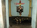
Sangameshwar Taluka
संगमेश्वर
Taluka
India Maharashtra location map.svg
Red pog.svg
Sangameshwar Taluka
Location in Maharashtra, India
Coordinates: 17°11′13″N73°33′11″E / 17.187°N 73.553°E / 17.187; 73.553
CountryFlag of India.svg  India
State Maharashtra
District Ratnagiri
Languages
  Official Marathi
Time zone UTC+5:30 (IST)
PIN
415611
Telephone code02354
Vehicle registration MH-08

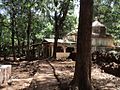
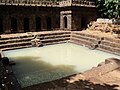
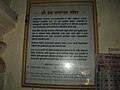
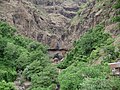
Sangameshwar Taluka is a taluka in Ratnagiri subdivision of Ratnagiri district in the Indian state of Maharashtra. The headquarters for the taluka is the town of Devrukh. [1] In Sangameshwar the two rivers Sonavi and Shastri flow together. The meaning of Sangama in Marathi (and most Indian languages) is "confluence," and so the name "Sangameshwar". It is historically important as the place where Chhatrapati Sambhaji, son of Chhatrapati Shivaji was captured by Mughal Emperor Aurangzeb. [2] Chhatrapati Sambhaji was tortured and executed in Tulapur.

Contents

Geography

The city lies on the confluence of the Shastri River and Sonavi River. To the east of the city lie the Western Ghats and to the west lies Ganpatipule. The region has a tropical climate. The 'rainy season' — the monsoon lasts normally from June till October. The dome of main temple is constructed of single piece of stone; lately extended for entrance.

Transportation

The nearest bus stand is Sangameshwar S.T. Stand (MSRTC) nearly 4 km from Sangameshwar Road railway station . The Sangameshwar railway station is located on National Highway 66 (Mumbai - Goa Highway). The nearest main bus depot is Devrukh of MSRTC nearly 13 km from Sangameshwar S.T. Stand from where you can reach to Sakharapa and then Kolhapur also from Devrukh you can reach to Ratnagiri and Lanja city.

Attractions

The Marleshwar temple entrance. Marleshwar entrance.JPG
The Marleshwar temple entrance.

Related Research Articles

<span class="mw-page-title-main">Ganpatipule</span> Town in Ratnagiri district, Maharashtra, India

Ganpatipule is a coastal town in Ratnagiri district of Maharashtra. Due to its Ganpati mandir the town is popular Hindu pilgrimage and tourists destination.

<span class="mw-page-title-main">Roha</span> Town in Maharashtra, Roha India

Roha is a town and taluka in the Raigad district of the Maharashtra state of India. It is located 120 km southeast of Mumbai. It is the starting point of Konkan railways and end point of central railways (Mumbai). Many chemical industries have opened up their manufacturing bases in Roha. Roha is located between the banks of the Kundalika River and the hills of Kalasgiri. It has a population of over 20,849. Roha is connected to Mumbai by Panvel-Roha railway line. Roha is also the northern end of the Konkan Railway. Roha is off of the Mumbai Goa Highway, via the Kolad road.

<span class="mw-page-title-main">Khed, Ratnagiri</span> Town in Maharashtra, India

Khed is a municipal council in the Ratnagiri district of the state of Maharashtra, India. Khed town is situated on the Mumbai - Ratnagiri Highway.

Kamshet is located in Pune district in the state of Maharashtra, India, 110 km from Mumbai City, and 45 km from Pune in Pune district. It is 16 km from the twin hill stations of Khandala and Lonavala and is accessible by road and rail from Mumbai and Pune. Kamshet is home to small villages that are built in the traditional style - with mud, thatch and reeds.

<span class="mw-page-title-main">Dapoli</span> Urban in Maharashtra, India

Dapoli is a town in Ratnagiri district, Maharashtra which is also a coastal hill station. It lies 215 km (134 mi) south of the state capital of Mumbai. the town is also known as Camp Dapoli, as the British had set their camps here. Many high-ranking British officers' graves are found in this town. There is also an abandoned church from the time of the British Raj. Dapoli is administered by a Municipal Council.

<span class="mw-page-title-main">Mahad</span> City & Sub-district in Maharashtra , India

Mahad is a city in Raigad district situated in the North Konkan region of Maharashtra state, India. It is located 108.5 km (67.4 mi) from District's headquarter Alibag, and 167 km (104 mi) from Mumbai. Mahad is known for Raigad Fort, the capital of the Maratha Empire in Shivaji's era and the revolutionary Mahad Satyagraha launched by at Chavdar Tale in the wake of modern India.

<span class="mw-page-title-main">Chiplun</span> City in Maharashtra, India

Chiplun is a city in Ratnagiri district in the state of Maharashtra, India. It is the financial and commercial Hub of Ratnagiri, and the headquarters of Chiplun taluka. It is about 320 km south of Mumbai in the Konkan region of Maharashtra, on the Mumbai–Goa highway (NH-66). It has a long history and a strong cultural background. Recent decades have seen much industrial development in it and its and surrounding areas.

Erandol is a town and a taluka in Jalgaon district in the Indian state of Maharashtra state. It is situated on the banks of the Anjani River.

<span class="mw-page-title-main">Karad</span> City in Maharashtra, India

Karad is a city in Satara district of Indian state of Maharashtra and it is 320 km (180.19 miles) from Mumbai, 72 km From Sangli and 159 km from Pune. It lies at the confluence of Koyna River and the Krishna River known as the "Priti sangam". The two rivers originate at Mahabaleshwar, which is around 100 km from Karad. They diverge at their origin and travel about the same distance to meet again in Karad. The rivers meet exactly head-on, thus forming the letter "T" which is the only head-on confluence in the world. Hence Krishna and Koyna river's confluence is called Preeti Sangam, meaning Confluence of Love. Karad is well known for sugar production and is known as the sugar bowl of Maharashtra owing to the presence of many sugar factories in and around Karad. It is considered an important educational hub in Western Maharashtra due to the presence of many prestigious educational institutes. This place is also known as the resting place (Samadhi) of the first chief minister of Maharashtra Shri. Yashwantrao Chavan situated at the confluence of the Krishna and Koyana rivers.

Shirur is an administrative subdivision of the Pune district in the Indian state of Maharashtra. It is located on the eastern boundary of the district, on the banks of the Ghod River. The town is also called Ghodnadi to distinguish it from other locations that have the same name. Ghodnadi in Marathi Language means Ghod River.

Mandangad is the headquarters of Mandangad taluka the northmost taluka in Ratnagiri district of Maharashtra, India.

<span class="mw-page-title-main">Hadapsar</span> Suburb in Pune, Maharashtra, India

Hadapsar is a developed town in eastern Pune City, Maharashtra. After 1990, Hadapsar developed into a major industrial area and is now one of the most densely populated and developed areas of Pune District. It is well connected to all parts of city. Distances to popular city centers is: Pune Railway Station 8 km, Lohegaon Airport 8 km, Koregaon Park 5 km, Swargate Bus Stand 7 km and Shivaji Nagar Railway Station 12 km.

Shirol is a historic place. In a great war between Chhatrapati Shivaji Maharaj and the Mughal Empire, the Mughals were defeated and the heads of Mughal soldiers were hanged at the main gate of city. So the name Shirol: Shir (heads) + ol (row).

Chandgad is a Small city and tehsil headquarters of chandgad taluka, of Kolhapur district that is in the Indian state of Maharashtra.

Shivajinagar is an inner suburb of the city of Pune, India.

Devrukh is a town in the tehsil of Sangameshwar in the Ratnagiri district of the Indian state of Maharashtra. It is headquarters for the Sangameshwar tehsil and a part of the Konkan region. The town enjoys salubrious climate, and the majority population is involved in agriculture. Summers are warm and winters are not very chilly. Every year Devrukh experiences heavy monsoon. Rice, cashew and alphonso (hapus) mangoes are the major crops in Devrukh.

<span class="mw-page-title-main">Shreekshetra Audumbar</span> Village/ Religious Place in Maharashtra, India

Shree Kshetra Audumbar is in Palus Taluka, it is about only 12km from Palus city, 15km from Kirloskarvadi and 8 Kilometers east from Bhilawadi Railway station, audumbar is known for the shrine of Shree Dattatraya held in high reverence. It is said to have been built in honor of Shree Narasimha Saraswati who is supposed to be the second incarnation of Shree Dattatraya.

<span class="mw-page-title-main">Parshuram Temple, Chiplun</span> Hindu temple at Chiplun, Ratnagiri district, Maharashtra, India

Parshuram Temple is a temple of Lord Parshurama, the sixth avatar of Vishnu in Hinduism located near Chiplun in Ratnagiri district of Maharashtra, India.

<span class="mw-page-title-main">Rameshwar Wadi</span> Town in Maharashtra, India

Rameshwar also known as Rameshwar Wadi is a small town located on the coast of Sindhudurg District of Maharashtra on the west coast of India. A very old Shri Dev Rameshwar Temple is located in this town which is dedicated to the Hindu deity Shiva.

References

  1. The headquarters was moved from the village of Sangameshwar to Devrukh in 1878. "Devrukh". Ratnagiri District.
  2. Alexander Mikaberidze (31 July 2011). Conflict and Conquest in the Islamic World: A Historical Encyclopedia. ABC-CLIO. p. 609. ISBN   978-1-59884-337-8 . Retrieved 6 March 2012.