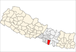
Bara District lies in Province No. 2. It is one of the seventy-seven districts of Nepal. The district, with Kalaiya as its district headquarters, covers an area of 1,190 km² and has a population (2011) of 687,708. Bakaiya, Jamuniya, Pasaha, Dudhaura and Bangari are the main rivers of Bara. The main languages spoken in Bara are Bhojpuri, Bajjika, Tharu and Nepali.

Irkhu is a village and market center of Chautara Sangachowkgadi Municipality in Sindhupalchok District in the Bagmati Zone of central Nepal. The formerly Village Development Committee was merged to the new Municipality in 2017. At the time of the 1991 Nepal census it had a population of 2628 and had 480 houses in the village.
Syaule Bazar is a village and market center of Chautara Sangachowkgadi Municipality in Sindhupalchok District in the Bagmati Zone of central Nepal. The former Village Development Committee was merged to the new municipality in 2017. At the time of the 1991 Nepal census it had a population of 3875 and had 726 houses in the village.
Bariyarpur was a town and Village Development Committee in Bara District but now it is converted into municipality in the Narayani Zone of south-eastern Nepal. At the time of the 2001 Nepal census it had a population of 10000 persons residing in 1250 individual households.
Chhata Pipra is a town in Gadhimai Municipality in Bara District in the Narayani Zone of south-eastern Nepal. The formerly Village Development Committee was merged to form new municipality on 18 May 2014. At the time of the 2011 Nepal census it had a population of 7,175 persons living in 1,065 individual households. There were 3,674 males and 3,501 females at the time of census.
Dumarwana is a town in Gadhimai Municipality in Bara District in the Narayani Zone of south-eastern Nepal. The formerly Village Development Committee was merged to form new municipality since 18 May 2014. At the time of the 2011 Nepal census it had a population of 21,470 persons living in 4,416 individual households.There were 10,228 males and 11,242 females at the time of census.
Fattepur is a town in Gadhimai Municipality in Bara District in the Narayani Zone of south-eastern Nepal. The formerly Village Development Committee was merged to form new municipality on 18 May 2014. At the time of the 2011 Nepal census it had a population of 8,890 persons living in 1,504 individual households. Elevation: 377 ft.There were 4,521 males and 4,369 females at the time of census.
Pipara Simara is a town in Gadhimai Municipality in Bara District in Province No. 2 of south-eastern Nepal. The formerly Village Development Committee was merged to form a new municipality on 18 May 2014. At the time of the 2011 Nepal census it had a population of 23,835 people living in 5,253 individual households.
Bahuwa Madanpur was a village development committee in Rautahat District in the Narayani Zone of south-eastern Nepal.
Bariyarpur was a village development committee in Rautahat District in the Narayani Zone of south-eastern Nepal.
Dharampur was a village development committee in Rautahat District in the Narayani Zone of south-eastern Nepal.
Gamhariya was a village development committee in Rautahat District in the Narayani Zone of south-eastern Nepal.
Samanpur was a village development committee in Rautahat District in the Narayani Zone of south-eastern Nepal.
Jitpur Simara is a sub-metropolitan city in Bara District in Province No. 2 of southern Nepal that was formed on 10 March 2017 after merging Gadhimai Municipality, Inarwasira, Amlekhganj, as well as parts of Manharwa, Haraiya and Rampur Tokani to form a new sub-metropolitain city. At the time of the 2011 Nepal census, the former settlements that would make up the sub-metropolitan city had a joint population of 117,094 people living in 21,670 individual households.
Pathari Sanischare (पथरी-शनिश्चरे) is a Municipality in Morang District in the Koshi Zone of south-eastern Nepal. It was formed by merging two existing village development committees i.e. Pathari and Sanischare in May 2014.

Chaudandigadhi is a municipality in Udayapur District of Province No. 1 in Nepal that was established on 10 March 2017 by merging the former Village development committees Chaudandi, Sithdipur, Hadiya and Sundarpur with the former municipality Beltar Basaha. At the time of the 2011 Nepal census, the localities out of which Chaudandigadhi would be formed had a joint population of 48,574 people living in 10,519 individual households. It is surrounded by Belka Municipality in the east, Triyuga in the west, the districts of Khotang and Bhojpur in the north and Sunsari District in the south.

Sundar Haraicha is a municipality in Morang District of Province No. 1 in Nepal that was established on 10 March 2017 by merging the former municipalities Sundar Dulari and Koshi Haraicha. At the time of the 2011 Nepal census, the localities out of which Chaudandigadhi would be formed had a joint population of 80,518 people living in 18,610 individual households.
Gadhimai is a municipality in Rautahat District, a part of Province No. 2 in Nepal. It was formed in 2016 occupying current 9 sections (wards) from previous 9 former VDCs. It occupies an area of 49.44 km2 with a total population of 40,410.