Sankt Kathrein am Hauenstein

Last updated
St. Kathrein am Hauenstein
AUT St. Kathrein am Hauenstein COA.jpg
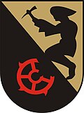
Coat of arms
Sankt Kathrein am Hauenstein in WZ.png
Location within Weiz district
Austria adm location map.svg
Red pog.svg
St. Kathrein am Hauenstein
Location within Austria
Coordinates: 47°29′22″N15°41′38″E / 47.48944°N 15.69389°E / 47.48944; 15.69389 Coordinates: 47°29′22″N15°41′38″E / 47.48944°N 15.69389°E / 47.48944; 15.69389
Country Austria
State Styria
District Weiz
Government
   Mayor Peter Knöbelreiter (ÖVP)
Area
[1]
  Total19.25 km2 (7.43 sq mi)
Elevation
822 m (2,697 ft)
Population
(2018-01-01) [2]
  Total633
  Density33/km2 (85/sq mi)
Time zone UTC+1 (CET)
  Summer (DST) UTC+2 (CEST)
Postal code
8672
Area code +43 3173
Vehicle registration WZ
Website www.st-kathrein-hauenstein.at

Sankt Kathrein am Hauenstein is a municipality in the district of Weiz in the Austrian state of Styria.
Austria Federal republic in Central Europe

Austria, officially the Republic of Austria, is a country in Central Europe comprising 9 federated states. Its capital, largest city and one of nine states is Vienna. Austria has an area of 83,879 km2 (32,386 sq mi), a population of nearly 9 million people and a nominal GDP of $477 billion. It is bordered by the Czech Republic and Germany to the north, Hungary and Slovakia to the east, Slovenia and Italy to the south, and Switzerland and Liechtenstein to the west. The terrain is highly mountainous, lying within the Alps; only 32% of the country is below 500 m (1,640 ft), and its highest point is 3,798 m (12,461 ft). The majority of the population speaks local Bavarian dialects as their native language, and German in its standard form is the country's official language. Other regional languages are Hungarian, Burgenland Croatian, and Slovene.

Styria State of Austria

Styria is a state, or Bundesland, located in the southeast of Austria. In area it is the second largest of the nine Austrian federated states, covering 16,401 km2 (6,332 sq mi). It borders Slovenia and the Austrian states of Upper Austria, Lower Austria, Salzburg, Burgenland, and Carinthia. The capital city is Graz which had 276,526 inhabitants at the beginning of 2015.

Contents

Geography

The municipality lies in the valley of the Hirschbach, a tributary of the Feistritz, in the Fischbach Alps.

Related Research Articles

Otterthal Place in Lower Austria, Austria

Otterthal is a municipality in the Industrieviertel of Lower Austria, Austria. 61.72 percent of the municipality is forested. There are 25 agricultural companies. 266 persons are employed. The activity rate was 48.31%.

Deutsch Schützen-Eisenberg Place in Burgenland, Austria

Deutsch Schützen-Eisenberg is a municipality in Burgenland in the district of Oberwart in Austria.

Bartholomäberg Place in Vorarlberg, Austria

Bartholomäberg is a municipality and popular tourism resort in the district of Bludenz in the Austrian state of Vorarlberg.

Schiefling am See Place in Carinthia, Austria

Schiefling am See is a market town in the district of Klagenfurt-Land in the Austrian state of Carinthia.

Gedersdorf Place in Lower Austria, Austria

Gedersdorf is a municipality in the district of Krems-Land in the Austrian state of Lower Austria.

Oberhofen im Inntal Place in Tyrol, Austria

Oberhofen im Inntal is a municipality in the western district of Innsbruck-Land in the Austrian state of Tyrol located 21 km west of Innsbruck and 2.6 km east of Telfs. Once a part of Pfaffenhofen it became an own municipality in 1786.

Altach Place in Vorarlberg, Austria

Altach is a municipality in Feldkirch district in the Austrian state of Vorarlberg.

Wöllersdorf-Steinabrückl Place in Lower Austria, Austria

Wöllersdorf-Steinabrückl is a municipality in the district of Wiener Neustadt-Land in the Austrian state of Lower Austria.

Klösterle, Austria Place in Vorarlberg, Austria

Klösterle is a municipality in the district of Bludenz in the Austrian state of Vorarlberg.

Höchst, Austria Place in Vorarlberg, Austria

Höchst is a municipality in the district of Bregenz in the Austrian state of Vorarlberg.

Dünserberg Place in Vorarlberg, Austria

Dünserberg is a municipality in the district of Feldkirch in the Austrian state of Vorarlberg.

Pfaffstätt Place in Upper Austria, Austria

Pfaffstätt is a municipality in the district of Braunau am Inn in Austrian state of Upper Austria.

Obernberg am Inn Place in Upper Austria, Austria

Obernberg am Inn is a municipality in the district of Ried im Innkreis in the Austrian state of Upper Austria.

Haslach an der Mühl Place in Upper Austria, Austria

Haslach an der Mühl is a municipality in the district of Rohrbach in the Austrian state of Upper Austria.

Altschwendt Place in Upper Austria, Austria

Altschwendt is a municipality in the district of Schärding in the Austrian state of Upper Austria.

Engelhartszell an der Donau Place in Upper Austria, Austria

Engelhartszell an der Donau is a municipality in the district of Schärding in the Austrian state of Upper Austria.

Ampflwang im Hausruckwald Place in Upper Austria, Austria

Ampflwang im Hausruckwald is a municipality in the district of Vöcklabruck in the Austrian state of Upper Austria.

Bad Waltersdorf Place in Styria, Austria

Bad Waltersdorf is a municipality in the district of Hartberg-Fürstenfeld in Styria, Austria.

Sankt Kathrein am Offenegg Place in Styria, Austria

Sankt Kathrein am Offenegg is a municipality in the district of Weiz in the Austrian state of Styria.

Waldbach-Mönichwald Place in Styria, Austria

Waldbach-Mönichwald is a municipality since 2015 in the Hartberg-Fürstenfeld District of Styria, Austria.

References

  1. "Dauersiedlungsraum der Gemeinden Politischen Bezirke und Bundesländer - Gebietsstand 1.1.2018". Statistics Austria. Retrieved 10 March 2019.
  2. "Einwohnerzahl 1.1.2018 nach Gemeinden mit Status, Gebietsstand 1.1.2018". Statistics Austria. Retrieved 9 March 2019.