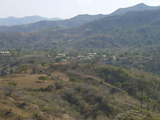
San Francisco is a town, with a population of 3,437, and a municipality in the Honduran department of Atlántida. The largest town of the municipality is Santa Ana, with a population of 6,776.

Santa Ana de Yusguare is a municipality in the Honduran department of Choluteca.
Santa Cruz de Yojoa is a town, with a population of 18,780, and a municipality in the Honduran department of Cortés.
Lepaterique is a municipality in the Honduran department of Francisco Morazán.

Orica is a municipality in the Honduran department of Francisco Morazán.
Santa Ana is a municipality in the Honduran department of Francisco Morazán.

Valle de Ángeles is a municipality in the Honduran department of Francisco Morazán.
Ramón Villeda Morales is a municipality in the Honduran department of Gracias a Dios. It was named after a Former President Ramon Villeda Morales
San José is a municipality in the Honduran department of La Paz.
Santa María is a municipality in the Honduran department of La Paz.

La Virtud is a municipality in the Honduran department of Lempira.
Santa Rita is a town and a municipality in the Honduran department of Yoro. The Humuya River passes through it.
Arada is a municipality in the Honduran department of Santa Bárbara.
Chinda is a municipality in the Honduran department of Santa Bárbara.
Las Vegas is a town, with a population of 10,760, and a municipality in the Honduran department of Santa Bárbara.
Naranjito is a municipality in the Honduran department of Santa Bárbara. It is 920 meters above sea level.
The Tl'etinqox-t'in Government Office is a First Nations government located in the Chilcotin District in the western Central Interior region of the Canadian province of British Columbia. Governing a reserve communities near Alexis Creek known as Anaham Reserve First Nations or Anaham, it is a member of the Tsilhqot'in Tribal Council aka known as the Tsilhqot'in National Government. The main reserve is officially known as Anahim's Flat No. 1, and is more commonly as Anaham. Other reserves are Anahim's Meadow No. 2 and 2A, and Anahim Indian Reserves Nos. 3 through 18. Anaham, or Anahim and Alexis were chiefs of the Tsilhqot'in during the Chilcotin War of 1864, although they and their people did not take part in the hostilities.
Piprabirta is a town and Village Development Committee in Bara District in the Narayani Zone of south-eastern Nepal. At the time of the 1991 Nepal census it had a population of 3,162 persons living in 537 individual households.
Colonia Lerdo, a ghost town located in San Luis Río Colorado Municipality, Sonora, Mexico, was founded as an agricultural colony in 1872 by entrepreneur Thomas H. Blythe and Mexican Gen. Guillermo Andrade. Lerdo Landing was located 80 miles up the Colorado River from its mouth, and Lerdo was located just east of the river landing on a mesa. Lerdo was described as having streets lined with Eucalyptus trees. The colony was intended to grow and harvest the wild hemp that grew over much of the Colorado River Delta. They also experimented with growing cotton and raised corn and other vegetables for their own use.


