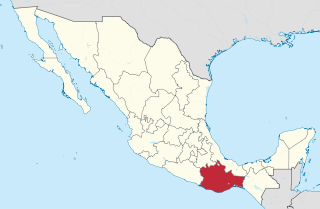
Oaxaca, officially the Free and Sovereign State of Oaxaca, is one of the 32 states that compose the Federative Entities of Mexico. It is divided into 570 municipalities, of which 418 are governed by the system of usos y costumbres with recognized local forms of self-governance. Its capital city is Oaxaca de Juárez.
The Chatinos are an indigenous people of Mexico. Chatino communities are located in the southeastern region of the state of Oaxaca in southern central Mexico. Their native Chatino language are spoken by about 23,000 people, but ethnic Chatinos may number many more. The Chatinos of San Juan Quiahije call themselves neq-a tnya-j and their language Chaq-f tnya-b.
Santa Catarina Juquila is a town in the State of Oaxaca, Mexico, and is the seat of the municipality also called Santa Catarina Juquila. It is part of the Juquila District in the center of the Costa Region. The name "Juquila" comes from "Xuhquililla", which means "Place of blue milkweed".
Putla Villa de Guerrero or simply Putla, is a town and municipality in the State of Oaxaca, Mexico. It is part of Putla District in the west of the Sierra Sur Region.
Nejapa de Madero is a town and municipality in Oaxaca in south-western Mexico. It is part of the Yautepec District in the east of the Sierra Sur Region, not far from the main highway between Oaxaca, Oaxaca and Salina Cruz. The name "Nejapa" means "ash water".
Santa Catarina Quioquitani is a town and municipality in Oaxaca in south-western Mexico. It is part of the Yautepec District in the east of the Sierra Sur Region.
San Gabriel Mixtepec is a town and municipality in Oaxaca in south-western Mexico. It is part of the Juquila District in the center of the Costa Region. The name "Mixtepec" means "Hill of clouds".
San Jacinto Tlacotepec is a town and municipality in Oaxaca in south-western Mexico. The municipality covers an area of 233.5 km². It is part of the Sola de Vega District in the Sierra Sur Region.
San Juan Mazatlán is a town and municipality in Oaxaca in south-western Mexico. It is part of the Sierra Mixe district within the Sierra Norte de Oaxaca Region. Mazatlán's name in Nahuatl means "the place of deer".
San Juan Quiahije is a town and municipality in Oaxaca in south-western Mexico. It is part of the Juquila District in the centre of the Costa Region. The origin of the name Quiahije is not known, some people conjecture it might mean "Stone Forest" in the Zapotec language.
San Miguel Panixtlahuaca is a town and municipality in Oaxaca in south-western Mexico. It is part of the Juquila District in the center of the Costa Region. The name "Panixtlahuatl" in the Nahuatl language means "Plain of the Bridge".
San Pedro Mártir Quiechapa is a town and municipality in Oaxaca in south-western Mexico. It is part of the Yautepec District in the east of the Sierra Sur Region. The name Quiechapa in the Zapotec language means "stone woman."
Tataltepec de Valdés is a town and municipality in Oaxaca in south-western Mexico. It is part of the Juquila District in the center of the Costa Region. The town was established around 400-300 BC. The name "Tataltepec" means "Grandfather hill". Antonio Valdés, born in the town, was an early leader of the independence movement in Oaxaca who died on 19 November 1811.
Santa María Ecatepec is a town and municipality in Oaxaca in south-western Mexico. It is part of the Yautepec District in the east of the Sierra Sur Region. The name "Ecatepec" means "mountain air".
Santa María Quiegolani is a town and municipality in Oaxaca in south-western Mexico. It is part of the Yautepec District in the east of the Sierra Sur Region.
Santa María Temaxcaltepec is a town and municipality in Oaxaca in south-western Mexico. It is part of the Juquila District in the center of the Costa Region.
Santiago Yaitepec is a town and municipality in Oaxaca in south-western Mexico, two kilometers southeast of Santa Catarina Juquila. It is part of the Juquila District in the center of the Costa Region. The name "Yaitepec" means "Three hills".

The Costa Region or Costa Chica lies on the Pacific coast of the state of Oaxaca, Mexico, south of the more mountainous Sierra Sur inland from the coast. It includes the districts of Jamiltepec, Juquila and Pochutla.

Juquila District is located in the center of the Costa Region of the State of Oaxaca, Mexico, on the Pacific coast. It has an area of 5,055 km2. As of 2005 it had a total population of 134,365 of whom 33,106 spoke an indigenous language. Economic activities include agriculture and tourism. The Santuario (Sanctuary) de Juquila is a major attraction.

The Indigenous people of Oaxaca are descendants of the inhabitants of what is now the state of Oaxaca, Mexico who were present before the Spanish invasion. Several cultures flourished in the ancient region of Oaxaca from as far back as 2000 BC, of whom the Zapotecs and Mixtecs were perhaps the most advanced, with complex social organization and sophisticated arts.


