Santa Luzia Dam | |
---|---|
Santa Luzia Dam | |
Official name | Barragem de Santa Luzia |
Location | municipality Pampilhosa da Serra, Coimbra District, Portugal |
Coordinates | 40°5′23.2″N7°51′28.8″W / 40.089778°N 7.858000°W Coordinates: 40°5′23.2″N7°51′28.8″W / 40.089778°N 7.858000°W |
Status | Operational |
Construction began | 1930 |
Opening date | 1942 |
Dam and spillways | |
Type of dam | Concrete arch dam |
Impounds | Unhais |
Height | 76 metres (249 ft) |
Length | 115 metres (377 ft) |
Width (crest) | 2.5 metres (8 ft 2 in) |
Dam volume | 80,000 m3 (2,800,000 cu ft) |
Reservoir | |
Creates | Santa Luzia Reservoir |
Total capacity | 53,700,000 m3 (1.90×10⁹ cu ft) |
Surface area | 2.46 km2 (0.95 sq mi) |
Power Station | |
Commission date | 1942 |
Turbines | 4 x 8 MW Pelton-type |
Installed capacity | 32 MW |
Annual generation | 55 GWh |
Wikimedia Commons has media related to Santa Luzia Dam . |
Santa Luzia Dam (Portuguese: Barragem de Santa Luzia) is a concrete arch dam on the Unhais, a northern tributary of the Zêzere River, located in the municipality Pampilhosa da Serra, in Coimbra District, Portugal. The dam was constructed between 1930 and 1942 [1] and was designed by André Coyne. [2]
Concrete, usually Portland cement concrete, is a composite material composed of fine and coarse aggregate bonded together with a fluid cement that hardens over time—most frequently a lime-based cement binder, such as Portland cement, but sometimes with other hydraulic cements, such as a calcium aluminate cement. It is distinguished from other, non-cementitious types of concrete all binding some form of aggregate together, including asphalt concrete with a bitumen binder, which is frequently used for road surfaces, and polymer concretes that use polymers as a binder.
An arch dam is a concrete dam that is curved upstream in plan. The arch dam is designed so that the force of the water against it, known as hydrostatic pressure, presses against the arch, compressing and strengthening the structure as it pushes into its foundation or abutments. An arch dam is most suitable for narrow canyons or gorges with steep walls of stable rock to support the structure and stresses. Since they are thinner than any other dam type, they require much less construction material, making them economical and practical in remote areas.
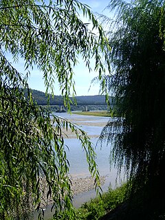
The Zêzere is a river in Portugal, tributary to the Tagus. It rises in the Serra da Estrela, near the Torre, the highest point of continental Portugal. The Zêzere runs through the town Manteigas, runs through Belmonte, passes south of the city Covilhã and east of the town of Pedrogão Grande. It flows into the Tagus in Constância. It is the second longest river in Portugal. Its slope allows for the hydroelectric powerplants of Cabril, Bouçã and Castelo de Bode.
Santa Luzia Dam is a 76 m tall and 115 m long arch dam. The volume of the dam is 80.000 m³. The dam contains 2 crest spillways and one bottom outlet. At full reservoir level the reservoir of the dam (Portuguese: Albufeira da Barragem de Santa Luzia) has a surface area of 2.46 km² and its total capacity is 53.7 Mio m³. [1]
A spillway is a structure used to provide the controlled release of flows from a dam or levee into a downstream area, typically the riverbed of the dammed river itself. In the United Kingdom, they may be known as overflow channels. Spillways ensure that the water does not overflow and damage or destroy the dam.
The concrete of the dam is affected by concrete swelling, caused by an alkali–silica reaction, that leads to tensions and cracks in the concrete. [3] [4]
The alkali–silica reaction (ASR), more commonly known as "concrete cancer", is a swelling reaction that occurs over time in concrete between the highly alkaline cement paste and the reactive non-crystalline (amorphous) silica found in many common aggregates, given sufficient moisture.
The power plant is one of the smaller hydroelectric power stations in Portugal with a nameplate capacity of 32 MW. Its average annual generation is 55 Mio. kWh. The power station contains four Pelton turbine-generators. [1]
Hydroelectricity is electricity produced from hydropower. In 2015, hydropower generated 16.6% of the world's total electricity and 70% of all renewable electricity, and was expected to increase about 3.1% each year for the next 25 years.
Portugal, officially the Portuguese Republic, is a country located mostly on the Iberian Peninsula in southwestern Europe. It is the westernmost sovereign state of mainland Europe. It is bordered to the west and south by the Atlantic Ocean and to the north and east by Spain. Its territory also includes the Atlantic archipelagos of the Azores and Madeira, both autonomous regions with their own regional governments.
Nameplate capacity, also known as the rated capacity, nominal capacity, installed capacity, or maximum effect, is the intended full-load sustained output of a facility such as a power plant, electric generator, a chemical plant, fuel plant, metal refinery, mine, and many others. Nameplate capacity is the number registered with authorities for classifying the power output of a power station usually expressed in megawatts (MW).
Picote Dam is a concrete arch dam on the Douro, located in the municipality Miranda do Douro, in Bragança District, Portugal.
Bemposta Dam is a concrete arch dam on the Douro, where the river forms the national border line between Spain and Portugal. It is located in the municipality Mogadouro, in Bragança District, Portugal.
Miranda Dam is a concrete buttress dam on the Douro, where the river forms the national border line between Spain and Portugal. It is located in the municipality Miranda do Douro, in Bragança District, Portugal.
Aguieira Dam also known as Foz do Dão Dam is a concrete multiple arch dam on the Mondego River, where the river forms the border line between the districts of Coimbra and Viseu. It is located in the municipality Penacova, in Coimbra District, Portugal.
Cabril Dam is a concrete double curvature arch dam on the Zêzere River, where the river forms the border line between the districts of Castelo Branco and Leiria. It is located in the municipality Sertã, in Castelo Branco District, Portugal.
Carrapatelo Dam is a concrete gravity dam on the Douro, where the river forms the border line between the districts of Porto and Viseu. It is located in the municipality Marco de Canaveses, in Porto District, Portugal.
Alto Lindoso Dam is a concrete double curvature arch dam on the Lima River. It is located in the municipality Ponte da Barca, in Viana do Castelo District, Portugal. The dam lies in Peneda-Gerês National Park close to the border with Spain.
Alto Rabagão Dam is a concrete dam on the Rabagão River, a left tributary of the Cávado River. It is located in Peneda-Gerês National Park, in the municipality Montalegre, in Vila Real District, Portugal.
Fratel Dam is a concrete gravity dam on the Tagus, where the river forms the border line between the districts of Portalegre and Castelo Branco. It is located in the municipality Nisa, in Portalegre District, Portugal.
Belver Dam is a concrete gravity dam on the Tagus, where the river forms the border line between the Portuguese districts of Portalegre and Santarém. It is located in the municipality Gavião, in Portalegre District.
Bouçã Dam is a concrete double curvature arch dam on the Zêzere River, where the river forms the border line between the districts of Castelo Branco and Leiria. It is located in the municipality Pedrógão Grande, in Leiria District, Portugal.
The Caniçada Dam is a concrete arch dam on the Cávado River, the civil parish of Parada do Bouro, in the municipality of Vieira do Minho, in the Portuguese Norte (district of Braga. It is owned by Companhia Portuguesa de Produção de Electricidade.
Salamonde Dam is a concrete arch dam on the Cávado River, where the river forms the border line between the districts of Braga and Vila Real. It is located in the municipality Vieira do Minho, in Braga District, Portugal.
Pocinho Dam is a concrete gravity dam on the Douro, where the river forms the border line between the districts of Guarda and Bragança. It is located in the municipality Vila Nova de Foz Côa, in Guarda District, Portugal.
Valeira Dam is a concrete gravity dam on the Douro, where the river forms the border line between the districts of Viseu and Bragança. It is located in the municipality São João da Pesqueira, in Viseu District, Portugal.
Régua Dam is a concrete gravity dam on the Douro, where the river forms the border line between the districts of Vila Real and Viseu. It is located in the municipality Peso da Régua, in Vila Real District, Portugal.
Crestuma-Lever Dam is a concrete gravity dam on the Douro. It is located in the municipality Vila Nova de Gaia, in Porto District, Portugal.
Touvedo Dam is a concrete gravity dam on the Limia. It is located in the municipality Ponte da Barca, in Viana do Castelo District, Portugal.
Raiva Dam is a concrete gravity dam on the Mondego. It is located in the municipality Penacova, in Coimbra District, Portugal.
Vilar Dam is an embankment dam on the Távora, a left (southern) tributary of the Douro. It is located in the municipality Tabuaço, in Viseu District, Portugal.