Quito, officially the Metropolitan District of Quito, is a canton in the province of Pichincha, Ecuador.

Cotacachi is a canton of Imbabura province of Ecuador in South America. The name also refers to the city which is the seat of that canton, one of Ecuador's leading artisanal manufacturers of leather goods, and to the dormant Cotacachi Volcano which overlooks the canton.
Puerto Quito is a canton in Pichincha Province, Ecuador. It has only one parish, the urban parish of Puerto Quito, which is also the seat of the canton.
San Miguel de los Bancos, or simply Los Bancos, is a canton in the province of Pichincha, Ecuador. The long name of the town refers to dedication of the area to the archangel Michael. Local tradition attributes the "Los Bancos" part of the name to the use of tree trunks as benches at the junction of the through road from Quito to Esmeraldas with the road into the Rio Blanco valley.
Guayllabamba is a small agricultural town located 29 kilometers northeast of the city of Quito in northern Ecuador. In the Ecuadorian national census of November 24, 2001, the parish had a population of 12,227. The elevation of the town is 2,142 metres (7,028 ft) above sea level.
Sangolquí is a suburb of Quito and is the seat of Rumiñahui canton in the province of Pichincha, in northern Ecuador. It is connected to Quito by the Autopista General Rumiñahui.

Rumiñahui or Rumiñawi is a canton of Pichincha Province in Ecuador. Its seat is Sangolquí. The canton lies southeast of Quito Canton and forms a suburb of Quito.
Benalcázar is an urban parish in the northeastern part of the city of Quito, capital of Ecuador. The parish was named after conquistador Sebastián de Benalcázar. Today its official name is "Inaquito"

Alfaro is an electoral urban parish or district of Quito, Ecuador. The parish was established as a result of the October 2004 political elections, when the city was divided into 19 electoral urban parishes.
Chaupicruz is an electoral parish or district of Quito, the capital city of Ecuador in northwestern South America. The parish was established as a result of the October 2004 political elections when the city was divided into 19 urban electoral parishes.
El Salvador is an electoral parish or district of Quito, the capital city of Ecuador. The parish was established as a result of the October 2004 political elections when the city was divided into 19 urban electoral parishes.

Guápulo is a district of Quito, Ecuador, also called an electoral parish. The parish was established as a result of the October 2004 political elections when the city was divided into 19 urban electoral parishes. Set behind Hotel Quito, the neighborhood of Guápulo runs down the winding Camino de Orellana, from González Suárez to Calle de los Conquistadores, the main road out of Quito and to the neighboring suburbs. Often considered an artsy, bohemian neighborhood of Quito, Guápulo is home to many local artists and a couple of hippy cafés/bars. Every year on September 7 the guapuleños honor their neighborhood with the Fiestas de Guápulo, a fantastic celebration complete with costumes, parade, food, drink, song, dance, and fireworks.
La Floresta is an electoral parish or district of Quito, the capital city of Ecuador. The parish was established as a result of the October 2006 political elections when the city was divided into 19 urban electoral parishes.
La Magdalena is an electoral parish or district of Quito, the capital city of Ecuador. The parish was established as a result of the October 2004 political elections when the city was divided into 19 urban electoral parishes.
La Vicentina is an electoral parish or district of Quito, Ecuador. The parish was established as a result of the October 2004 political elections when the city was divided into nineteen urban electoral parishes.
San Roque is an electoral parish or district of Quito, the capital city of Ecuador. The parish was established as a result of the October 2004 political elections when the city was divided into 19 urban electoral parishes.
San Sebastián is an electoral parish or district of Quito, the second most populous city in Ecuador. The parish was established as a result of the October 2004 political elections when the city was divided into 19 urban electoral parishes.
Villa Flora is an electoral parish or district of Quito, Ecuador. The parish was established as a result of the October 2004 political elections when the city was divided into 19 urban electoral parishes.
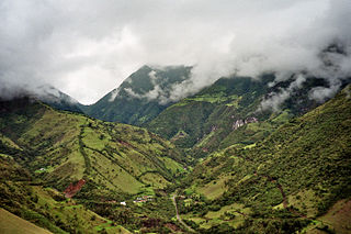
Casitahua is a dormant, eroded volcano in the north of Quito Canton, Pichincha Province, Ecuador. The volcano is in the Western Cordillera of the northern Ecuadorian Andes, between Pululagua Volcano to the north and Pichincha Volcano approximately to the southwest. Casitahua's caldera is open approximately towards the west-northwest.

San Miguel de Urcuquí Canton, or Urkuki, is a canton of Ecuador, located in the Imbabura Province. Its seat is the town of Urcuquí. Its population in the 2001 census was 14,381 and was 15,671 in the 2010 census. The area of the canton is 779 square kilometres (301 sq mi).