Related Research Articles

Willacy County is a county in the U.S. state of Texas. As of the 2020 census, its population was 20,164. Its county seat is Raymondville. The county was created in 1911 and organized the next year.

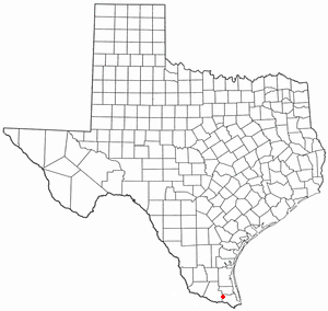
Cameron County, officially the County of Cameron, is the southernmost county in the U.S. state of Texas. As of the 2020 census, its population was 421,017. Its county seat is Brownsville.

Brownsville is a borough in Fayette County, Pennsylvania, United States, first settled in 1785 as the site of a trading post a few years after the defeat of the Iroquois enabled a resumption of westward migration after the Revolutionary War. The trading post soon became a tavern and inn and was receiving emigrants heading west, as it was located above the cut bank overlooking the first ford that could be reached to those descending from the Allegheny Mountains. Brownsville is located 40 miles (64 km) south of Pittsburgh along the east bank of the Monongahela River.

Brownsville is a city in the U.S. state of Texas and the seat of Cameron County, located on the western Gulf Coast in South Texas, adjacent to the border with Matamoros, Tamaulipas, Mexico. The city covers 145.2 sq mi (376.066 km2), and had a population of 186,738 at the 2020 census. As of the 2020 U.S. Census, it is the 139th-largest city in the United States and 18th-largest in Texas. It is part of the Matamoros–Brownsville metropolitan area. The city is known for its year-round subtropical climate, deep-water seaport, and Hispanic culture.

Combes is a town in northern Cameron County, Texas, United States. Its population was 2,999 at the 2020 census. It is part of the Brownsville–Harlingen–Raymondville and the Matamoros–Brownsville metropolitan areas.

Green Valley Farms is a census-designated place (CDP) in Cameron County, Texas, United States. The population was 655 at the 2020 census, down from 1,272 at the 2010 census. It is part of the Brownsville–Harlingen Metropolitan Statistical Area.

Los Fresnos is a city in Cameron County, Texas, United States. The population was 8,114 at the 2020 census, up from 5,542 at the 2010 census. It is part of the Brownsville–Harlingen–Raymondville and the Matamoros–Brownsville metropolitan areas.

Palm Valley is a city in Cameron County, Texas, United States. The population was 1,413 at the 2020 census. It is part of the Brownsville–Harlingen–Raymondville and the Matamoros–Brownsville metropolitan areas.
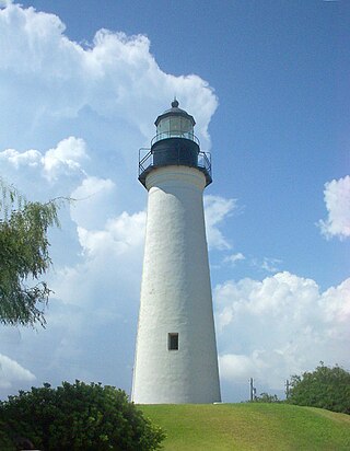
Port Isabel is a city in Cameron County, Texas, United States. It is part of the Brownsville–Harlingen–Raymondville and the Matamoros–Brownsville metropolitan areas. The population was 5,028 at the 2020 census.

San Benito is a city in Cameron County, in the US state of Texas, United States. Its population was 24,861 at the 2020 census. On April 3, 2007, San Benito celebrated the 100th anniversary of its naming.

San Pedro is a census-designated place (CDP) in Cameron County, Texas, United States. The population was 442 at the 2020 census. It is part of the Brownsville–Harlingen Metropolitan Statistical Area.

Santa Maria is a census-designated place (CDP) in Cameron County, Texas, United States. The population was 651 at the 2020 census. It is part of the Brownsville–Harlingen Metropolitan Statistical Area.
Santa Rosa is a town in Cameron County, Texas, United States. The population was 2,450 at the 2020 census. It is part of the Brownsville–Harlingen–Raymondville and the Matamoros–Brownsville metropolitan areas.

Edinburg is a city in and the county seat of Hidalgo County, Texas, United States. The population was 100,243 at the 2020 census, and in 2022, its estimated population was 104,294, making it the second-largest city in Hidalgo County, and the third-largest city in the larger Rio Grande Valley region.
Raymondville is a city in and the county seat of Willacy County, Texas, United States. The population was 11,284 at the 2010 census. It may be included as part of the Brownsville–Harlingen–Raymondville and the Matamoros–Brownsville metropolitan areas.

The Lower Rio Grande Valley, commonly known as the Rio Grande Valley or locally as the Valley or RGV, is a region spanning the border of Texas and Mexico located in a floodplain of the Rio Grande near its mouth. The region includes the southernmost tip of South Texas and a portion of northern Tamaulipas, Mexico. It consists of the Brownsville, Harlingen, Weslaco, Pharr, McAllen, Edinburg, Mission, San Juan, and Rio Grande City metropolitan areas in the United States and the Matamoros, Río Bravo, and Reynosa metropolitan areas in Mexico. The area is generally bilingual in English and Spanish, with a fair amount of Spanglish due to the region's diverse history and transborder agglomerations. It is home to some of the poorest cities in the nation, as well as many unincorporated, persistent poverty communities called colonias. A large seasonal influx occurs of "winter Texans" — people who come down from the north for the winter and then return north before summer arrives.

The Cortina Troubles is the generic name for the First Cortina War, from 1859 to 1860, and the Second Cortina War, in 1861, in which paramilitary forces led by the Mexican rancher and local leader Juan Cortina, confronted elements of the United States Army, the Confederate States Army, the Texas Rangers, and the local militias of Brownsville, Texas, and Matamoros, Tamaulipas.
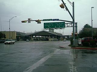
Gateway International Bridge is one of three international bridges that cross the U.S.-Mexico border between the cities of Brownsville, Texas, and Matamoros, Tamaulipas. It is owned and operated by Cameron County. Over the past century, it has developed the nickname of "The New Bridge" when the bridge was remodeled back in the 20th century. Despite the fact that the Veteran's International Bridge is newer than Gateway, it still retains its nickname.

The Brownsville & Matamoros International Bridge, also known as B&M International Bridge, Brownsville-Matamoros International Bridge and Express Bridge, is one of three international bridges that cross the U.S.-Mexico border between the cities of Brownsville, Texas, and Matamoros, Tamaulipas. This international bridge unites the Matamoros–Brownsville Metropolitan Area, which counts with a population of 1,136,995, making it the 4th largest metropolitan area in the Mexico-US border.
Boca Chica is an area on the eastern portion of a subdelta peninsula of Cameron County, at the far south of the US State of Texas along the Gulf Coast. It is bordered by the Brownsville Ship Channel to the north, the Rio Grande and Mexico to the south, and the Gulf of Mexico to the east. The area extends about 25 miles (40 km) east of the city of Brownsville. The peninsula is served by Texas State Highway 4—also known as the Boca Chica Highway, or Boca Chica Boulevard within Brownsville city limits—which runs east–west, terminating at the Gulf and Boca Chica Beach.
References
- 1 2 3 4 "Santa Rita, Texas". Texas State Historical Association. Retrieved 7 December 2011.
- ↑ Rozeff, Norman. "The Story of Cameron County Courthouses". Valley History. Archived from the original on 6 October 2011. Retrieved 7 December 2011.
