The City of South Padre Island was officially incorporated in 1973 to better manage development and tourism. Growth was initially spurred by the construction of the original causeway in the early 1950s, which for the first time provided a permanent vehicular link between the island and the mainland. In 1974, this causeway was replaced by the Queen Isabella Causeway, a higher-capacity bridge that further boosted accessibility and economic development.[7] Governed by a home-rule charter, the City of South Padre Island operates with a council-manager form of government, which outlines local governance rules and administrative procedures. South Padre Island became a popular spring break destination for college students and a resort destination for families. Many multistory resort hotels and condominiums have been erected along the coastline of the Gulf of Mexico. [8]
Industry
Tourism
Tourism is the primary industry in the area, driven by its coastal location, subtropical climate, and accessibility. Visitors engage in beach recreation, water sports, fishing, and wildlife observation. Seasonal events such as spring break, winter Texans and fishing tournaments also contribute to the local economy.[9]
Beaches: The island’s beaches consist primarily of fine-grained quartz sand, typical of barrier island formations along the Texas Gulf Coast.[10]
Water Sports: Activities such as kiteboarding, windsurfing, and jet skiing are popular, with the island featured on National Geographic’s global destination list for kiteboarding.[11]
Surfing: A steep drop-off in the nearby continental shelf contributes to wave conditions not typically found elsewhere along the Gulf Coast.[12]
Fishing: The region supports both deep-sea and bay fishing, with opportunities for recreational anglers throughout the year.[13]
Birding: Located along the Central Flyway, the island serves as a critical stopover for migratory birds. Coastal, dune, and wetland habitats support hundreds of species annually. The Birding and Nature Center offers boardwalks and observation towers for wildlife viewing.[14]
Eco-Tourism: The nonprofit conservation center Sea Turtle, Inc. rehabilitates injured sea turtles and educates the public about marine conservation. It plays a key role in the protection of the endangered Kemp’s ridley sea turtle, which nests on nearby beaches.[15]
Nightlife: Bars, restaurants, and live music venues operate along the beachfront and commercial districts, especially during peak tourism seasons such as spring break and summer weekends.[16]
Port of Brownsville
The Port of Brownsville plays a significant role in the economy and industry of South Padre Island. As one of the largest ports in Texas, the Port of Brownsville facilitates substantial maritime traffic through the channel south of the island, contributing to local economic growth and providing numerous employment opportunities. The port handles a diverse range of cargo, including petroleum, agricultural products, and manufactured goods, which are essential to the region's trade activities.
The economic impact of the port extends to various sectors, including shipping, logistics, and transportation, creating a robust industrial network that supports the local community. Infrastructure projects associated with the port, such as channel deepening and dock expansions, further enhance its capacity and efficiency, leading to increased economic activity in the area.[17]
Environmental considerations are also a crucial aspect of the port's operations. Efforts are made to mitigate the impact of maritime activities on the surrounding ecosystem, ensuring the protection of local wildlife and marine habitats. These measures include pollution control initiatives, habitat restoration projects, and adherence to environmental regulations.[18]
Additionally, the port's presence influences the tourism and recreational activities on South Padre Island. While the industrial operations are concentrated in specific areas, the overall economic benefits from the port contribute to the island's development, enhancing the quality of life for residents and attracting visitors.[19]
Geography
The town of South Padre Island is located at the southern end of South Padre Island, with the town limits extending from the northern edge of Isla Blanca Park in the south to the end of development north of Wharf Street in the north, a distance of 6 miles (10km). The Queen Isabella Causeway is the only road access to the mainland; it leads 2.5 miles (4.0km) across Laguna Madre to the city of Port Isabel. Brownsville is 25 miles (40km) southwest of South Padre Island.
According to the United States Census Bureau, the town has a total area of 2.3 square miles (6.0km2), of which 2.1 square miles (5.5km2) is land and 0.2 square miles (0.5km2), or 8.44%, is water.[20]
Water clarity & quality
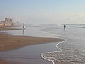
South Padre Island beach in June. Boardwalks provide access over the dunes.
South Padre Island is renowned for its clear, turquoise Gulf waters, a result of several favorable environmental factors. These include its distance from major sediment-laden river outlets such as the Mississippi Delta, calm weather periods that allow suspended particles to settle, and minimal nutrient runoff that discourages algae blooms. Together, these factors sustain consistently high visibility ideal for swimming and marine recreation.[21]
Monitoring data from the Texas GLO Beach Watch program, which tests 21 sites on South Padre Island during peak season—consistently show that bacteria levels (Enterococcus) remain well within EPA safety standards. Advisories are rare, reflecting overall high coastal water quality.[22]
Recent USGS hydrodynamic studies within the lower Laguna Madre adjacent to South Padre Island underscore the role of dense, prolific seagrass meadow, primarily Halodule wrightii (shoalgrass), in enhancing water clarity. These seagrass beds stabilize sediments, reducing turbidity and promoting optical transparency even in shallow lagoons.[23]
South Padre Island experiences a warm humid subtropical climate (KöppenCwa), transitioning into a hot semi-arid climate (BSh). The average high in January is 68°F (20°C) and the average low is 52°F (11°C). The average high in July is 90°F (32°C), and the average low is 77°F (25°C). The warm season is long, as average high temperatures are 80–89°F (27–32°C), and average low temperatures typically around 77°F (25°C). The region experiences relatively high dew point values, around 75°F (24°C) in the summer time, resulting in higher relative humidity values from June through September. Rainfall tends to be the highest during the summer and autumn months, usually ranging from 2 to 6 inches of rain each month. September has the highest rainfall, averaging 6.3 inches, followed by October, which averages 4 inches of rain. Due to the island being next to the ocean, temperatures above 100°F (37.8°C) are not common. South Padre Island went down to at least 25°F (−4°C) during the 2021 Texas freeze.
Due to the fact that South Padre Island is surrounded by water, precipitation is a little higher than cities farther inland in the Rio Grande Valley.
As of the 2020 United States census, there were 2,066 people, 1,477 households, and 892 families residing in the town.
2000 census
As of the census[2] of 2000, there were 2,422 people, 1,222 households, and 662 families residing in the town. The population density was 1,335.9 inhabitants per square mile (515.8/km2). There were 4,685 housing units at an average density of 2,584.1 per square mile (997.7/km2). The racial makeup of the town was 94.59% White, 0.70% African American, 0.45% Native American, 0.21% Asian, 0.04% Pacific Islander, 2.77% from other races, and 1.24% from two or more races. 22.83% of the population is Hispanic or Latino of any race.
There were 1,211 households, out of which 15.4% had children under the age of 18 living with them, 47.2% were married couples living together, 4.2% had a female householder with no husband present, and 45.3% were non-families. 35.8% of all households were made up of individuals, and 7.8% had someone living alone who was 65 years of age or older. The average household size was 2.00 and the average family size was 2.54.
In the town, the population was spread out, with 12.9% under the age of 18, 6.2% from 18 to 24, 28.2% from 25 to 44, 34.2% from 45 to 64, and 18.4% who were 65 years of age or older. The median age was 47 years. For every 100 females, there were 113.8 males. For every 100 females age 18 and over, there were 115.9 males.
The median income for a household in the town was $45,417, and the median income for a family was $53,250. Males had a median income of $39,250 versus $30,028 for females. The per capita income for the town was $31,708. About 10.2% of families and 12.0% of the population were below the poverty line, including 11.1% of those under age 18 and 7.8% of those age 65 or over.
South Padre Island is governed by a home-rule charter Home rule in the United States, the city operates with a council-manager form of government, which outlines local governance rules and administrative procedures.
South Padre Island is served by Island Metro (formerly known as The Wave), a free deviated fixed‑route shuttle system operating daily from 7 a.m. to 9 p.m., seven days a week.[50] The service spans the length of the island and includes a route crossing the Queen Isabella Causeway to Port Isabel, with stops at beach accesses, hotels, restaurants, attractions, and the visitors center.[51] Each shuttle is ADA accessible, includes a bicycle rack, and offers complimentary Wi‑Fi for passengers.[52]
A new, second causewaybridge to South Padre Island has been designated as Texas State Highway 104, it will be situated 3 to 4 miles north of the existing Queen Isabella Causeway, just north of the South Padre Island Convention Center and approximately 3 to 4 miles north of State Highway 100. [53] In 2023, the Texas Transportation Commission formally designated Texas State Highway 104 (SH 104) as the route for South Padre Island’s second causeway, providing a secondary access point along the island’s north side, approximately 3–4 miles north of the existing Queen Isabella Memorial Bridge. This proposed four‑lane span will stretch roughly 8 miles over water and about 11 miles in total between FM 106 and Park Road 100. The project is intended to improve hurricane evacuation, enhance emergency access, and relieve traffic on the only current gateway to the island. Environmental clearance is anticipated by fall 2026, with construction potentially beginning around 2029, pending partnerships between TxDOT, the Cameron County Regional Mobility Authority, and local stakeholders. Estimated cost ranges from $700 million to $1 billion.[54]
Gallery
South Padre Island entrance sign with roundabout for photos.
A street in SPI with residences and condominiums
A person taking an early morning walk on the Gulf side of the island
This walkway provides access to the beach from a condo.
↑Note: the US Census treats Hispanic/Latino as an ethnic category. This table excludes Latinos from the racial categories and assigns them to a separate category. Hispanics/Latinos can be of any race.[42][43]
This page is based on this Wikipedia article Text is available under the CC BY-SA 4.0 license; additional terms may apply. Images, videos and audio are available under their respective licenses.