Related Research Articles

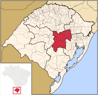
Rio Grande do Sul is a state in the southern region of Brazil. It is the fifth-most-populous state and the ninth largest by area. Located in the southernmost part of the country, Rio Grande do Sul is bordered clockwise by Santa Catarina to the north and northeast, the Atlantic Ocean to the east, the Uruguayan departments of Rocha, Treinta y Tres, Cerro Largo, Rivera and Artigas to the south and southwest, and the Argentine provinces of Corrientes and Misiones to the west and northwest. The capital and largest city is Porto Alegre. The state has the highest life expectancy in Brazil, and the crime rate is relatively low compared to the Brazilian national average. Despite the high standard of living, unemployment is still high in the state, as of 2017. The state has 5.4% of the Brazilian population and it is responsible for 6.6% of the Brazilian GDP.

Santa Rosa is a municipality in the Brazilian state of Rio Grande do Sul, located at latitude 27º52'15" and longitude 54º28'53" at a height of 277 meters above sea level. It has an area of 488.42 km2. Its estimated population is 73,575 (2020). It is known as the "National Cradle of Soybeans".

The Pelotas River is a river in southern Brazil, and a tributary of the Uruguay River.
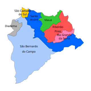
The ABC Region is an industrial region in Greater São Paulo, Brazil.

The Caturrita Formation is a rock formation found in Rio Grande do Sul, Brazil. Its sediments were deposited in the Paraná Basin. The formation is from the Upper Triassic and forms part of the Santa Maria Supersequence in the upper section of the Rosário do Sul Group.

Crissiumal is a municipality in the state of Rio Grande do Sul, Brazil, with a population of 13,357 inhabitants. It has a fluvial border with Argentina along the Uruguay River.
Guarani das Missões is a municipality in the state of Rio Grande do Sul, Brazil.
Mariano Moro is a municipality in the state of Rio Grande do Sul, Brazil.
Nova Candelária is a municipality in the state of Rio Grande do Sul, Brazil. As of 2020, the estimated population was 2,688.

Planalto is a municipality in the state of Rio Grande do Sul, Brazil, located at 27°19′44″S53°03′31″W, at an elevation of 568 meters above sea level. It has a total area of 237.35 km². Its estimated population in 2020 was 10,019 inhabitants.

Santo Expedito do Sul is a municipality in the state of Rio Grande do Sul, Brazil. As of 2020, the estimated population was 2,305.
Sete de Setembro is a municipality in the state of Rio Grande do Sul, Brazil. As of 2020, the estimated population was 1,950.
Tiradentes do Sul is a municipality in the state of Rio Grande do Sul, Brazil. As of 2020, the estimated population was 5,616.

Tucunduva is a municipality in the state of Rio Grande do Sul, Brazil. Known as the Capital of Mechanized Crops, Tucunduva has the highest grain yield per hectare in Brazil and is also known as the Land of Musicians.
Tuparendi is a municipality in the state of Rio Grande do Sul, Brazil. As of 2020, the estimated population was 7,810.
The Santa Maria River is a river of Rio Grande do Sul state in southern Brazil. It joins the Ibicuí-Mirim River to form the Ibicuí River.
The Santo Cristo River is a river of Rio Grande do Sul state in southern Brazil.
The Centro Oriental Rio-Grandense is one of the seven Mesoregion of the state of Rio Grande do Sul in Brazil. It consists of 54 municipalities, grouped in three Microregions:

Noroeste Rio-Grandense was one of the seven Mesoregions on the state of Rio Grande do Sul in Brazil. It included 216 municipalities grouped in thirteen microregions. The IBGE has since discontinued the microregion system for population tracking, replacing it with the term "immediate geographic region".
References
- ↑ Rio Santa Rosa at GEOnet Names Server
- ↑ GNS coordinates adjusted using Google Maps, and GeoLocator