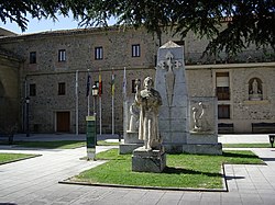
Santo Domingo de la Calzada | |
---|---|
Municipality | |
Coordinates: 42°26′31″N2°57′9″W / 42.44194°N 2.95250°W | |
Country | ![]() |
Autonomous Community | ![]() |
Province | La Rioja |
Comarca | Santo Domingo de la Calzada |
Government | |
• Mayor | Agustín García Metola (PSOE) |
Area | |
• Total | 40 km2 (20 sq mi) |
Elevation (AMSL) | 641 m (2,103 ft) |
Population (2024) [1] | |
• Total | 6,348 |
• Density | 160/km2 (410/sq mi) |
Time zone | UTC+1 (CET) |
• Summer (DST) | UTC+2 (CEST (GMT +2)) |
Postal code | 26250 |
Area code | +34 (Spain) + 941 (La Rioja) |
Website | Town Hall |
Santo Domingo de la Calzada is a municipality in La Rioja, Spain, situated on the banks of the Oja River. Its name refers to its founder, Dominic de la Calzada, who built a bridge, hospital, and hotel in the town for Christian pilgrims on the French Way, the most popular path of the Way of St. James. De la Calzada began constructing the town's Cathedral of Santo Domingo de la Calzada.[ when? ] He is buried within, and it is dedicated to him. [2]
Philosopher Gustavo Bueno was born in the town in 1924.[ citation needed ] Santo Domingo de la Calzada is also the site of the supposed miracle of the "hanged innocent," a pilgrim wrongly accused of theft. The witnesses for the thief's successful appeal, a pair of beheaded, supposedly cooked chickens, are represented by their descendants, a pair of whom are kept at all times in the choir loft of the cathedral. Other descendants are kept in the local pilgrimage refuge. [3]
Term | Mayor | Political party |
---|---|---|
1979–1983 | Rodolfo Varona Aransay | Grouping of electors |
1983–1987 | Rodolfo Varona Aransay | PR |
1987–1991 | José Ramón Mendi Barrón | UCD |
1991–1995 | Javier Ruiz Aznárez | PSOE |
1995–1999 | Esther Vargas Domingo | PP |
1999–2003 | Esther Vargas Domingo | PP |
2003–2007 | Agustín García Metola | PSOE |
2007–2011 | Agustín García Metola | PSOE |
2011–2015 | Javier Azpeitia Sáez | PP |
2015–2019 | Agustín García Metola | PSOE |
2019–2023 | Javier Ruiz Bartolomé | PSOE |
2023– | n/d | n/d |
42°25′59″N2°57′00″W / 42.433°N 2.950°W