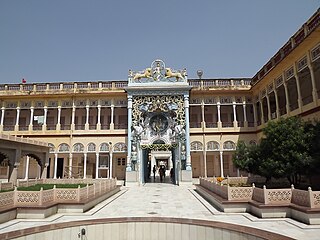
Sikar is a city and municipal council in the Sikar district of the state of Rajasthan in India. It is the administrative headquarters of the Sikar district. It is largest city of the Shekhawati region, which consists of Sikar, Churu and Jhunjhunu. After Kota, Sikar is one of the major hubs for private coaching in the country for competitive public examination preparations and has a number of engineering and medical coaching institutes.
Jhunjhunu is a city in the state of Rajasthan in northern India and the administrative headquarters of Jhunjhunu District. Rajasthani and Hindi are widely spoken in Jhunjhunu. Jhunjhunu has given the highest number of soldiers to the Indian army and the paramilitary.

Gangapur City is a city and a municipal council located in Gangapur district in the Indian state of Rajasthan. It is the administrative headquarters of Gangapur district. It is famous for its Sweet Cuisine Kheermohan and newly built Kushalgarh Baba Shyam Temple.
Jobner is a tehsil headquarter and one of the oldest municipalities in Jaipur district in the Indian state of Rajasthan.

Kishtwar is a town, municipality and administrative headquarter of the Kishtwar district in the Indian-administered Jammu and Kashmir. The district was carved out of the Doda district in 2007. and is located in the Jammu division. The town of Kishtwar is situated at a distance of 211.5 km (131.4 mi) from the winter capital of Jammu. A large ground locally called as Chowgan ground is located in the heart of the town.

Shrimadhopur is a city and a municipality, in Neem Ka Thana district in the Indian state of Rajasthan. It was founded on 18 April 1761 under the reign of Maharaja Sawai Madho Singh I. It was mainly famous for his temples. Shrimadhopur's Wheat market is the biggest wheat market in Neem ka thana district. Shrimadhopur Government school is one of the biggest school of the Neem Ka Thana district. It is one of the five tehsils of the district. Dedicated Delhi-Mumbai Freight Corridor is passing through this city. This city is chosen for the development of crossing station on this route.

Kalasa is a taluk located in Chikmagalur district in Karnataka. Kalasa is home to the Kalaseshwara Temple dedicated to Lord Shiva. Kalasa lies 92 Kilometres South-west of Chickmagalur and is located on the banks of the Bhadra River. Kannada language is spoken here.
Palsana is a Town located in the Sikar District region of Rajasthan state in India. It is 84 km away from Jaipur, 350 km from Jodhpur 245 km from Bikaner and 250 km from Delhi30 km from Sikar.
Kalipahari village is a big community of Shekhawat Rajputs in the Jhunjhunu District of Rajasthan. It is situated 5 km south of Bagar, Jhunjhunu. The village is famous for the frescos on its grand havelis.

Mandela is a town in the Shekhawati region and Jhunjhunu district of Rajasthan state in India.
Mandhana is a town in the Kanpur district of the Indian state of Uttar Pradesh, situated about 20 kilometres (12 mi) from Kanpur on the Grand Trunk Road to Delhi. As of the 2011 Census of India, the town had 213 households with a population of 993 of which 504 were male and 489 female. It has a 60% literacy rate and is 5 kilometres (3.1 mi) from Chobepur, its sister town. It also falls within the Kanpur metropolitan area. The language commonly spoken is Hindi with accent and tone of Kannauji. The IIT Kanpur is just 7 kilometres from Mandhana and also houses some of the successful alumnus of the institute. Mandhana is also known for private institutes like Maharana Pratap Engineering College and Rama University.
Danta Ramgarh is a census town and a tehsil tehsil of Sikar district in the Indian state of Rajasthan. Ex vice president of India Bhairon Singh Shekhawat, was born in village Khachariyaws close by to east of Ramgarh. Dantaramgarh tehsil is the largest tehsil in Sikar district and its population is above 300,000. This village is famous for its strategic fort built by Guman Singh Ladkhani in the year 1744. The topography of the surroundings from the top of the fort is breaths taking. Baba Balinath was a very popular saint about 400 years back. He is regarded as a village deity in the area..
Karinkallathani is a town in Perinthalmanna taluk of the Malappuram district of the Indian state of Kerala.

Malwas is a village and post in the Churu district of northern Rajasthan state, India.
Inana is a village in Mundwa Tehsil in Nagaur district in the Indian state of Rajasthan. It belongs to the Ajmer division of Rajasthan. It is located 13 km east from district headquarters in Nagaur, 8 km from Mundwa main town and 232 km from state capital Jaipur. The postal code of Inana is 341026.
Mauzmabad is a town and a municipality in Jaipur district in the state of Rajasthan, India. The town is situated at a distance of 51.5 km from Jaipur on National Highway No. 12. Town is also one of the 16 tehsil headquarters of Jaipur District.
Nepora or Nipor is a village in Anantnag tehsil in Anantnag district in Jammu and Kashmir. This village lies between Anantnag and Kulgam districts and acts as a bordering village between two districts. The nearest railway station is Sadura railway station. A tributary of river Jehlum 'Sandran' flows through the village.
Kabeersar is a village in Jhunjhunun, Rajasthan, India. Its population as of the 2011 census was 705.
Mankote is a village and tehsil in Poonch district of the Indian union territory of Jammu and Kashmir. The village is located 91 kilometers from the district headquarters in Poonch. The 2 most spoken languages spoken in Mankote is Gojri and Pahari.

