For the town in India, see Ziro.

The A514 road is a road in England. It is a 15-mile (24 km) stretch of single-carriageway road which runs south from Derby city centre (52.9166°N 1.4736°W).

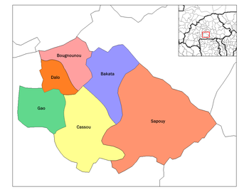
Sapouy is the capital of the province of Ziro in Burkina Faso. It is the capital of Ziro Province. The town is on the N6 highway which connects the national capital, Ouagadougou and Léo, the capital of Sissili Province.
CJJM-FM is a Canadian radio station, broadcasting at 99.3 FM in Espanola, Ontario. The station currently airs an adult contemporary format and is branded on-air as Moose FM. The station is owned by Vista Radio.

Boromo is a department of Balé Province in southern Burkina Faso. Its capital is the town of Boromo. According to the 2019 census the department has a population of 40,228.

Pâ is a department or commune of Balé Province in southern Burkina Faso. Its capital lies at the town of Pâ. According to the 1996 census the department has a total population of 18,637.
Siby is a department or commune of Balé Province in southern Burkina Faso. Its capital lies at the town of Siby. According to the 1996 census the department has a total population of 12,089.

Bagré is a department or commune of Boulgou Province in eastern Burkina Faso. Its capital lies at the town of Bagré. According to the 2006 census, actualized for the municipal élections of 2013, the department has a total population of 29,164.
Yoroko is a town in the Zabré Department of Boulgou Province in south-eastern Burkina Faso. As of 2005, the town has a population of 2,439.
Zalesie is a village in the administrative district of Gmina Sidra, within Sokółka County, Podlaskie Voivodeship, in north-eastern Poland. It lies approximately 7 kilometres (4 mi) east of Sidra, 17 km (11 mi) north of Sokółka, and 55 km (34 mi) north-east of the regional capital Białystok.
Dagninikorosso is a village in the Ouo Department of Comoé Province in south-western Burkina Faso. The village has a population of 75.
Nowica is a village in the administrative district of Gmina Uście Gorlickie, within Gorlice County, Lesser Poland Voivodeship, in southern Poland, close to the border with Slovakia. It lies approximately 5 kilometres (3 mi) north-east of Uście Gorlickie, 12 km (7 mi) south of Gorlice, and 106 km (66 mi) south-east of the regional capital Kraków.
Smolniki is a village in the administrative district of Gmina Iława, within Iława County, Warmian-Masurian Voivodeship, in northern Poland. It lies approximately 6 kilometres (4 mi) south-east of Iława and 65 km (40 mi) south-west of the regional capital Olsztyn.
Wały is a village in the administrative district of Gmina Nidzica, within Nidzica County, Warmian-Masurian Voivodeship, in northern Poland. It lies approximately 11 kilometres (7 mi) north-east of Nidzica and 41 km (25 mi) south of the regional capital Olsztyn.
Gierzwałd is a village in Ostróda County, Warmian-Masurian Voivodeship, in northern Poland. It is the seat of the gmina called Gmina Grunwald. It lies approximately 19 kilometres (12 mi) south-east of Ostróda and 38 km (24 mi) south-west of the regional capital Olsztyn.
Cwaliny is a village in the administrative district of Gmina Biała Piska, within Pisz County, Warmian-Masurian Voivodeship, in northern Poland. It lies approximately 9 kilometres (6 mi) south-west of Biała Piska, 17 km (11 mi) south-east of Pisz, and 104 km (65 mi) east of the regional capital Olsztyn.
Guacá is a corregimiento in David District, Chiriquí Province, Panama. It has a land area of 69.2 square kilometres (26.7 sq mi) and had a population of 1,891 as of 2010, giving it a population density of 27.3 inhabitants per square kilometre (71/sq mi). Its population as of 1990 was 1,483; its population as of 2000 was 1,726.
Dos Ríos is a corregimiento in Dolega District, Chiriquí Province, Panama. It has a land area of 18.1 square kilometres (7.0 sq mi) and had a population of 1,634 as of 2010, giving it a population density of 90.2 inhabitants per square kilometre (234/sq mi). Its population as of 1990 was 1,172; its population as of 2000 was 1,352.
Tinajas is a corregimiento in Dolega District, Chiriquí Province, Panama. It has a land area of 29.4 square kilometres (11.4 sq mi) and had a population of 1,530 as of 2010, giving it a population density of 52 inhabitants per square kilometre (130/sq mi). Its population as of 1990 was 1,084; its population as of 2000 was 1,237.
La Colorada is a corregimiento in Los Santos District, Los Santos Province, Panama with a population of 1,030 as of 2010. Its population as of 1990 was 987; its population as of 2000 was 1,010.