
The Nile is a major north-flowing river in northeastern Africa. It flows into the Mediterranean Sea. The Nile is the longest river in Africa. It has historically been considered the longest river in the world, though this has been contested by research suggesting that the Amazon River is slightly longer. Of the world's major rivers, the Nile is one of the smallest, as measured by annual flow in cubic metres of water. About 6,650 km (4,130 mi) long, its drainage basin covers eleven countries: the Democratic Republic of the Congo, Tanzania, Burundi, Rwanda, Uganda, Kenya, Ethiopia, Eritrea, South Sudan, Sudan, and Egypt. In particular, the Nile is the primary water source of Egypt, Sudan and South Sudan. The Nile is an important economic driver supporting agriculture and fishing.

Thebes, known to the ancient Egyptians as Waset, was an ancient Egyptian city located along the Nile about 800 kilometers (500 mi) south of the Mediterranean. Its ruins lie within the modern Egyptian city of Luxor. Thebes was the main city of the fourth Upper Egyptian nome and was the capital of Egypt for long periods during the Middle Kingdom and New Kingdom eras. It was close to Nubia and the Eastern Desert, with its valuable mineral resources and trade routes. It was a religious center and the most venerated city during many periods of ancient Egyptian history. The site of Thebes includes areas on both the eastern bank of the Nile, where the temples of Karnak and Luxor stand and where the city was situated; and the western bank, where a necropolis of large private and royal cemeteries and funerary complexes can be found. In 1979, the ruins of ancient Thebes were classified by UNESCO as a World Heritage Site.

A corniche is a road on the side of a cliff or mountain, with the ground rising up on one side of the roadway and falling away on the other. The English language has adopted the word from the French term route à corniche or "road on a ledge", itself derived from the Italian cornice, for "ledge".
The history of ancient Egypt spans the period from the early prehistoric settlements of the northern Nile valley to the Roman conquest of Egypt in 30 BC. The pharaonic period, the period in which Egypt was ruled by a pharaoh, is dated from the 32nd century BC, when Upper and Lower Egypt were unified, until the country fell under Macedonian rule in 332 BC.

Sohag Governorate is one of the governorates of Egypt. It is located in the southern part of the country, and covers a stretch of the Nile Valley. Since 1960, its capital has been the city of Sohag. Prior to that, the capital was the city of Girga and the name of the governorate was Girga Governorate.

Akhmim is a city in the Sohag Governorate of Upper Egypt. Referred to by the ancient Greeks as Khemmis or Chemmis and Panopolis, it is located on the east bank of the Nile, four miles (6.4 km) to the northeast of Sohag.

The Thebaid or Thebais was a region in ancient Egypt, comprising the 13 southernmost nomes of Upper Egypt, from Abydos to Aswan.
Qift is a city in the Qena Governorate of Egypt about 43 km (27 mi) north of Luxor, situated a little south of latitude 26° north, on the east bank of the Nile. In ancient times its proximity to the Red Sea made it an important trading emporium between India, Punt, Arabia Felix and the North. It was important for nearby gold and quartzite mines in the Eastern Desert, and as a starting point for expeditions to Punt by way of the path through the Wadi Hammamat to the Red Sea port at Tjau.

Shendi or Shandi is a small city in northern Sudan, situated on the southeastern bank of the Nile River 150 km northeast of Khartoum. Shandi is also about 45 km southwest of the ancient city of Meroë. Located in the River Nile state, Shandi is the center of the Ja'alin tribe and an important historic trading center. Its principal suburb on the west bank is Matamma. A major traditional trade route across the Bayuda Desert connects Matamma to Merowe and Napata, 250 km to the northwest. The city is the historical capital of the powerful Sudanese Arab Ja'alin tribe whom most of its denizens belong to. The village of Hosh Bannaga, hometown of former President Omar al-Bashir, is located on the outskirts of the city.

Sohag, also spelled as Suhag or Suhaj, is a city on the west bank of the Nile in Egypt. It has been the capital of Sohag Governorate since 1960, before which the capital was Girga and the name of the governorate was Girga Governorate. It also included Esna Governorate.

Girga, alternatively Digirga or Digurga is a city in the Sohag Governorate of Upper Egypt. It is located on the west bank of the Nile River. It is the metropolitan see of the Coptic Orthodox Church, and is the oldest continuously-inhabited city on the African continent.
Hebenu or Alabastron was a city in ancient Egypt. It was located in Middle Egypt, or the Heptanomy, and belonged to the Hare nome (𓉆. It was the early capital of the Oryx nome (𓉇. The modern village of Zawiyat al-Amwat is built on the site where the ancient city stood.

A sāqiyah or saqiya, also spelled sakia or saqia) is a mechanical water lifting device. It is also called a Persian wheel, tablia, rehat, and in Latin tympanum. It is similar in function to a scoop wheel, which uses buckets, jars, or scoops fastened either directly to a vertical wheel, or to an endless belt activated by such a wheel. The vertical wheel is itself attached by a drive shaft to a horizontal wheel, which is traditionally set in motion by animal power Because it is not using the power of flowing water, the sāqiyah is different from a noria and any other type of water wheel.

Elkab, also spelled El-Kab or El Kab, is an Upper Egyptian site on the east bank of the Nile at the mouth of the Wadi Hillal about 80 kilometres (50 mi) south of Luxor. Elkab was called Nekheb in the Egyptian language, a name that refers to Nekhbet, the goddess depicted as a white vulture. In Greek it was called Eileithyias polis, "city of the goddess Eileithyia".

Saqiya was a village in Palestine 8.5 kilometers (5.3 mi) away from Jaffa, depopulated in 1948.

Nubia is a region along the Nile river encompassing the confluence of the Blue and White Niles, and the area between the first cataract of the Nile or more strictly, Al Dabbah. It was the seat of one of the earliest civilizations of ancient Africa, the Kerma culture, which lasted from around 2500 BC until its conquest by the New Kingdom of Egypt under Pharaoh Thutmose I around 1500 BC, whose heirs ruled most of Nubia for the next 400 years. Nubia was home to several empires, most prominently the Kingdom of Kush, which conquered Egypt in the eighth century BC during the reign of Piye and ruled the country as its 25th Dynasty.

Dar el-Salam is a small Upper Egyptian city near Akhmim. It is located on the east bank of the Nile, in the Sohag Governorate.
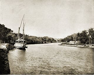
El Mahmoudia is an Egyptian city on the connection point between the Nile and Mahmoudiyah canal. It is a city with a history despite its modernity. It was one of the most important trade ports on the Nile River. Trading ships traveling from Upper Egypt and Lower Egypt to Alexandria passed through its lock and up the Mahmoudiyah Canal. Trading ships from Alexandria also carried imported merchandise to Cairo through the port.
Egyptians are an ethnic group native to the Nile Valley in Egypt. Egyptian identity is closely tied to geography. The population is concentrated in the Nile Valley, a small strip of cultivable land stretching from the First Cataract to the Mediterranean and enclosed by desert both to the east and to the west. This unique geography has been the basis of the development of Egyptian society since antiquity.
New Akhmim is a new Egyptian planned city of the third generation cities, located in Sohag, and administratively affiliated to New Urban Communities Authority, Established with the Presidential decree No. 195 of 2000 and edited by the Ministerial decree No. 1623 of 2015.
