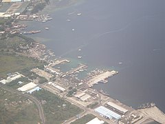
Mindanao is the second-largest island in the Philippines, after Luzon, and seventh-most populous island in the world. Located in the southern region of the archipelago, the island is part of an island group of the same name that also includes its adjacent islands, notably the Sulu Archipelago. According to the 2020 census, Mindanao had a population of 26,252,442, while the entire island group had an estimated population of 27,021,036.
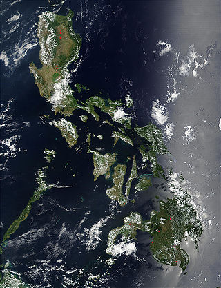
The Philippines is an archipelago that comprises 7,641 islands, and with a total land area of 300,000 square kilometers (115,831 sq mi), it is the world's fifth largest island country. The eleven largest islands contain 95% of the total land area. The largest of these islands is Luzon at about 105,000 square kilometers (40,541 sq mi). The next largest island is Mindanao at about 95,000 square kilometers (36,680 sq mi). The archipelago is around 800 kilometers (500 mi) from the Asian mainland and is located between Taiwan and Borneo.

Zamboanga Peninsula is an administrative region in Mindanao, Philippines, designated as Region IX. It consists of the provinces of Zamboanga del Norte, Zamboanga Sibugay and Zamboanga del Sur, and the cities of Isabela and Zamboanga City. The region was previously known as Western Mindanao. Pagadian serves as the regional center, while Zamboanga City is the commercial and industrial center.

Misamis Occidental, officially the Province of Misamis Occidental, is a province located in the region of Northern Mindanao in the Philippines. Its capital is the city of Oroquieta while Ozamiz is the most-populous city. The province borders Zamboanga del Norte and Zamboanga del Sur to the west and is separated from Lanao del Norte by Panguil Bay to the south and Iligan Bay to the east. The province of Misamis was originally inhabited by Subanens who were an easy target by the sea pirates from Lanao.

Davao Region, formerly called Southern Mindanao, is an administrative region in the Philippines, designated as Region XI. It is situated at the southeastern portion of Mindanao and comprises five provinces: Davao de Oro, Davao del Norte, Davao del Sur, Davao Oriental, and Davao Occidental.

South Cotabato, officially the Province of South Cotabato, is a province in the Philippines located in the Soccsksargen region in Mindanao. Its capital is Koronadal, and it borders Sultan Kudarat to the north and west, Sarangani to the south and northeast, and Davao del Sur to the far northeast. To the southeast lies Sarangani Bay.

Sarangani, officially the Province of Sarangani, is a province in the Philippines located in the Soccsksargen region. Its capital is Alabel while Glan is the most populous municipality in the province. With a 230-kilometer (140 mi) coastline along the Sarangani Bay and Celebes Sea, the province is at the southernmost tip of Mindanao island, and borders South Cotabato and Davao del Sur to the north, Davao Occidental to the east, and the Celebes Sea to the south.
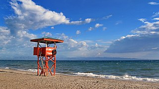
Soccsksargen, formerly known as Central Mindanao, is an administrative region of the Philippines, designated as Region XII. Located in south-central Mindanao, its name is an acronym that stands for the region's four provinces and one highly urbanized city. The regional center is in Koronadal, located in the province of Cotabato del Sur, and the center of commerce and industry is General Santos, which is the most populous city in the region.

The Autonomous Region in Muslim Mindanao was an autonomous region of the Philippines, located in the Mindanao island group of the Philippines, that consisted of five predominantly Muslim provinces: Basilan, Lanao del Sur, Maguindanao, Sulu, and Tawi-Tawi. It was the only region that had its own government. The region's de facto seat of government was Cotabato City, although this self-governing city was outside its jurisdiction.

General Santos, officially the City of General Santos, and abbreviated as GenSan, is a 1st class highly urbanized city in the region of Soccsksargen, Philippines. According to the 2020 census, it has a population of 697,315 people making it the most populous city in Soccsksargen Region.
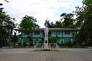
Alabel, officially the Municipality of Alabel, is a 1st class municipality and capital of the province of Sarangani, Philippines. According to the 2020 census, it has a population of 88,294 people.

Koronadal, officially the City of Koronadal, also known as Marbel, is a 1st class component city and capital of the province of South Cotabato, Philippines. According to the 2020 census, it has a population of 195,398 people.

Jose Abad Santos, officially the Municipality of Jose Abad Santos, is a 1st class municipality in the province of Davao Occidental, Philippines. According to the 2020 census, it has a population of 73,381 people.
Sarangani, officially the Municipality of Sarangani, is a 4th class municipality in the province of Davao Occidental, Philippines. According to the 2020 census, it has a population of 22,515 people, making it the least populated municipality in the province.

Siargao is a tear-drop shaped island in the Philippine Sea situated 196 kilometers southeast of Tacloban. It has a land area of approximately 437 square kilometres (169 sq mi). The east coast is relatively straight with one deep inlet, Port Pilar. The coastline is marked by a succession of reefs, small points and white, sandy beaches. The neighboring islands and islets have similar landforms. Siargao is known as the surfing capital of the Philippines, and was voted the Best Island in Asia in the 2021 Conde Nast Travelers Readers awards.
Indonesians in the Philippines consist of expatriates and immigrants from Indonesia residing in the Philippines, and their descendants. Among them were many formerly stateless people, legally called Persons of Indonesian descent (PID), whom the United Nations and the governments of the two countries helped to acquire citizenship.
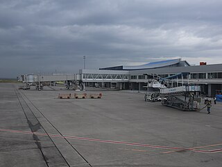
General Santos International Airport, also known as Tambler Airport and General Santos City Airport, is an alternate international airport located in the city of General Santos, Philippines serving the greater area of Soccsksargen. Situated in Fatima, General Santos, it is a large airport on the island of Mindanao and is officially classified as an international airport by the Civil Aviation Authority of the Philippines (CAAP), a government bureau which is responsible for the management and operations of General Santos International Airport and all other airports in the country except regular international airports.
Balut Island, also known as Malulong, is a potentially active volcanic island south of the tip of Davao Occidental province in the Mindanao region, southern Philippines. At the center of the island is Balut Volcano, a fumarolic volcano with no historical eruptions.

Davao Occidental, officially the Province of Davao Occidental, is a province in the Philippines located in the Davao Region in Mindanao. Its capital is the municipality of Malita, the most populous town in the province. To the east lies Davao Gulf. It also shares a maritime border with the Indonesian province of North Sulawesi to the south.

The Aliwagwag Protected Landscape is a protected area that preserves a major drainage catchment in the southern Philippine island of Mindanao in the Davao Region. It contains the headwaters of the Cateel River in the southern Diuata Mountain Range which provides the water source and irrigation for surrounding rice fields and communities in Davao de Oro and Davao Oriental provinces. It was named after the remote rural village in the municipality of Cateel where Aliwagwag Falls, the country's highest waterfall, is located.


