Allah Valley

Last updated

Allah Valley
Surallah South Cotabato 2.jpg
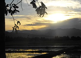
Allah Valley at Surallah, South Cotabato
Philippines relief location map (square).svg
Red pog.svg
Allah Valley
Location in the Philippines
Area2,520 km2 (970 sq mi)
Geography
Location Mindanao
CountryPhilippines
State
Region Soccsksargen
Population centers
Borders on
  • Roxas-Matulas Range (north)
  • Daguma Mountain Range (south)
Coordinates 6°25′N124°42′E / 6.417°N 124.700°E / 6.417; 124.700
Rivers
Source: area [1]

The Allah Valley (at times also spelled Alah) is a large valley of the Allah River in the provinces of South Cotabato and Sultan Kudarat on the island of Mindanao, Philippines. It is formed by the Roxas-Matulas Range in the north and the Daguma Mountain Range in the south. [1]

Contents

It is accessible via the Allah Valley Airport in Surallah, South Cotabato. [2]

The valley is known for its natural environment, such as Lake Sebu, Lake Holon, Baras Bird Sanctuary, and Esperanza Hot and Cold Springs. [3] On the other hand, it is adversely affected by flooding, siltation, riverbank migration, unstable agriculture production, and upland degradation, [1] as well as illegal logging. [4]

The entire valley was declared a watershed forest reserve in 1985 through the signing of Proclamation No. 2455. The 102,350-hectare (252,900-acre) protected area also includes Lake Sebu, the Tasaday-Manobo Special Forest Reserve, the Datu Ma Falen Civil Reservation, and the National Cultural Minorities Settlement Reservation located within the valley. [5]

The bestselling Lonely Planet described Lake Sebu as a place located in a “bowl of forests and mountains.” The 42,450-hectare landscape consisting the domains of the Allah Valley is recognized by United Nations Educational, Scientific and Cultural Organization (UNESCO) as a cultural landscape in Mindanao. [6]

Geography

It is a well populated valley with fertile soil, bisected by the Allah and Banga Rivers (tributaries of the Pulangi River). The placid lake of Lake Sebu can be found in the upper part of the Allah Valley. Its elevation ranges from 439 to 1,814 feet (134 to 553 m).

The 2,520 square kilometres (970 sq mi) [1] valley covers over the half of South Cotabato spanning 6 of the 10 municipalities of South Cotabato.

Municipalities in the valley

People

As of 2007, Allah Valley is home to some 628,832 people, composed of Indigenous T'bolis, B'laan, Tirurays, Manobos and Maguindanaons and settlers from Luzon and Visayas. [1]

Economy

The economy is based on agriculture producing mostly rice, maize, banana, pineapple, oil palm, and asparagus. [1] Another source of income is aquaculture of tilapia in Lake Sebu.

Companies are starting to invest to build factories in the area especially in the municipalities of Surallah and Tboli. Especially eco-tourism is being promoted as a means to boost the region's economy. [3]

Surallah South Cotabato 7.jpg
Panorama of the Allah Valley at Surallah

Related Research Articles

<span class="mw-page-title-main">Geography of the Philippines</span>

The Philippines is an archipelago that comprises 7,641 islands, and with a total land area of 300,000 square kilometers (115,831 sq mi), it is the world's fifth largest island country. The eleven largest islands contain 95% of the total land area. The largest of these islands is Luzon at about 105,000 square kilometers (40,541 sq mi). The next largest island is Mindanao at about 95,000 square kilometers (36,680 sq mi). The archipelago is around 800 kilometers (500 mi) from the Asian mainland and is located between Taiwan and Borneo.

<span class="mw-page-title-main">Mount Apo</span> Dormant volcano in the Philippines

Mount Apo, also known locally as Apo Sandawa, is a large solfataric, dormant stratovolcano on the island of Mindanao, Philippines. With an elevation of 2,954 meters (9,692 ft) above sea level, it is the highest-mountain in the Philippine Archipelago, Mindanao and 24th-highest peak of an island on Earth. Located on the tripartite border of Davao City and Davao del Sur in the Davao Region, and Cotabato in Soccsksargen, Mount Apo is the most-prominent mountain in the Philippines. The peak overlooks from Davao City 45 kilometers (28 mi) to the northeast, Digos 25 kilometers (16 mi) to the southeast, and Kidapawan 20 kilometers (12 mi) to the west. It is a protected area and a Natural Park of the Philippines.

<span class="mw-page-title-main">Bukidnon</span> Province in Northern Mindanao, Philippines

Bukidnon, officially the Province of Bukidnon, is a landlocked province in the Philippines located in the Northern Mindanao region. Its capital is the city of Malaybalay. The province borders, clockwise from the north, Misamis Oriental, Agusan del Sur, Davao del Norte, Cotabato, Lanao del Sur, and Lanao del Norte. According to the 2020 census, the province is inhabited by 1,541,308 residents. The province is composed of 2 component cities and 20 municipalities. It is the third largest province in the country in terms of total area of jurisdiction behind Palawan and Isabela respectively.

<span class="mw-page-title-main">South Cotabato</span> Province in Soccsksargen, Philippines

South Cotabato, officially the Province of South Cotabato, is a province in the Philippines located in the Soccsksargen region in Mindanao. Its capital is Koronadal, and it borders Sultan Kudarat to the north and west, Sarangani to the south and northeast, and Davao del Sur to the far northeast. To the southeast lies Sarangani Bay.

<span class="mw-page-title-main">Lake Sebu, South Cotabato</span> Municipality in South Cotabato, Philippines

Lake Sebu, officially the Municipality of Lake Sebu, is a 1st class municipality in the province of South Cotabato, Philippines. According to the 2020 census, it has a population of 81,221 people.

<span class="mw-page-title-main">Maguindanao language</span> Austronesian language spoken in the Philippines

Maguindanaon, or Magindanawn is an Austronesian language spoken by Maguindanaon people who form majority of the population of eponymous provinces of Maguindanao del Norte and Maguindanao del Sur in the Philippines. It is also spoken by sizable minorities in different parts of Mindanao such as the cities of Zamboanga, Davao, and General Santos, and the provinces of North Cotabato, Sultan Kudarat, South Cotabato, Sarangani, Zamboanga del Sur, Zamboanga Sibugay, Davao del Sur, as well as Metro Manila.

<span class="mw-page-title-main">Lebak</span> Municipality in Sultan Kudarat, Philippines

Lebak, officially the Municipality of Lebak, is a 1st class municipality in the province of Sultan Kudarat, Philippines. According to the 2020 census, it has a population of 88,868.

<span class="mw-page-title-main">Koronadal</span> Capital of South Cotabato, Philippines

Koronadal, officially the City of Koronadal, also known as Marbel, is a 1st class component city and capital of the province of South Cotabato, Philippines. According to the 2020 census, it has a population of 195,398 people.

<span class="mw-page-title-main">Arakan, Cotabato</span> Municipality in Cotabato, Philippines

Arakan, officially the Municipality of Arakan is a 1st class municipality in the province of Cotabato, Philippines. According to the 2020 census, it has a population of 50,558 people.

<span class="mw-page-title-main">Lake Sebu</span> Lake in South Cotabato, Philippines

Lake Sebu is a natural lake located in the municipality of Lake Sebu, South Cotabato within the Alah Valley region. The Philippine government has recognized it as one of the country's most important watersheds. Lake Sebu is one of the many bodies of water supplying important irrigation to the provinces of Sultan Kudarat and South Cotabato.

<span class="mw-page-title-main">Banga, South Cotabato</span> Municipality in South Cotabato, Philippines

Banga, officially the Municipality of Banga, is a 1st class municipality in the province of South Cotabato, Philippines. According to the 2020 census, it has a population of 89,164 people.

<span class="mw-page-title-main">Surallah</span> Municipality in South Cotabato, Philippines

Surallah, officially the Municipality of Surallah, is a 1st class municipality in the province of South Cotabato, Philippines. According to the 2020 census, it has a population of 89,340 people.

<span class="mw-page-title-main">Lumad</span> Group of Austronesian indigenous people

The Lumad are a group of Austronesian indigenous peoples in the southern Philippines. It is a Cebuano term meaning "native" or "indigenous". The term is short for Katawhang Lumad, the autonym officially adopted by the delegates of the Lumad Mindanao Peoples Federation (LMPF) founding assembly on 26 June 1986 at the Guadalupe Formation Center, Balindog, Kidapawan, Cotabato, Philippines. Usage of the term was accepted in Philippine jurisprudence when President Corazon Aquino signed into law Republic Act 6734, where the word was used in Art. XIII sec. 8(2) to distinguish Lumad ethnic communities from the islands of Mindanao.

The legislative districts of South Cotabato are the representations of the province of South Cotabato and the urbanized city of General Santos in the various national legislatures of the Philippines. The province is currently represented in the lower house of the Congress of the Philippines through its first and second congressional districts.

<span class="mw-page-title-main">Pulangi River</span> River in BARMM, Philippines

The Pulangi River ;, also spelled Pulangui, is one of the major tributaries of the Rio Grande de Mindanao, an extensive river system in Mindanao, Philippines. With a length of 320 kilometres (199 mi), it is the longest river in Bukidnon and the 5th longest river in the Philippines. It traverses through majority of the cities and municipalities of Bukidnon from its source in Barangay Kalabugao, Impasugong, Bukidnon.

<span class="mw-page-title-main">Peñablanca Protected Landscape and Seascape</span> Protected area in Philippines

The Peñablanca Protected Landscape and Seascape is a protected area and national park in Peñablanca, Cagayan. It is on the border with Isabela province, contiguous with the Northern Sierra Madre Natural Park. The protected area, best known as the location of Callao Cave, covers the largest block of forest under conservation in the province. It covers 118,781.582 hectares of the northern Sierra Madre mountain range and its adjacent Pacific coast.

<span class="mw-page-title-main">Bicol Natural Park</span> Protected area of the Philippines

The Bicol Natural Park is a protected area of the Philippines located in the Bicol Region of southern Luzon. It straddles the mountainous border between the provinces of Camarines Norte and Camarines Sur in the northern interior of the Bicol Peninsula. First declared as a national park covering 4,225 hectares on 13 February 1934 through Proclamation No. 657 of Governor General Frank Murphy, the Bicol National Park was later extended to its present area of 5,201 hectares through amendments made in Proclamation No. 655 signed by President Manuel Luis Quezon on 23 December 1940. The area was reclassified as a natural park on 29 December 2000 by virtue of Proclamation No. 43 by President Joseph Estrada.

The Mount Timolan Protected Landscape is a protected area covering Mount Timolan and its surrounding forested landscape in the region of Zamboanga Peninsula on Mindanao in the Philippines. The park encompasses an area of 1,994.79 hectares and a buffer zone of 695.39 hectares in the municipalities of San Miguel, Guipos and Tigbao in the province of Zamboanga del Sur. It was established on 14 August 2000 through Proclamation Order No. 354 issued by President Joseph Estrada. The park was also earlier established by the provincial government of Zamboanga del Sur as a provincial park and wildlife sanctuary known as the Zamboanga del Sur Provincial Park through Provincial Ordinance No. 3 in 1992.

The Allah River flows through the Allah Valley on the island of Mindanao in the Philippines. It is located in the provinces of South Cotabato, Sultan Kudarat and Maguindanao. The name of the river could have come from the word of Allah itself, which is the meaning of God in Arabic.

Mount Diwata, colloquially nicknamed as Diwalwal, is a remote 1,261-metre (4,137 ft) high range of volcanic mountain and biodiversity area in Davao Region in the eastern part of Mindanao island of Philippines. Rich in gold and copper ores and mines, it is spread across the 3 municipalities: (a) Monkayo in the province of Davao de Oro; as well as (b) Cateel and (c) Boston in the province of Davao Oriental. Laguna Copperplate Inscription, the oldest written document in Philippines dated to 900 CE, refers to Mount Diwata.

References

  1. 1 2 3 4 5 6 Silverio L. Tandog (2012). "A Presentation to the Collaboration Workshop for the Agusan River Basin" (PDF). Allah Valley Landscape Development Alliance. Archived from the original (PDF) on September 2, 2013. Retrieved May 22, 2014.
  2. "Allah Valley Airport (AAV)". World Airport Codes. Retrieved May 22, 2014.
  3. 1 2 "Status Report: April 2013- September 2013". Eco-Cultural Tourism Development Project. Allah Valley Landscape Development Alliance. Retrieved May 22, 2014.
  4. Louie O. Pacardo (February 23, 2014). "Checkpoints vs illegal logging in Central Mindanao planned". Alternate Forum for Research in Mindanao (AFRIM), Inc. Retrieved May 22, 2014.
  5. "Proclamation No. 2455, s. 1985". Official Gazette of the Republic of the Philippines. Retrieved October 24, 2015.
  6. "9 spectacular places to visit in Mindanao".