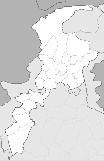
Salhad is one of the 51 union councils (sub-divisions) of Abbottabad District in the Khyber-Pakhtunkhwa province of Pakistan.

Palak is one of the 51 union councils of Abbottabad District in the Khyber Pakhtunkhwa Province of Pakistan.

Dewal Manal is one of the 51 union councils of Abbottabad District in the Khyber-Pakhtunkhwa province of Pakistan.

Langra is one of the 51 union councils of Abbottabad District in the Khyber Pakhtunkhwa province of Pakistan.

Birot Kalan is one of the 51 union councils of Abbottabad District in the Khyber-Pakhtunkhwa province of Pakistan.

Namal is one of the 51 union councils of Abbottabad district in the Khyber Pakhtunkhwa province of Pakistan.
Phalla Union council takes its name from the chief village in the area. It is one of the most densely populated union councils of Abbottabad District in Khyber-Pakhtunkhwa province of Pakistan. Most of the area is hilly. These mountain are linked with the mountains of the Murree and Margalla hills of Islamabad. Village Phalla and Ghambir are thickly populated area of this Union Council.

Goreeni is one of the 51 union councils of Abbottabad District in Khyber-Pakhtunkhwa province of Pakistan.

Garhi Phulgran is one of the 51 union councils of Abbottabad District in Khyber-Pakhtunkhwa province of Pakistan.

Pattan Kalan is one of twenty-nine union councils of the Abbottabad District, in the Khyber-Pakhtunkhwa province of Pakistan. It lies within an area that was affected by the 2005 earthquake, after which a total of 27 small camps were set up in the area.

Tajwal is one of the 51 union councils of Abbottabad District in Khyber-Pakhtunkhwa province of Pakistan.

Pind Kargoo Khan is one of the 51 union councils of Abbottabad District in Khyber-Pakhtunkhwa province of Pakistan. It is located 30 km from Abbottabad city.

Abbottabad Central is one of the 51 union councils of Abbottabad District in the Khyber Pakhtunkhwa province of Pakistan. Located in Abbottabad city, the capital of the district, it borders the following union councils: Malikpura Urban to the north and west, by Salhad to the south and by Dhamtour to the east.

Bagh is a union council of Abbottabad District in Khyber-Pakhtunkhwa province of Pakistan, it has two high schools GHS Bagh and GMS Kehial The main tribe of this area are the Jadun and the Dhund Abbasis.

Seer Sharqi Bhattian is one of the 51 union councils of Abbottabad District in Khyber-Pakhtunkhwa province of Pakistan. It is located in the south of the district – to the south and east it borders Murree, it also borders the following union councils within Abbottabad District, to the north Seer Gharbi, and to the west is Nagri Totial.

Mir Pur is one of the 51 union councils of Abbottabad District in the Khyber Pakhtunkhwa Province of Pakistan. It is located at an altitude of 1251 metres and lies in the west of the district.The population of the union council Mirpur was 46,206 in the 2017 census. Now the government have established this union council into three village councils .These are VC1,VC2 and VC3. Majority of the residents of Mirpur are jadoon (pashtuns)

Kehal Urban is one of the 51 union councils of Abbottabad District in Khyber-Pakhtunkhwa province of Pakistan. It is located in the west of the district. It is one of the beautiful Union Councils of the District Abbottabad. After Local Bodies Election its Local Body members are:

Malikpura Urban is one of the 51 union councils of Abbottabad District in Khyber-Pakhtunkhwa province of Pakistan. It is located in the west of the district.

Nawansher Urban is one of the 51 union councils of Abbottabad District in Khyber-Pakhtunkhwa province of Pakistan. It is located in the north of the district. It is one of the oldest settlements in Abbottabad district.

Haveliani Urban is one of the 51 union councils of Abbottabad District in Khyber-Pakhtunkhwa province of Pakistan. It is located in the west of the district.


