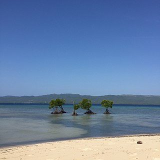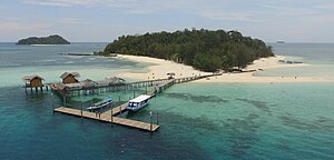
Oriental Mindoro, is a province in the Philippines located on the island of Mindoro under Mimaropa region in Luzon, about 140 kilometres (87 mi) southwest of Manila. The province is bordered by the Verde Island Passage and the rest of Batangas to the north, by Marinduque, Maestre de Campo Island, Tablas Strait and the rest of Romblon to the east, by Semirara and the rest of Caluya Islands, Antique to the south, and by Occidental Mindoro to the west. Calapan, the only city in the island, is the provincial capital.

Central Sulawesi is a province of Indonesia located at the centre of the island of Sulawesi. The administrative capital and largest city is located in Palu. The 2010 census recorded a population of 2,635,009 for the province, and the 2020 Census recorded 2,985,734, of whom 1,534,706 were male and 1,451,028 were female. The official estimate as at mid 2021 was 3,021,879. Central Sulawesi has an area of 61,841.29 km2 (23,877 sq mi), the largest area among all provinces on Sulawesi Island, and has the second-largest population on Sulawesi Island after the province of South Sulawesi. It is bordered by the provinces of Gorontalo to the north, West Sulawesi, South Sulawesi and South East Sulawesi to the south, by Maluku to the east, and by the Makassar Strait to the west. The province is inhabited by many ethnic groups, such as the Kaili, Tolitoli, etc. The official language of the province is Indonesian, which is used for official purposes and inter-ethnic communication, while there are several indigenous language spoken by the Indigenous peoples of Central Sulawesi. Islam is the dominant religion in the province, followed by Christianity which is mostly adhered to by the people in the eastern part of the province.

North Sulawesi is a province of Indonesia. It is located on the Minahasa Peninsula of Sulawesi, south of the Philippines and southeast of Sabah, Malaysia. It borders the Philippine province of Davao Occidental and Soccsksargen regions of the Philippines to the north, the Maluku Sea to the east, Gorontalo and Celebes Sea to the west and the Gulf of Tomini to the southwest. With Miangas, it is the northernmost province of Indonesia. The province's area is 13,892.47 square kilometres (5,363.91 sq mi), and its population was 2,270,596 according to the 2010 census; this rose to 2,621,923 at the 2020 Census, while the official estimate as at mid 2021 was 2,638,631.

Rote Island is an island of Indonesia, part of the East Nusa Tenggara province of the Lesser Sunda Islands. According to legend, this island got its name accidentally when a lost Portuguese sailor arrived and asked a farmer where he was. The surprised farmer, who could not speak Portuguese, introduced himself, "Rote".
Belitung is an island on the east coast of Sumatra, Indonesia in the Java Sea. It covers 4,800.6 km2 (1,853.5 sq mi), and had a population of 309,097 at the 2020 Census. Administratively, it forms two regencies within the province of Bangka-Belitung Islands. The island is known for its pepper and for its tin. It was in the possession of the United Kingdom from 1812 until Britain ceded control of the island to the Netherlands in the Anglo-Dutch Treaty of 1824. Its main town is Tanjung Pandan. The United Nations Educational, Scientific and Cultural Organization has declared 17 tourist attractions in the Belitung Geopark as world geoparks.

The Lingga Regency is a group of islands in Indonesia, located south of Singapore, along both sides of the equator, off the eastern coast of Riau Province on Sumatra island. They are south of the populated Riau Archipelago, known for the industrial island of Batam and the tourist-frequented island of Bintan, although the Lingga Islands themselves are rarely visited due to the infrequent local transportation. The equator goes through the northern tip of Lingga Island, the main island in the archipelago.

Tobelo is a town and a district on the eastern Indonesian island of Halmahera. It is the capital of the regency (kabupaten) of North Halmahera, part of the province of North Maluku. The town was formalised as the capital of North Halmahera in the district elections held in 2004. It had a population of 34,150 at the 2020 Census. A palm tree lined coastal road connects Tobelo to Galela. The town is predominantly Christian, and a Protestant Church has existed in Tobelo since at least 1924.

The Banyak Islands are a group of inhabited islands located between Simeulue and Nias off the western coast of Sumatra in Indonesia's Aceh Province. Surveys of the area approximate around 71 islands and additional mangrove stands in shallow off-shore areas, although locals count 99 islands. The largest island in the group is Tuangku, with the principal town of Haloban. Two other major islands located either side of Tuangku are Bangkaru and Ujung Batu. Tuangku is separated from Bangkaru by a fault line.

Weh Island, often known as Sabang after the city of which the island is administrated, is a small active volcanic island to the northwest of Sumatra, 45 minutes by fast regular ship or 2 hours by ferry from mainland, Banda Aceh. It was originally connected to the Sumatran mainland and became separated by sea after the volcano's last eruption in the Pleistocene era. The island is situated in the Andaman Sea.

Raja Ampat, or the Four Kings, is an archipelago located off the northwest tip of Bird's Head Peninsula on the island of New Guinea, in Indonesia's West Papua province. It comprises over 1,500 small islands, cays, and shoals surrounding the four main islands of Misool, Salawati, Batanta, and Waigeo, and the smaller island of Kofiau.

North Gorontalo is a regency of Gorontalo Province, Indonesia, stretching along the entire northern coast of the province. It is located on the northern peninsula of the island of Sulawesi. It was established in 2007 under Law Number 11/2007 from the former northern districts of Gorontalo Regency. The new regency has an area of 1,777.02 km2, and it had a population of 104,133 at the 2010 Census and 124,957 at the 2020 Census; the official estimate as at mid 2021 was 126,521. Its regency seat is the town of Moluo in Kwandang District.
Taka Bonerate National Park is a marine park which includes the Takabonerate atoll islands, located in the Flores Sea, south of Sulawesi island of Indonesia.

North Halmahera Regency is a regency of North Maluku Province, Indonesia. It was declared a Regency on 31 May 2003. The capital town of the regency lies at the port of Tobelo. The Regency, which has been considerably reduced by the separation of Tidore and of Morotai Island, now covers an area of 3,891.62 square kilometres (1,502.56 sq mi) and had a population of 161,847 people at the 2010 Census, 179,783 at the 2015 Intermediate Census. and 197,640 at the 2020 Census. The official estimate as at mid 2021 was 199,936. The principal settlements are Tobelo, Kao and Galela. The area is noted for its white beaches and coral reefs.

Gorontalo or Hulondalo people are the native people of the northern part of Sulawesi. They are the most populous ethnicity in the Minahasa Peninsula. The Gorontalo people are predominantly Muslim. Their native language is the Gorontalo language. The Gorontalo people have traditionally been concentrated in the provinces of Gorontalo, North Sulawesi, and the northern part of Central Sulawesi.

Bangka Island is a small island located off the northeastern tip of Sulawesi, Indonesia. Bangka is known for its unspoiled beaches and dive tourism. It belongs administratively to the district of East Likupang in the North Minahasa regency, North Sulawesi province. The island has three main coastal villages: Lihunu, Kahuku and Libas. Controversy exists over a Chinese company's development of an iron ore mining facility on the island, as the company's permits were revoked by Indonesian courts.

The Thousand Islands are a chain of islands to the north of Jakarta's coast. It forms the only regency of Jakarta, the capital of Indonesia. It consists of a string of 342 islands stretching 45 km (28 mi) north into the Java Sea at West Jakarta Bay and in fact north of Banten Province.

Gorontalo is a province of Indonesia on the island of Sulawesi. Located on the Minahasa Peninsula, Gorontalo was formerly part of the province of North Sulawesi until its inauguration as a separate province on 5 December 2000. In Indonesian history, the only Indonesian President from the Gorontaloan people is the third President of the Republic of Indonesia, Prof. DR. Ing. Bacharuddin Jusuf Habibie. His father, Alwi Abdul Jalil Habibie, comes from the "Habibie" clan.

Alibijaban is a small island located off the southeastern coast of Bondoc Peninsula in the Philippines. It belongs administratively to the municipality of San Andres, Quezon province, and is coterminous with the barangay of the same name. With a population of 1,643 inhabitants in 2015, it is the smallest of seven barangays in San Andres.

Biaro Island, an island in the North Sulawesi sea and a part of the Sitaro Islands Regency, is located off the northern extremity of Sulawesi Island, North Sulawesi Province, Indonesia. Sitaro regency was formed under Law Number 15 Year 2007 from 2 January 2007.


